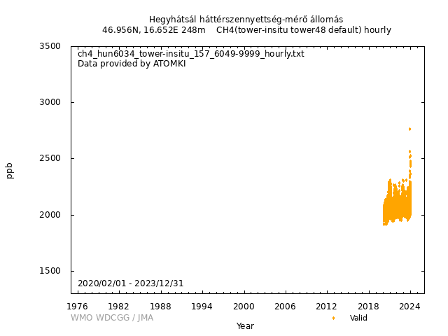
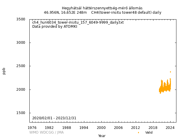
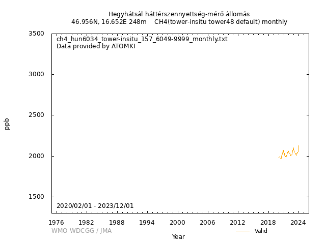
Data Policy
GAW Data Policy
"For Scientific purposes, access to these data is unlimited and provided without charge.
By their use you accept that an offer of co-authorship will be made through personal contact with the data providers
or owners whenever substantial use is made of their data.
In all cases, an acknowledgement must be made to the data providers or owners and to the data centre when these data are used within a publication."
Version
2025-01-01-0237 (Last updated: 2024-12-24)File
This data set is submitted by ATOMKI.
In line with the GAW Data Policy, users should contact the contributors of all data of interest and propose co-authorship or acknowledgement.
Organization
| NO | 157 |
|---|---|
| Acronym | ATOMKI |
| Name | Institute for Nuclear Research |
| Address 1 | Bem tér 18/C |
| Address 2 | H-4026 Debrecen, Hungary |
| Address 3 | |
| Country/Territory | Hungary |
| Website | https://www.atomki.hu/en/ |
Contact(s)
| Name | Laszlo Haszpra |
|---|---|
| Prefix | Mr/Dr |
| haszpra.l@gmail.com | |
| Organization No | 157 |
| Organization acronym | ATOMKI |
| Organization name | Institute for Nuclear Research |
| Organization country/territory | Hungary |
| Address 1 | |
| Address 2 | Bem tér 18/C |
| Address 3 | H-4026 Debrecen, Hungary |
| Country/territory | Hungary |
| Tel | +36-30-454-3309 |
| Fax | |
| Last updated date | 2025-10-20 |
|
|||||||
| Background observation | |||||||
| UTC+01:00 | |||||||
| ppb | |||||||
|
9999-12-31 00:00:00 - 9999-12-31 23:59:59: WMO CH4 X2004 |
|||||||
|
9999-12-31 00:00:00 - 9999-12-31 23:59:59: Picarro Model G2301(CRDS) |
|||||||
|
2020-02-19 18:00:00 - 2022-07-20 06:59:59: 48 (m) 2022-07-20 07:00:00 - 9999-12-31 23:59:59: 50 (m) |
|||||||
| 8 minutes | |||||||
| Monthly 4-point calibration using standard gases prepared by Max-Planck-Institute for Biogeochemistry (Jena, Germany). The scale is traceable to the WMO GAW Central Calibration Laboratory operated by NOAA. | |||||||
| Only technically false data are removed | |||||||
|
[Hourly] Hourly data are taken from the arithmetic mean of observed data for one hour after the technically bad data are rejected. [Daily] Daily data are calculated as the arithmetic mean of hourly data measured between 12 h and 16 h local standard time (early afternoon values having expanded spatial representativeness). [Monthly] Monthly data are calculated as the arithmetic mean of the daily (early afternoon) data if at least 10 daily data are available. |
|||||||
| No flagging. Only technically correct data are reported. | |||||||
| Operational/Reporting | |||||||
|
HUN was operated by the Hungarian Meteorological Service (HMS) until 31 August 2020. Since 1 September 2020, the operator of the station is the Institute for Nuclear Research (ATOMKI). Methane measurements were started on 23 March 2006 at 96 m above ground. The gas chromatograph used for this project was supervised by Eötvös Loránd University, Budapest (ELTE) as a contributor to HMS. This project was terminated on 9 October 2014. Methane measurements were restarted by HMS using a Picarro Model G2301 gas analyzer on 22 March 2016. It was a single elevation continuous measurement at 82 m above ground. The measurement frequency was 1 minute, which was based on the raw output of the instrument of 5-second resolution. These details are not included in the metadata yet. On the afternoon of 19 February 2020, HMS changed the measurement protocol of the above instrument to sample not only a single level at 82 m above ground but also the other available sample elevations (10 m, 48 m, 115 m). From this point, there are data from 4 elevations on the tower. The data processing also had to be changed accordingly. The basic measurement period is two minutes at each elevation, consisting of 90 s flushing and 30 s signal integration. Each 30 s average is based on 6 measurements (5 s resolution of the instrument). The multiport selector valve steps through the four monitoring elevation levels in eight minutes. (It means the measurement frequency became 8 minutes.) Every hour 7-8 data are recorded at each measurement elevation. This measurement project and protocol were taken over from HMS by ATOMKI on 1 September 2020. |
|||||||
|
Wind direction: Wind speed: Relative humidity: Precipitation amount: Air pressure: Air temperature: Dew point temperature: Sea water temperature: Sea surface water temperature: Sea water salinity: Sea surface water salinity: |
|||||||
|
Meteorological data may remain as first provided, even when greenhouse gas data are updated. |
No DOI available
Related information
| Format | Text (WDCGG Data Format Table, WDCGG Meteorological Data Format Table), NetCDF | ||||
|---|---|---|---|---|---|
| Relation List (Is Part Of) |
All CH4 data contributed to WDCGG by GAW stations and mobiles by 2025-09-16 All CH4 data contributed to WDCGG by GAW stations and mobiles by 2024-09-24 All CH4 data contributed to WDCGG by GAW stations and mobiles by 2023-09-13 All CH4 data contributed to WDCGG by GAW stations and mobiles by 2022-09-07 |
||||
| Geolocation Point |
|
GAW Data Policy
"For Scientific purposes, access to these data is unlimited and provided without charge.
By their use you accept that an offer of co-authorship will be made through personal contact with the data providers
or owners whenever substantial use is made of their data.
In all cases, an acknowledgement must be made to the data providers or owners and to the data centre when these data are used within a publication."
Citation format
This format is an example of the WDCGG standard citation.
Please follow the citation format which the data providers or owners indicate.
Please follow the citation format which the data providers or owners indicate.
Laszlo Haszpra (ATOMKI),
Atmospheric CH4
at Hegyhátsál háttérszennyettség-mérő állomás by Institute for Nuclear Research,
dataset published as CH4_HUN6034_tower-insitu_ATOMKI_tower48 at WDCGG,
ver. 2025-01-01-0237 (Reference date*: YYYY/MM/DD)
* As the reference date, please indicate the date you downloaded the files.
* As the reference date, please indicate the date you downloaded the files.


