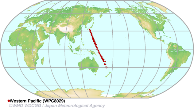
Adrigole Map
| WDCGG ID | ADR6021 |  |
|---|---|---|
| GAW ID | ADR | |
| WIGOS ID | 0-20008-0-ADR | |
| Station name | Adrigole | |
| GAW category | GAW Regional | |
| WMO region | REGION VI (Europe) | |
| Country/territory | Ireland | |
| Address 1 | ||
| Address 2 | ||
| Address 3 | ||
| Latitude (north: +; south: −) | 51.6800003052 | |
| Longitude (east: +; west: −) | -9.7299995422 | |
| Elevation (m a.s.l.) | 50 | |
| Timezone | UTC | |
| Category | fixed station | |
| Gawsis | https://gawsis.meteoswiss.ch/GAWSIS//index.html#/search/station/stationReportDetails/85 | |
| Climate Zone | Cfb (Warm temperate climate, fully humid, warm summer) | |
| Website | ||
| Status | Closed | |
| Description | ||
| Contributor(s) |
|
|
| Gas Species |
|
|
Alert Map
| WDCGG ID | ALT4001 |  |
|---|---|---|
| GAW ID | ALT | |
| WIGOS ID | 0-20008-0-ALT | |
| Station name | Alert | |
| GAW category | GAW Global | |
| WMO region | REGION IV (North and Central America) | |
| Country/territory | Canada | |
| Address 1 | ||
| Address 2 | ||
| Address 3 | ||
| Latitude (north: +; south: −) | 82.4991455078 | |
| Longitude (east: +; west: −) | -62.3415260315 | |
| Elevation (m a.s.l.) | 185 | |
| Timezone | UTC-05:00 | |
| Category | fixed station | |
| Gawsis | https://gawsis.meteoswiss.ch/GAWSIS//index.html#/search/station/stationReportDetails/487 | |
| Climate Zone | ET (Tundra climate) | |
| Website | ||
| Status | Operational | |
| Description | In 1986, the Alert Background Air Pollution Monitoring Network (BAPMoN) Observatory was opened as Canada's first research station for the continuous monitoring of background concentrations of trace gases and aerosols. Currently, the Dr. Neil Trivett Global Atmosphere Watch Observatory at Alert, NU is the most northerly site in the GAW Network. It is located on the northeastern tip of Ellesmere Island in Nunavut, Canada, far removed from the major industrial regions of the Northern Hemisphere. Alert is also the site of a military station (CFS Alert) staffed with about 60 personnel, and an Environment and Climate Change Canada Upper Air Weather Station. The Alert GAW Observatory is approximately 400 m2 in size and is situated 185 m above sea level and 6 km SSW of CFS Alert. It is a key site for Arctic atmospheric process studies, which have led to the discovery of such phenomena as Arctic haze, important chemical interactions of pollutants with snow surfaces, and rapid changes in the chemical composition of the atmospheric boundary layer during polar sunrise. A team of Canadian scientists, working in partnership with international scientists, maintains the extensive measurement program at Alert. Currently at Alert, Environment and Climate Change Canada's Greenhouse Gas Measurement Lab (GGML), continuously measures ambient CO2, CH4 and CO via Cavity Ring Down Spectroscopy from a 10m tower. Biweekly integrated samples are taken and analyzed for 14C isotope in CO2, by the University of Heidelberg. Aerosol optical, physical and chemical properties are measured, including light absorption, scattering, number size distribution, black carbon /organic carbon (BC/OC) concentrations and their 13C and 14C compositions. Weekly ambient flask samples were taken at the site and analyzed for CO2, CH4 and N2O from 1999-2018, as well as 13C and 18O isotopes in CO2, from 1998-2010 by GGML. Currently, other institutes such as NOAA, CSIRO, MPI and Scripps continue to take weekly flask samples. | |
| Contributor(s) |
|
|
| Gas Species |
|
|
Amsterdam Island Map
| WDCGG ID | AMS1010 |  |
|---|---|---|
| GAW ID | AMS | |
| WIGOS ID | 0-20008-0-AMS | |
| Station name | Amsterdam Island | |
| GAW category | GAW Global | |
| WMO region | REGION I (Africa) | |
| Country/territory | France | |
| Address 1 | LSCE CEA Orme des Merisiers 91191 Gif-sur-Yvette Cedex France | |
| Address 2 | ||
| Address 3 | ||
| Latitude (north: +; south: −) | -37.7983016968 | |
| Longitude (east: +; west: −) | 77.5378036499 | |
| Elevation (m a.s.l.) | 70 | |
| Timezone | UTC+05:00 | |
| Category | fixed station | |
| Gawsis | https://gawsis.meteoswiss.ch/GAWSIS//index.html#/search/station/stationReportDetails/485 | |
| Climate Zone | Cfc (Warm temperate climate, fully humid, cool summer) | |
| Website | ||
| Status | Operational | |
| Description | This research station is situated on an island of 58 km2. The station is located in the South Indian Ocean. This special geographical situation offers the opportunity to monitor background concentrations, with sporadic events originating from Southern Africa. | |
| Contributor(s) |
|
|
| Gas Species |
|
|
Anmyeon-do Map
| WDCGG ID | AMY2014 |  |
|---|---|---|
| GAW ID | AMY | |
| WIGOS ID | 0-20008-0-AMY | |
| Station name | Anmyeon-do | |
| GAW category | GAW Regional | |
| WMO region | REGION II (Asia) | |
| Country/territory | Republic of Korea | |
| Address 1 | 1764-6 Seungen-ri Anmyeon-up Taean-gun Chung-nam 357-961, Korea | |
| Address 2 | ||
| Address 3 | ||
| Latitude (north: +; south: −) | 36.5386 | |
| Longitude (east: +; west: −) | 126.33 | |
| Elevation (m a.s.l.) | 42 | |
| Timezone | UTC+09:00 | |
| Category | fixed station | |
| Gawsis | https://gawsis.meteoswiss.ch/GAWSIS//index.html#/search/station/stationReportDetails/653 | |
| Climate Zone | Cfa (Warm temperate climate, fully humid, hot summer) | |
| Website | http://www.climate.go.kr/home/Eng/htmls/kgawc/sub4.html | |
| Status | Operational | |
| Description | ||
| Contributor(s) |
|
|
| Gas Species |
|
|
Arembepe Map
| WDCGG ID | ABP3003 |  |
|---|---|---|
| GAW ID | ABP | |
| WIGOS ID | 0-20008-0-ABP | |
| Station name | Arembepe | |
| GAW category | GAW Global | |
| WMO region | REGION III (South America) | |
| Country/territory | Brazil | |
| Address 1 | ||
| Address 2 | ||
| Address 3 | ||
| Latitude (north: +; south: −) | -12.7666664124 | |
| Longitude (east: +; west: −) | -38.1666679382 | |
| Elevation (m a.s.l.) | 0 | |
| Timezone | UTC-03:00 | |
| Category | fixed station | |
| Gawsis | https://gawsis.meteoswiss.ch/GAWSIS//index.html#/search/station/stationReportDetails/458 | |
| Climate Zone | Af (Equatorial rainforest, fully humid) | |
| Website | ||
| Status | Closed | |
| Description | The station coexists with a turtle sanctuary on the sea coast of the state of Bahia. Steady trade wind flow from the Atlantic. The station is located on a beach about 2 km north of the village of Arembepe, that has about 5000 inhabitants. It is about 25 km NE of the city of Salvador. The wind direction is about 95% of time from the South Atlantic Ocean, perpendicular to the shore. | |
| Contributor(s) |
|
|
| Gas Species |
|
|
Argyle (ME) Map
| WDCGG ID | AMT4017 |  |
|---|---|---|
| GAW ID | AMT | |
| WIGOS ID | 0-20008-0-AMT | |
| Station name | Argyle (ME) | |
| GAW category | GAW Other elements | |
| WMO region | REGION IV (North and Central America) | |
| Country/territory | United States of America | |
| Address 1 | ||
| Address 2 | ||
| Address 3 | ||
| Latitude (north: +; south: −) | 45.0299987793 | |
| Longitude (east: +; west: −) | -68.6800003052 | |
| Elevation (m a.s.l.) | 50 | |
| Timezone | UTC-05:00 | |
| Category | fixed station | |
| Gawsis | https://gawsis.meteoswiss.ch/GAWSIS//index.html#/search/station/stationReportDetails/797 | |
| Climate Zone | UNK (Unknown) | |
| Website | ||
| Status | Non-reporting | |
| Description | ||
| Contributor(s) |
|
|
| Gas Species |
|
|
Arrival Heights Map
| WDCGG ID | ARH7009 |  |
|---|---|---|
| GAW ID | ARH | |
| WIGOS ID | 0-554-0-89668 | |
| Station name | Arrival Heights | |
| GAW category | GAW Regional | |
| WMO region | ANTARCTICA | |
| Country/territory | New Zealand | |
| Address 1 | ||
| Address 2 | ||
| Address 3 | ||
| Latitude (north: +; south: −) | -77.83011 | |
| Longitude (east: +; west: −) | 166.66049 | |
| Elevation (m a.s.l.) | 187.41 | |
| Timezone | UTC+12:00 | |
| Category | fixed station | |
| Gawsis | https://gawsis.meteoswiss.ch/GAWSIS//index.html#/search/station/stationReportDetails/676 | |
| Climate Zone | EF (Frost climate) | |
| Website | https://www.niwa.co.nz/atmosphere/facilities/lauder-atmospheric-research-station | |
| Status | Operational | |
| Description | Arrival Heights is located on Hut Point Peninsula, Ross Island, Antarctica. It is about 1.5 km north of McMurdo Station and 3 km northwest of Scott Base. The station is managed by Antarctica New Zealand (www.antarcticanz.govt.nz). Arrival Heights is located in Antarctic Specially Protected Area (ASPA 122); it is protected to prevent disturbance to an electromagnetically quiet and atmospherically clean area containing highly sensitive upper atmospheric equipment. Arrival Heights is a NDACC station with UVvis, FTIR and Dobson measurements. | |
| Contributor(s) |
|
|
| Gas Species |
|
|
Ascension Island Map
| WDCGG ID | ASC1007 |  |
|---|---|---|
| GAW ID | ASC | |
| WIGOS ID | 0-20008-0-ASC | |
| Station name | Ascension Island | |
| GAW category | GAW Regional | |
| WMO region | REGION I (Africa) | |
| Country/territory | United Kingdom of Great Britain and Northern Ireland | |
| Address 1 | ||
| Address 2 | ||
| Address 3 | ||
| Latitude (north: +; south: −) | -7.9699997902 | |
| Longitude (east: +; west: −) | -14.3999996185 | |
| Elevation (m a.s.l.) | 91 | |
| Timezone | UTC | |
| Category | fixed station | |
| Gawsis | https://gawsis.meteoswiss.ch/GAWSIS//index.html#/search/station/stationReportDetails/92 | |
| Climate Zone | UNK (Unknown) | |
| Website | ||
| Status | Operational | |
| Description | NOAA "Carbon Capture Surface Flask" project | |
| Contributor(s) |
|
|
| Gas Species |
|
|
Assekrem Map
| WDCGG ID | ASK1003 |  |
|---|---|---|
| GAW ID | ASK | |
| WIGOS ID | 0-20008-0-ASK | |
| Station name | Assekrem | |
| GAW category | GAW Global | |
| WMO region | REGION I (Africa) | |
| Country/territory | Algeria | |
| Address 1 | PObox 31 - TAMANRASSET 11000- ALGERIA | |
| Address 2 | ||
| Address 3 | ||
| Latitude (north: +; south: −) | 23.26116 | |
| Longitude (east: +; west: −) | 5.63115 | |
| Elevation (m a.s.l.) | 2710 | |
| Timezone | UTC+01:00 | |
| Category | fixed station | |
| Gawsis | https://gawsis.meteoswiss.ch/GAWSIS//index.html#/search/station/stationReportDetails/464 | |
| Climate Zone | BWh (Desert climate, hot arid) | |
| Website | http://www.meteo.dz/html/station_vag.htm | |
| Status | Operational | |
| Description | The station is located on the summit (plateau) of the second highest point of the Hoggar mountain range in the Saharan desert. The site is very remote at a distance of 50 km from Tamanrasset. Touristic activities in the area are limited due to difficult access to a few dozen visitors per day. Vegetation is extremely sparse. | |
| Contributor(s) |
|
|
| Gas Species |
|
|
Baltic Sea Map
| WDCGG ID | BAL6009 |  |
|---|---|---|
| GAW ID | BAL | |
| WIGOS ID | 0-20008-0-BAL | |
| Station name | Baltic Sea | |
| GAW category | GAW Regional | |
| WMO region | REGION VI (Europe) | |
| Country/territory | Poland | |
| Address 1 | ||
| Address 2 | ||
| Address 3 | ||
| Latitude (north: +; south: −) | 55.5 | |
| Longitude (east: +; west: −) | 16.6700000763 | |
| Elevation (m a.s.l.) | 7 | |
| Timezone | UTC+01:00 | |
| Category | fixed station | |
| Gawsis | https://gawsis.meteoswiss.ch/GAWSIS//index.html#/search/station/stationReportDetails/96 | |
| Climate Zone | UNK (Unknown) | |
| Website | ||
| Status | Non-reporting | |
| Description | The sampling station is located on the ferry boat “Stena Baltica” operating between Gdynia, Poland and Karlskrona, Sweden. There is an automatic system of sampling that is operated by captains and mates of the boat, all of them trained in sampling. The samples (two of them each time) are collected twice a week; then they are sent to Boulder, Colorado via Sea Fisheries Institute and the American Embassy in Warsaw. The station is considered to be among the best organized stations in the whole sampling network and that fact was acknowledged by NOAA in 2003; Dr. Marianna Pastuszak, captains and mates of the “Stena Baltica” were rewarded with NOAA Environmental Hero Awards. | |
| Contributor(s) |
|
|
| Gas Species |
|
|
Baring Head Map
| WDCGG ID | BHD5012 |  |
|---|---|---|
| GAW ID | BHD | |
| WIGOS ID | 0-20008-0-BHD | |
| Station name | Baring Head | |
| GAW category | GAW Regional | |
| WMO region | REGION V (South-West Pacific) | |
| Country/territory | New Zealand | |
| Address 1 | ||
| Address 2 | ||
| Address 3 | ||
| Latitude (north: +; south: −) | -41.4081916809 | |
| Longitude (east: +; west: −) | 174.870803833 | |
| Elevation (m a.s.l.) | 85 | |
| Timezone | UTC+12:00 | |
| Category | fixed station | |
| Gawsis | https://gawsis.meteoswiss.ch/GAWSIS//index.html#/search/station/stationReportDetails/98 | |
| Climate Zone | Cfb (Warm temperate climate, fully humid, warm summer) | |
| Website | https://niwa.co.nz/atmosphere/facilities/baring-head | |
| Status | Operational | |
| Description | Baring Head Clean Air Monitoring Station is located on a remote coastal cliff top on the south coast of the North Island of New Zealand, overlooking the South Pacific Ocean. The station, which was established in 1970, is 85 m above mean sea level, and approximately 240 m from the ocean. The intervening land consists of a beach strip and cliff face containing sparse shrubby vegetation. There is a single residence to the north of the site, otherwise there is no permanent occupation within 3 km. The surrounding land has been used fairly consistently for low density livestock farming. Wellington city, which has a population of approximately 380,000, is 10km to the northwest of the site. The site is visited by staff for maintenance of equipment approximately weekly. Southerly wind episodes at the site represent oceanic air to the south of New Zealand. | |
| Contributor(s) |
|
|
| Gas Species |
|
|
Barrow (AK) Map
| WDCGG ID | BRW4003 |  |
|---|---|---|
| GAW ID | BRW | |
| WIGOS ID | 0-20008-0-BRW | |
| Station name | Barrow (AK) | |
| GAW category | GAW Global | |
| WMO region | REGION IV (North and Central America) | |
| Country/territory | United States of America | |
| Address 1 | P.O. Box 888 Barrow, AK 99723 | |
| Address 2 | ||
| Address 3 | ||
| Latitude (north: +; south: −) | 71.3230133057 | |
| Longitude (east: +; west: −) | -156.6114654541 | |
| Elevation (m a.s.l.) | 11 | |
| Timezone | UTC-09:00 | |
| Category | fixed station | |
| Gawsis | https://gawsis.meteoswiss.ch/GAWSIS//index.html#/search/station/stationReportDetails/489 | |
| Climate Zone | ET (Tundra climate) | |
| Website | https://gml.noaa.gov/obop/brw/ | |
| Status | Operational | |
| Description | The Barrow Atmospheric Baseline Observatory, established in 1973, is located near sea level 8 km east of Utqiagvik, Alaska at 71.32 degrees north. This facility is staffed year around by 2 engineers/scientists who often commute to work in winter on snow machines. Due to its unique location, dedicated and highly trained staff, excellent power and communications infrastructure, the Barrow Observatory is host to numerous cooperative research projects from around the world. BRW is located so that it receives minimal influence from anthropogenic effects. It is about 8 km northeast of the village of Utqiagvik and has a prevailing east-northeast wind off the Beaufort Sea. It is attended at least 5 days a week for routine inspection and maintenance of the instrumentation. In addition, the National Weather Service (NWS) maintains a weather observing facility in Utqiagvik. Although the measurements at BRW are made over open tundra, there are large lagoons and a number of lakes in the vicinity, and the Arctic Ocean is less than 3 km northwest of the site. Because of its proximity to these bodies of water and the fact that the prevailing winds are off the Beaufort Sea, BRW is perhaps best characterized as having an Arctic maritime climate affected by variations of weather and sea ice conditions in the Central Arctic. | |
| Contributor(s) |
|
|
| Gas Species |
|
|
Begur Map
| WDCGG ID | BGU6046 |  |
|---|---|---|
| GAW ID | BGU | |
| WIGOS ID | 0-20008-0-BGU | |
| Station name | Begur | |
| GAW category | GAW Other elements | |
| WMO region | REGION VI (Europe) | |
| Country/territory | Spain | |
| Address 1 | IC3 Institut Català de Ciències del Clima Laboratori de l'Atmosfera i dels Oceans Parc Científic de Barcelona Baldiri i Reixac 2 08028 Barcelona | |
| Address 2 | ||
| Address 3 | ||
| Latitude (north: +; south: −) | 41.9700012207 | |
| Longitude (east: +; west: −) | 3.2300000191 | |
| Elevation (m a.s.l.) | 13 | |
| Timezone | UTC+01:00 | |
| Category | fixed station | |
| Gawsis | https://gawsis.meteoswiss.ch/GAWSIS//index.html#/search/station/stationReportDetails/763 | |
| Climate Zone | Csa (Warm temperate climate with dry and hot summer) | |
| Website | ||
| Status | Non-reporting | |
| Description | ||
| Contributor(s) |
|
|
| Gas Species |
|
|
Behchoko Map
| WDCGG ID | BCK4129 |  |
|---|---|---|
| GAW ID | BCK | |
| WIGOS ID | 0-20008-0-BCK | |
| Station name | Behchoko | |
| GAW category | GAW Regional | |
| WMO region | REGION IV (North and Central America) | |
| Country/territory | Canada | |
| Address 1 | ||
| Address 2 | ||
| Address 3 | ||
| Latitude (north: +; south: −) | 62.797934 | |
| Longitude (east: +; west: −) | -115.918255 | |
| Elevation (m a.s.l.) | 184 | |
| Timezone | UTC-07:00 | |
| Category | fixed station | |
| Gawsis | https://gawsis.meteoswiss.ch/GAWSIS//index.html#/search/station/stationReportDetails/925 | |
| Climate Zone | UNK (Unknown) | |
| Website | ||
| Status | Operational | |
| Description | The Behchoko observational site is located on the northwest tip of Great Slave Lake, approximately 80 km northwest of Yellowknife in Canada’s Northwest Territories. The community of Behchoko is located 10km Northwest of the site. The immediate area consists of steep wooded hills interspersed with lakes. Tree cover is mixed conifer and deciduous (6-10 metres in height). The site (a backup power generation station) and 60m communication tower is owned by the Northwest Territories Power Corporation. Currently, Environment and Climate Change Canada’s Greenhouse Gas Monitoring Laboratory continuously measures ambient air for CO2, CH4 and CO using Cavity Ring Down Spectroscopy using the 60m tower. | |
| Contributor(s) |
|
|
| Gas Species |
|
|
BEO Moussala Map
| WDCGG ID | BEO6045 |  |
|---|---|---|
| GAW ID | BEO | |
| WIGOS ID | 0-20008-0-BEO | |
| Station name | BEO Moussala | |
| GAW category | GAW Regional | |
| WMO region | REGION VI (Europe) | |
| Country/territory | Bulgaria | |
| Address 1 | Boul. Tsarigradsko shose 72 Sofia 1784 Bulgaria | |
| Address 2 | ||
| Address 3 | ||
| Latitude (north: +; south: −) | 42.1791992188 | |
| Longitude (east: +; west: −) | 23.5855998993 | |
| Elevation (m a.s.l.) | 2925 | |
| Timezone | UTC+03:00 | |
| Category | fixed station | |
| Gawsis | https://gawsis.meteoswiss.ch/GAWSIS//index.html#/search/station/stationReportDetails/776 | |
| Climate Zone | Dfd (Snow climate, fully humid, extremely continental) | |
| Website | www.beo.inrne.bas.bg | |
| Status | Operational | |
| Description | BEO Moussala mission Observing, Monitoring and Study of Global Change, Climate, Aerospace and Terrestrial Environment, Natural Hazards and Technological Risks. Main research fields are: Atmospheric Physics and Chemistry; Physics and Astrophysics of Cosmic Rays; Complex Monitoring of Environment and Ecotoxicological Studies; Control of Long Range Radionuclides and Toxic Elements Transport; Sensors, Detectors and Complex Monitoring Devices Development BEO Moussala has a dynamic developing set of measuring, telecommunication and information systems and devices: automatic weather station, measuring temperature, pressure, direction and wind velocity, relative humidity and precipitations; automatic gas analyser, measuring concentrations of CO, CO2, SO2, O3, NO, NO2, NOx; the device for measuring the acidity of clouds; ozonometer, a device measuring ozone total column; detector of UV flux; aerosol properties measuring devices: nephelometer, measuring scaterring coefficient and scanning measurement particle seizer (SMPS); three devices for gamma background measurements, based on different principles; thermoluminescent detectors; device for measuring of aerosols radioactivity; high temperature semiconductor gamma spectrometer; active radon meter; neutron flux meter with high accuracy; device measuring the intensity cosmic neutron flux; complex cosmic ray detector SEVAN; passive neutron detector; Cerenkov leight telescope; muon Cerenkov telescope; LET spectrometer BEO Moussala has a developing data base with different levels and ways of access and high level of publicity in Internet, presenting on-line in real time the BEO Moussala data flows; refining QA/QC system. BEO Moussala is a modern complex High Mountain Observatory with developed and reliable infrastructure – double electricity supply and reserve supply; energy effective heating system; three times reserved communication; reliable transport, drinking water and water supply; optimal food stocks; modern active l | |
| Contributor(s) |
|
|
| Gas Species |
|
|
Bering Island Map
| WDCGG ID | BER2003 |  |
|---|---|---|
| GAW ID | BER | |
| WIGOS ID | 0-20008-0-BER | |
| Station name | Bering Island | |
| GAW category | GAW Regional | |
| WMO region | REGION II (Asia) | |
| Country/territory | Russian Federation | |
| Address 1 | ||
| Address 2 | ||
| Address 3 | ||
| Latitude (north: +; south: −) | 55.2000007629 | |
| Longitude (east: +; west: −) | 165.9799957275 | |
| Elevation (m a.s.l.) | 13 | |
| Timezone | UTC+12:00 | |
| Category | fixed station | |
| Gawsis | https://gawsis.meteoswiss.ch/GAWSIS//index.html#/search/station/stationReportDetails/106 | |
| Climate Zone | Dfc (Snow climate, fully humid, cool summer) | |
| Website | ||
| Status | Closed | |
| Description | Island sea shore, Kamchatka Peninsula | |
| Contributor(s) |
|
|
| Gas Species |
|
|
BEROMUENSTER Map
| WDCGG ID | BRM6413 |  |
|---|---|---|
| GAW ID | BRM | |
| WIGOS ID | 0-20000-0-06910 | |
| Station name | BEROMUENSTER | |
| GAW category | GAW Regional | |
| WMO region | REGION VI (Europe) | |
| Country/territory | Switzerland | |
| Address 1 | ||
| Address 2 | ||
| Address 3 | ||
| Latitude (north: +; south: −) | 47.189583 | |
| Longitude (east: +; west: −) | 8.175461 | |
| Elevation (m a.s.l.) | 797 | |
| Timezone | UTC+01:00 | |
| Category | fixed station | |
| Gawsis | https://gawsis.meteoswiss.ch/GAWSIS//index.html#/search/station/stationReportDetails/33316 | |
| Climate Zone | UNK (Unknown) | |
| Website | http://www.meteoswiss.ch | |
| Status | Operational | |
| Description | ||
| Contributor(s) |
|
|
| Gas Species |
|
|
Bilsdale Map
| WDCGG ID | BSD6293 |  |
|---|---|---|
| GAW ID | BSD | |
| WIGOS ID | 0-20008-0-BSD | |
| Station name | Bilsdale | |
| GAW category | GAW Regional | |
| WMO region | REGION VI (Europe) | |
| Country/territory | United Kingdom of Great Britain and Northern Ireland | |
| Address 1 | ||
| Address 2 | ||
| Address 3 | ||
| Latitude (north: +; south: −) | 54.359 | |
| Longitude (east: +; west: −) | -1.15 | |
| Elevation (m a.s.l.) | 380 | |
| Timezone | UTC | |
| Category | fixed station | |
| Gawsis | https://gawsis.meteoswiss.ch/GAWSIS//index.html#/search/station/stationReportDetails/32266 | |
| Climate Zone | Cfb (Warm temperate climate, fully humid, warm summer) | |
| Website | http://www.metoffice.gov.uk/research/monitoring/atmospheric-trends/sites/bilsdale | |
| Status | Non-reporting | |
| Description | Bilsdale tall tower is in a remote area of the North York Moors National Park and is the first monitoring site in the northeast region of England. The closest large conurbations are York and Middlesbrough, located 30 miles south and 16 miles northeast, respectively. The tower is on a high plateau overlooking green valleys used mainly for livestock (sheep and cattle). Air samples are taken from a line sampling 108 meters up a tall tower for all gases. CO2, CH4 and CO are also measured at a height of 248 m and 42 m above ground level. Due to the sites location, far from strong sources of local pollution, measurements from this site will be used to calculate emission maps of trace gas species in the UK in combination with other measurement stations in the UK (Ridge Hill and Tacolneston) and Ireland (Mace Head). | |
| Contributor(s) |
|
|
| Gas Species |
|
|
Bird Island (South Georgia) Map
| WDCGG ID | SGI3006 |  |
|---|---|---|
| GAW ID | SGI | |
| WIGOS ID | 0-20008-0-SGI | |
| Station name | Bird Island (South Georgia) | |
| GAW category | GAW Regional | |
| WMO region | REGION III (South America) | |
| Country/territory | United Kingdom of Great Britain and Northern Ireland | |
| Address 1 | ||
| Address 2 | ||
| Address 3 | ||
| Latitude (north: +; south: −) | -54.0083007813 | |
| Longitude (east: +; west: −) | -38.0512008667 | |
| Elevation (m a.s.l.) | 30 | |
| Timezone | UTC-02:00 | |
| Category | fixed station | |
| Gawsis | https://gawsis.meteoswiss.ch/GAWSIS//index.html#/search/station/stationReportDetails/110 | |
| Climate Zone | ET (Tundra climate) | |
| Website | ||
| Status | Non-reporting | |
| Description | Bird Island lies off the north-west tip of South Georgia in the Southern Atlantic Ocean. It is separated by a 500m channel, Bird Sound, from the South Georgia mainland. It is approximately 1000km south east of the Falkland Islands and is accessible only by boat or ship supported helicopter. - former NOAA flask sampling site | |
| Contributor(s) |
|
|
| Gas Species |
|
|
Birkenes Map
| WDCGG ID | BIR6298 |  |
|---|---|---|
| GAW ID | BIR | |
| WIGOS ID | 0-20008-0-BIR | |
| Station name | Birkenes | |
| GAW category | GAW Regional | |
| WMO region | REGION VI (Europe) | |
| Country/territory | Norway | |
| Address 1 | ||
| Address 2 | ||
| Address 3 | ||
| Latitude (north: +; south: −) | 58.3800010681 | |
| Longitude (east: +; west: −) | 8.25 | |
| Elevation (m a.s.l.) | 190 | |
| Timezone | UTC+01:00 | |
| Category | fixed station | |
| Gawsis | https://gawsis.meteoswiss.ch/GAWSIS//index.html#/search/station/stationReportDetails/111 | |
| Climate Zone | Cfb (Warm temperate climate, fully humid, warm summer) | |
| Website | ||
| Status | Operational | |
| Description | The terrain is undulating and the site is located in a clearing with relatively free exposure to exchange of air masses by wind. The site provides data on deposition in support of effect oriented studies (surface water acidification, forest damage, material deterioration etc.). Data for the site are applied for the following monitoring programmes; EMEP, ICP Waters, ICP Forest, ICP Integrated Monitoring, ICP Materials, The Norwegian Air and Precipitation Monitoring Programme, the Norwegian Monitoring Programme on Forest Damage (OPS), and others. | |
| Contributor(s) |
|
|
| Gas Species |
|
|
Bratt's Lake Map
| WDCGG ID | BRA4218 |  |
|---|---|---|
| GAW ID | BRA | |
| WIGOS ID | 0-20008-0-BRA | |
| Station name | Bratt's Lake | |
| GAW category | GAW Regional | |
| WMO region | REGION IV (North and Central America) | |
| Country/territory | Canada | |
| Address 1 | ||
| Address 2 | ||
| Address 3 | ||
| Latitude (north: +; south: −) | 50.201631 | |
| Longitude (east: +; west: −) | -104.711259 | |
| Elevation (m a.s.l.) | 580 | |
| Timezone | UTC-06:00 | |
| Category | fixed station | |
| Gawsis | https://gawsis.meteoswiss.ch/GAWSIS//index.html#/search/station/stationReportDetails/699 | |
| Climate Zone | Dfb (Snow climate, fully humid, warm summer) | |
| Website | ||
| Status | Operational | |
| Description | Bratt's Lake is situated approximately 23 Km south of the city of Regina, Saskatchewan. The original observatory was established for the WCRP BSRN. Since then, meteorological and air and precipitation chemistry measurements have been added. The observatory is on the Canadian praire and is situated on a working grain farm. The topography is flat within +/- 5 m over a radius of 20 km. Observations are spread out over an area of approximately a square kilometer. The station name refers to the Regional Municipality in which it is located. The 'lake' term refers to an intermittent body of water of less than 0.5 square kilometers 15 km to the east of the site. Currently, Environment and Climate Change Canada's Greenhouse Gas Measurement Lab, continuously measures ambient air for CO2, CO and CH4 via Cavity Ring Down Spectroscopy from a 35m tower. | |
| Contributor(s) |
|
|
| Gas Species |
|
|
Brotjacklriegel Map
| WDCGG ID | BRT6025 |  |
|---|---|---|
| GAW ID | BRT | |
| WIGOS ID | 0-20008-0-BRT | |
| Station name | Brotjacklriegel | |
| GAW category | GAW Other elements | |
| WMO region | REGION VI (Europe) | |
| Country/territory | Germany | |
| Address 1 | Federal Environmental Agency Monitoring site Brotjacklriegel Alte Schule 35 1/4 D-94508 Riggerding | |
| Address 2 | ||
| Address 3 | ||
| Latitude (north: +; south: −) | 48.8166656494 | |
| Longitude (east: +; west: −) | 13.2166662216 | |
| Elevation (m a.s.l.) | 1016 | |
| Timezone | UTC+01:00 | |
| Category | fixed station | |
| Gawsis | https://gawsis.meteoswiss.ch/GAWSIS//index.html#/search/station/stationReportDetails/11 | |
| Climate Zone | Cfb (Warm temperate climate, fully humid, warm summer) | |
| Website | ||
| Status | Closed | |
| Description | Mid mountain range, located on peak, forest environment.The station is situated on a mountain in the Bavarian Mountains, surrounded by forests. Monitoring on a wooden tower of the Bavarian Radio, 18 m above surface. Oil burning (heating) at site, distance to sampler 18 m, source height 7 m. Cities: Grafenau: 8,000 inhabitants, 14.3 km northeast; Regen: 11,000 inhab., 18.7 km northwest; Vilshofen: 15,000 inhab., 20.5 km south of the station.
 Cars: Only a small forest lane leading to the site with approx. 3 vehicles/day within 3.5 km. | |
| Contributor(s) |
|
|
| Gas Species |
|
|
Bukit Kototabang Map
| WDCGG ID | BKT5007 |  |
|---|---|---|
| GAW ID | BKT | |
| WIGOS ID | 0-20008-0-BKT | |
| Station name | Bukit Kototabang | |
| GAW category | GAW Global | |
| WMO region | REGION V (South-West Pacific) | |
| Country/territory | Indonesia | |
| Address 1 | PO.BOX 11 Bukit Tinggi 26100.Jalan Raya Bukit Tinggi - Medan Km. 17 Desa Muaro Kec. Palupuh West Sumatera, Indonesia | |
| Address 2 | ||
| Address 3 | ||
| Latitude (north: +; south: −) | -0.2019443959 | |
| Longitude (east: +; west: −) | 100.3180541992 | |
| Elevation (m a.s.l.) | 864 | |
| Timezone | UTC+07:00 | |
| Category | fixed station | |
| Gawsis | https://gawsis.meteoswiss.ch/GAWSIS//index.html#/search/station/stationReportDetails/453 | |
| Climate Zone | Af (Equatorial rainforest, fully humid) | |
| Website | https://gawbkt.id/ | |
| Status | Operational | |
| Description | The Global GAW station Bukit Kototabang is located on the island Sumatra, Indonesia (0° 12' 07" S - 100° 19' 05" E). The station is roughly 17 km north of the town Bukittinggi (population: 85'000) and around 120 km north of Padang which the capital of the province West Sumatra. The remote station Bukit Kototabang (which means The Hill of Flying City) is situated in the equatorial zone on the ridge of a high plateau at an altitude of 864.5 m a.s.l., and 40 km off the western coastline. The prevailing winds are blowing either from south-south-east (December to May) or from north-north-west (May to October). The temperature varies from 16 to 25 °C with only slight annual variation and the relative humidity is usually higher than 80%. The facilities at the site consist of a large one-storey building, which provides excellent space for offices, meeting room and laboratories. On the 300 m2 flat roof, the air inlet and several radiation and meteorological equipment are mounted. The station is reached over a small access road which is closed to the public and is a few kilometres off the westerly main road (moderate traffic) between Padang and Medan. The vegetation in the surrounding area (30 km) consists mainly of tropical forest. However, the small access road to the station enabled farmers to develop the area. The station responsible has asked the West Sumatra authorities for support about the concerns regarding the altering of the surrounding environment. | |
| Contributor(s) |
|
|
| Gas Species |
|
|
CAIRO Map
| WDCGG ID | CAI1001 |  |
|---|---|---|
| GAW ID | CAI | |
| WIGOS ID | 0-20008-0-CAI | |
| Station name | CAIRO | |
| GAW category | GAW Regional | |
| WMO region | REGION I (Africa) | |
| Country/territory | Egypt | |
| Address 1 | Kobry El-Koba, Cairo Egypt P.O.Box:11784 | |
| Address 2 | ||
| Address 3 | ||
| Latitude (north: +; south: −) | 30.0833339691 | |
| Longitude (east: +; west: −) | 31.2833328247 | |
| Elevation (m a.s.l.) | 35 | |
| Timezone | UTC+02:00 | |
| Category | fixed station | |
| Gawsis | https://gawsis.meteoswiss.ch/GAWSIS//index.html#/search/station/stationReportDetails/588 | |
| Climate Zone | BWh (Desert climate, hot arid) | |
| Website | ||
| Status | Operational | |
| Description | The air pollution, ozone and radiation measurement stations located at the headquarters of Egyptian Meteorological Authority EMA. It located in Cairo city, the capital of Egypt, far about 12 Km from Cairo International Airport. There are six regional centers: 1-Cairo Regional Center for Communications 2-Cairo Regional Center for forecasts 3-Cairo Regional Center for the solar radiation 4-Cairo Regional Center for ozone 5-Cairo Regional Center for the calibration 6-Cairo Regional Training Center Cairo is the capital city of Egypt, and is the largest city in Africa, and the Arab World. It is the largest metropolitan area in Egypt, and is one of the most populous in the world. Cairo has a population of about 12 million people, according to the 2008 population census. In Cairo, and along the Nile River Valley, the climate is an odd mixture between Mediterranean climate and desert climate , but often with high humidity due to the river valley's effects. Wind storms can be frequent, bringing Saharan dust into the city during the months of March and April. High temperatures in winter range from 13°C to 19°C, while nighttime lows drop to below 8°C, often to 5°C. In summer, the highs rarely surpass 40°C, and lows drop to about 20°C. Rainfall is sparse, but sudden showers do cause harsh flooding. In a city near Cairo called New Cairo, the temperatures often drop below zero during winter. New Cairo's weather is generally cooler than that of Cairo due to its high altitude. Cairo is a rapidly expanding city, which has led to many environmental problems. The air pollution in Cairo is a matter of serious concern. Greater Cairo's volatile aromatic hydrocarbon levels are higher than many other similar cities. Air quality measurements in Cairo have also been recording dangerous levels of lead, carbon dioxide, sulphur dioxide, and suspended particulate matter concentrations due to decades of unregulated vehicle emissions, urban industrial operations, and chaff and | |
| Contributor(s) |
|
|
| Gas Species |
|
|
Cambridge Bay Map
| WDCGG ID | CBY4165 |  |
|---|---|---|
| GAW ID | CBY | |
| WIGOS ID | 0-20008-0-CBY | |
| Station name | Cambridge Bay | |
| GAW category | GAW Regional | |
| WMO region | REGION IV (North and Central America) | |
| Country/territory | Canada | |
| Address 1 | ||
| Address 2 | ||
| Address 3 | ||
| Latitude (north: +; south: −) | 69.1284 | |
| Longitude (east: +; west: −) | -105.0577 | |
| Elevation (m a.s.l.) | 25 | |
| Timezone | UTC-06:00 | |
| Category | fixed station | |
| Gawsis | https://gawsis.meteoswiss.ch/GAWSIS//index.html#/search/station/stationReportDetails/970 | |
| Climate Zone | UNK (Unknown) | |
| Website | ||
| Status | Operational | |
| Description | Situated between Dease Strait and Queen Maud Gulf on the southeast coast of Victoria Island, part of the Canadian Arctic Archipelago, Cambridge Bay is a transportation and administrative centre for the Kitikmeot Region. The sampling site is located 1.2 km north of the town and is within a subarctic tundra region and approximately 500km from the closest sections of the tree line. Cambridge Bay has a polar climate with the surface of the arctic terrain broken by innumerable swamp-margined lakes and ponds In Aug. 2021, Environment and Climate Change Canada's Greenhouse Gas Measurement Lab, suspended the continuous measurements of ambient air for CO2, CO, CH4 via Cavity Ring Down Spectroscopy instrument from an inlet located on a 12m tower. Weekly flask samples were taken for CO2, CH4, and N2O from 2012-2017. | |
| Contributor(s) |
|
|
| Gas Species |
|
|
Candle Lake Map
| WDCGG ID | CDL4008 |  |
|---|---|---|
| GAW ID | CDL | |
| WIGOS ID | 0-20008-0-CDL | |
| Station name | Candle Lake | |
| GAW category | GAW Regional | |
| WMO region | REGION IV (North and Central America) | |
| Country/territory | Canada | |
| Address 1 | ||
| Address 2 | ||
| Address 3 | ||
| Latitude (north: +; south: −) | 53.987108 | |
| Longitude (east: +; west: −) | -105.117939 | |
| Elevation (m a.s.l.) | 591 | |
| Timezone | UTC-06:00 | |
| Category | fixed station | |
| Gawsis | https://gawsis.meteoswiss.ch/GAWSIS//index.html#/search/station/stationReportDetails/438 | |
| Climate Zone | Dfc (Snow climate, fully humid, cool summer) | |
| Website | ||
| Status | Closed | |
| Description | In 1994 and 1996 Canadian and US government agencies headed up the Boreal Ecosystem-Atmosphere study (BOREAS). BOREAS was a large-scale international interdisciplinary experiment in the northern boreal forests of Canada. The BOREAS program was completed in November 1996, however, several sites continued, including the sites in Saskatchewan, under the new study heading of the Boreal Ecosystem Research and Monitoring Sites (BERMs). There were three main study sites in the southern boreal forest of Saskatchewan, each representing a different forest type. The BERMS sites were also part of the Fluxnet-Canada network, comprised of seven flux stations in Canada. At the BERMs old black spruce (OBS) forest site, Environment and Climate Change Canada made continuous measurements of CO2, CH4, CO and N2O using Gas Chromatography, from 2002-2008, to compliment the ongoing CO2 and water flux measurements. A weekly flask-sampling program for CO2, CH4, N2O was also done from 2002-2005. The OBS site is located approximately 100km NE of Prince Albert within the Prince Albert national park. The vegetation is mostly black spruce, but approximately 15% of the forest consists of deciduous-type larch. | |
| Contributor(s) |
|
|
| Gas Species |
|
|
Cape Ferguson Map
| WDCGG ID | CFA5010 |  |
|---|---|---|
| GAW ID | CFA | |
| WIGOS ID | 0-20008-0-CFA | |
| Station name | Cape Ferguson | |
| GAW category | GAW Regional | |
| WMO region | REGION V (South-West Pacific) | |
| Country/territory | Australia | |
| Address 1 | ||
| Address 2 | ||
| Address 3 | ||
| Latitude (north: +; south: −) | -19.2773323059 | |
| Longitude (east: +; west: −) | 147.0584411621 | |
| Elevation (m a.s.l.) | 2 | |
| Timezone | UTC+10:00 | |
| Category | fixed station | |
| Gawsis | https://gawsis.meteoswiss.ch/GAWSIS//index.html#/search/station/stationReportDetails/122 | |
| Climate Zone | Aw (Equatorial savannah with dry summer) | |
| Website | ||
| Status | Operational | |
| Description | Marine coastal | |
| Contributor(s) |
|
|
| Gas Species |
|
|
Cape Kumukahi (HI) Map
| WDCGG ID | KUM5003 |  |
|---|---|---|
| GAW ID | KUM | |
| WIGOS ID | 0-20008-0-KUM | |
| Station name | Cape Kumukahi (HI) | |
| GAW category | GAW Regional | |
| WMO region | REGION V (South-West Pacific) | |
| Country/territory | United States of America | |
| Address 1 | ||
| Address 2 | ||
| Address 3 | ||
| Latitude (north: +; south: −) | 19.5200004578 | |
| Longitude (east: +; west: −) | -154.8200073242 | |
| Elevation (m a.s.l.) | 3 | |
| Timezone | UTC-10:00 | |
| Category | fixed station | |
| Gawsis | https://gawsis.meteoswiss.ch/GAWSIS//index.html#/search/station/stationReportDetails/123 | |
| Climate Zone | Af (Equatorial rainforest, fully humid) | |
| Website | ||
| Status | Operational | |
| Description | NOAA "Carbon Cycle Surface Flask" project | |
| Contributor(s) |
|
|
| Gas Species |
|
|
Cape Meares (OR) Map
| WDCGG ID | CMO4016 |  |
|---|---|---|
| GAW ID | CMO | |
| WIGOS ID | 0-20008-0-CMO | |
| Station name | Cape Meares (OR) | |
| GAW category | GAW Regional | |
| WMO region | REGION IV (North and Central America) | |
| Country/territory | United States of America | |
| Address 1 | ||
| Address 2 | ||
| Address 3 | ||
| Latitude (north: +; south: −) | 45 | |
| Longitude (east: +; west: −) | -124 | |
| Elevation (m a.s.l.) | 30 | |
| Timezone | UTC-08:00 | |
| Category | fixed station | |
| Gawsis | https://gawsis.meteoswiss.ch/GAWSIS//index.html#/search/station/stationReportDetails/712 | |
| Climate Zone | Csb (Warm temperate climate with dry and warm summer) | |
| Website | ||
| Status | Closed | |
| Description | former NOAA flask sampling and AGAGE measurements | |
| Contributor(s) |
|
|
| Gas Species |
|
|
Cape Ochiishi Map
| WDCGG ID | COI2008 |  |
|---|---|---|
| GAW ID | ||
| WIGOS ID | 0-20008-0-COI | |
| Station name | Cape Ochiishi | |
| GAW category | GAW Contributing networks | |
| WMO region | REGION II (Asia) | |
| Country/territory | Japan | |
| Address 1 | Ochi-ishi-nishi 243-2, Nemuro-shi, HOKKAIDO, 088-1781, JAPAN | |
| Address 2 | ||
| Address 3 | ||
| Latitude (north: +; south: −) | 43.16028 | |
| Longitude (east: +; west: −) | 145.49739 | |
| Elevation (m a.s.l.) | 42.4 | |
| Timezone | UTC+09:00 | |
| Category | fixed station | |
| Gawsis | https://gawsis.meteoswiss.ch/GAWSIS//index.html#/search/station/stationReportDetails/638 | |
| Climate Zone | Dfb (Snow climate, fully humid, warm summer) | |
| Website | https://db.cger.nies.go.jp/gem/en/warm/Ground/st02_osinfo.html | |
| Status | Operational | |
| Description | Cape Ochi-ishi is located at the eastern coast of Hokkaido, at base of Nemuro peninsula. It has considerably cold climate with average yearly temperature of about 5°C. Most of the cape is covered by marshy ground and designated as a Nature Preserve. Ochi-ishi area is a moor, preserved as a southernmost border for distribution of Sakai azalea (Natural monument:Rhododendron Lapponicum L. subsp. Parvifolium).The Cape Ochi-ishi monitoring station is located at the southern tip of the cape and 50 m above sea level. City of Nemuro (population of 35,000) is the closest city and is located at about 20 km east of the cape. The wind is mainly northerly to westerly between the late autumn(November) and early spring (March). The wind direction changes frequently between April and October, and it ranges from northeast to west-southwest. The annual mean wind speed is about 8 m/s at the top of tower (96 m above sea level), the annual mean surface temperature is about 5.5°C, and the annual rain fall is about 1000 mm. | |
| Contributor(s) |
|
|
| Gas Species |
|
|
Cape Point Map
| WDCGG ID | CPT1009 |  |
|---|---|---|
| GAW ID | CPT | |
| WIGOS ID | 0-20008-0-CPT | |
| Station name | Cape Point | |
| GAW category | GAW Global | |
| WMO region | REGION I (Africa) | |
| Country/territory | South Africa | |
| Address 1 | South African Weather Servicec/o CSIR (Environmentek)P.O. Box 320Stellenbosch 7599South Africa | |
| Address 2 | ||
| Address 3 | ||
| Latitude (north: +; south: −) | -34.3534812927 | |
| Longitude (east: +; west: −) | 18.4896831512 | |
| Elevation (m a.s.l.) | 230 | |
| Timezone | UTC+02:00 | |
| Category | fixed station | |
| Gawsis | https://gawsis.meteoswiss.ch/GAWSIS//index.html#/search/station/stationReportDetails/465 | |
| Climate Zone | Csb (Warm temperate climate with dry and warm summer) | |
| Website | http://www.weathersa.co.za | |
| Status | Operational | |
| Description | The Cape Point station is located in a nature reserve at the southern end of the Cape Peninsula, South Africa, (coordinates: 34°21' S, 18°29' E). The monitoring station is exposed to the sea on top of a cliff 230 m a.s.l., about 60 km south from the city of Cape Town. Since the dominant wind direction is SE - S - SW, the station is subjected to maritime air from the South Atlantic most of the time. The Cape Peninsula has a Mediterranean-type climate where the summers are generally dry and windy, whilst the winters are cold and wet. In 1995, the station moved to a newly built one story measurement location. The new location provides excellent space for present and future measurement activities and underlines the importance given to the site by the Government. It is situated adjoining the old station beneath the 30 m sampling tower and is built partially into the rock. The air inlet and several pieces of meteorological equipment are mounted on a platform at the top of the flat roof. Cape Point, which is also a popular tourist destination, can easily be reached by road from Cape Town, which is situated 60 km to the north. From the tourist parking area an electrical funicular railway leads up the hill. Tourists are only permitted to visit Cape Point during daylight hours. | |
| Contributor(s) |
|
|
| Gas Species |
|
|
Cape Rama Map
| WDCGG ID | CRI2036 |  |
|---|---|---|
| GAW ID | CRI | |
| WIGOS ID | 0-20008-0-CRI | |
| Station name | Cape Rama | |
| GAW category | GAW Other elements | |
| WMO region | REGION II (Asia) | |
| Country/territory | India | |
| Address 1 | ||
| Address 2 | ||
| Address 3 | ||
| Latitude (north: +; south: −) | 15.0799999237 | |
| Longitude (east: +; west: −) | 73.8300018311 | |
| Elevation (m a.s.l.) | 60 | |
| Timezone | UTC+05:30 | |
| Category | fixed station | |
| Gawsis | https://gawsis.meteoswiss.ch/GAWSIS//index.html#/search/station/stationReportDetails/780 | |
| Climate Zone | Am (Equatorial monsoon) | |
| Website | ||
| Status | Non-reporting | |
| Description | Cape Rama is located on the west coast of India. The sampling location is on a flat rocky terrain, about 60 m above sea level. The site is devoid of vegetation over a scale of 50 m on all sides and is at least a few hundred metres away from sparse habitation. The meteorological data from Panaji show that in this part of the west coast, the wind in the afternoon (sampling time) is from the sea (onshore) all year round. In the northern summer monsoon period, this flow direction matches with the general large-scale flow and Cape Rama is located south of the inter-tropical convergence zone (ITCZ). Therefore, air samples collected during this period (June to September) represent tropical or SH oceanic air mass, representative of a wider area, and not contaminated by large industrial emission or strong ecosystem exchanges. In the northern winter monsoon period, the zonal wind direction is from the land to the sea and matches with the morning local wind (offshore). However, the same air mass is recirculated by afternoon sea breezes, with some dilution of continental trace gas signatures. | |
| Contributor(s) |
|
|
| Gas Species |
|
|
Cape Verde Atmospheric Observatory Map
| WDCGG ID | CVO1004 |  |
|---|---|---|
| GAW ID | CVO | |
| WIGOS ID | 0-20008-0-CVO | |
| Station name | Cape Verde Atmospheric Observatory | |
| GAW category | GAW Global | |
| WMO region | REGION I (Africa) | |
| Country/territory | Cabo Verde | |
| Address 1 | c/o INMG Instituto Nacional de Meteorologia e Geofisca Delegação de S. Vicente Monte, CP 15 Mindelo Republic of Cape Verde | |
| Address 2 | ||
| Address 3 | ||
| Latitude (north: +; south: −) | 16.864025 | |
| Longitude (east: +; west: −) | -24.867519 | |
| Elevation (m a.s.l.) | 10 | |
| Timezone | UTC-01:00 | |
| Category | fixed station | |
| Gawsis | https://gawsis.meteoswiss.ch/GAWSIS//index.html#/search/station/stationReportDetails/442 | |
| Climate Zone | BWh (Desert climate, hot arid) | |
| Website | https://amof.ac.uk/observatory/cape-verde-atmospheric-observatory-cvao/ | |
| Status | Operational | |
| Description | The station is located approximately 50m from the coastline on a raised 30m x 30m platform built on top of lava rock. There are no habitations within a 2 km radius; the nearest public road is 1.2 km downwind. The prevailing wind is from the NE from the open ocean bringing airmasses from the tropical Atlantic and from the African continent. The main laboratory is housed in a converted 40ft shipping container, with a second 20ft container for ancillary use. A 10m mast and 30m scaffold tower are used for instrument inlets. | |
| Contributor(s) |
|
|
| Gas Species |
|
|
Capo Granitola Map
| WDCGG ID | CGR6048 |  |
|---|---|---|
| GAW ID | CGR | |
| WIGOS ID | 0-20008-0-CGR | |
| Station name | Capo Granitola | |
| GAW category | GAW Regional | |
| WMO region | REGION VI (Europe) | |
| Country/territory | Italy | |
| Address 1 | ||
| Address 2 | ||
| Address 3 | ||
| Latitude (north: +; south: −) | 37.571111 | |
| Longitude (east: +; west: −) | 12.659722 | |
| Elevation (m a.s.l.) | 5 | |
| Timezone | UTC+01:00 | |
| Category | fixed station | |
| Gawsis | https://gawsis.meteoswiss.ch/GAWSIS//index.html#/search/station/stationReportDetails/985 | |
| Climate Zone | UNK (Unknown) | |
| Website | http://www.i-amica.it/i-amica/?page_id=1125&lang=e | |
| Status | Operational | |
| Description | Capo Granitola is a remote site, directly exposed to the Strait of Sicily, it is an ideal site for monitoring the marine background conditions, the influence of vessel emissions from the major routes in the Mediterranean Sea and the Saharan dust transport from North Africa towards Europe. Moreover, being overlooking the Maditerranean sea, it is a perfect site for studying the marine aerosol, fresh and transported over long distances. Sicily is located in the middle of Mediterranean sea, where the atmospheric observations are almost inexistent. Capo Granitola observations will fill the gap in the lack of knowledge concerning atmospheric composition in Mediterranean basin. | |
| Contributor(s) |
|
|
| Gas Species |
|
|
Casey Map
| WDCGG ID | CYA7004 |  |
|---|---|---|
| GAW ID | CYA | |
| WIGOS ID | 0-20008-0-CYA | |
| Station name | Casey | |
| GAW category | GAW Regional | |
| WMO region | ANTARCTICA | |
| Country/territory | Australia | |
| Address 1 | ||
| Address 2 | ||
| Address 3 | ||
| Latitude (north: +; south: −) | -66.2833023071 | |
| Longitude (east: +; west: −) | 110.5167007446 | |
| Elevation (m a.s.l.) | 51 | |
| Timezone | UTC+08:00 | |
| Category | fixed station | |
| Gawsis | https://gawsis.meteoswiss.ch/GAWSIS//index.html#/search/station/stationReportDetails/746 | |
| Climate Zone | Dfc (Snow climate, fully humid, cool summer) | |
| Website | http://www.aad.gov.au/default.asp?casid=405 | |
| Status | Operational | |
| Description | Just 3880 kilometres due south of Perth, Casey is the closest of Australia's permanent Antarctic stations. Situated in an area of the low rocky Windmill Islands and peninsulas, Casey is perched on the edge of the massive Antarctic ice cap. With more than more than 50 islands in the group, the Windmill Islands are home to tens of thousands of birds, including Adelie penguins, giant petrels, skuas and snow petrels. To the east of Casey, rises Law Dome, a small and almost circular ice cap 200 kilometres in diameter. Law Dome, 1395 metres high and 110 kilometres inland, is an immense ice cap that was the site of a drilling project that finally reached bedrock in 1993. The ice was measured to be 1200m thick. Casey is also the site of large moss beds, recognised as among the most significant vegetated areas on the continent. An Antarctic Meteorological Centre, established at Casey in 1993 to provide high resolution satellite imagery to the World Meteorological Centre in Melbourne, is now becoming the focus for weather and climate research in this vital part of the global weather system. | |
| Contributor(s) |
|
|
| Gas Species |
|
|
Cesar (Cabauw) Map
| WDCGG ID | CBW6117 |  |
|---|---|---|
| GAW ID | CBW | |
| WIGOS ID | 0-20008-0-CES | |
| Station name | Cesar (Cabauw) | |
| GAW category | GAW Regional | |
| WMO region | REGION VI (Europe) | |
| Country/territory | Kingdom of the Netherlands | |
| Address 1 | ||
| Address 2 | ||
| Address 3 | ||
| Latitude (north: +; south: −) | 51.9710006714 | |
| Longitude (east: +; west: −) | 4.9270000458 | |
| Elevation (m a.s.l.) | -1 | |
| Timezone | UTC+01:00 | |
| Category | fixed station | |
| Gawsis | https://gawsis.meteoswiss.ch/GAWSIS//index.html#/search/station/stationReportDetails/794 | |
| Climate Zone | Cfb (Warm temperate climate, fully humid, warm summer) | |
| Website | http://www.cesar-database.nl | |
| Status | Operational | |
| Description | The Cesar Observatory is located in the western part of the Netherlands (51.971° N, 4.927° E) in a polder 0.7 m below average sealevel. At the site a large set of instruments is operated to study the atmosphere and its interaction with the land surface. The Cesar site is used for: - Monitoring of long term tendencies in atmospheric changes, - Studies of atmospheric and land surface processes for climate modelling, - Validation of space-borne observations, - The development and implementation of new measurement techniques, and - Training of young scientists at post-doc, PhD and master level. Three universities and five major research institutes collaborate in Cesar. It is the focal point of experimental atmospheric research in The Netherlands. A 213 m high mast was specifically built at the Cabauw site for meteorological research to establish relations between the state of the atmospheric boundary layer (ABL), land surface conditions and the general weather situation for all seasons. This site was chosen because it is representative for this part of the Netherlands and because only minor landscape developments were planned in this region. Indeed, the present surroundings of Cabauw do not differ significantly from those in 1972. The North Sea is more than 50 km away to the WNW. The nearby region is agricultural, and surface elevation changes are at most a few metres over 20 km. Within 40 km radius there are four major synoptic weather stations, among which is the regular radiosonde station at De Bilt (06260), ensuring a permanent supporting mesoscale network. Near the mast, the terrain is open pasture for at least 400 m in all directions, and in the WSW direction for at least 2 km. Farther away, the landscape is generally very open in the West sector, while the distant East sector is more rough (windbreaks, orchards, low houses). The distant North and South sectors are mixed landscapes, much pasture and some windbreaks. Therefore the highest mast levels | |
| Contributor(s) |
|
|
| Gas Species |
|
|
Chapais Map
| WDCGG ID | CPS4245 |  |
|---|---|---|
| GAW ID | CPS | |
| WIGOS ID | 0-20008-0-CPS | |
| Station name | Chapais | |
| GAW category | GAW Regional | |
| WMO region | REGION IV (North and Central America) | |
| Country/territory | Canada | |
| Address 1 | ||
| Address 2 | ||
| Address 3 | ||
| Latitude (north: +; south: −) | 49.821583 | |
| Longitude (east: +; west: −) | -74.974551 | |
| Elevation (m a.s.l.) | 383 | |
| Timezone | UTC-04:00 | |
| Category | fixed station | |
| Gawsis | https://gawsis.meteoswiss.ch/GAWSIS//index.html#/search/station/stationReportDetails/684 | |
| Climate Zone | Dfc (Snow climate, fully humid, cool summer) | |
| Website | ||
| Status | Operational | |
| Description | Currently in Chapais, Environment and Climate Change Canada (ECCC)'s Greenhouse Gas Measurement Lab, continuously measures ambient air for CO2 and CH4 via Cavity Ring Down Spectroscopy from a 40m tower.Chapais was begun in December 2011, to replace the closed fluxnet site in Chibougamau, Quebec.The Chapais site is located 10 km west of the town of Chapais in the centre of Quebec lying about halfway between the southern and northern tree line limits of the boreal forest. It's located ~45 km NW of the old Chibougamau site. The objective of the site is to enhance the network coverage over the boreal and wetland regions in eastern Canada, to improve the natural CO2 and CH4 source estimates and reduce associated modelling uncertainties. Unfortunately, an extensive multi-year overlap of the two sites was not possible to determine if the CO2 and CH4 measurements at both sites were statistically comparable. Weekly flask samples were also taken for CO2, CH4 and N2O from 2012-2016. | |
| Contributor(s) |
|
|
| Gas Species |
|
|
Chibougamau Map
| WDCGG ID | CHM4012 |  |
|---|---|---|
| GAW ID | CHM | |
| WIGOS ID | 0-20008-0-CHM | |
| Station name | Chibougamau | |
| GAW category | GAW Regional | |
| WMO region | REGION IV (North and Central America) | |
| Country/territory | Canada | |
| Address 1 | ||
| Address 2 | ||
| Address 3 | ||
| Latitude (north: +; south: −) | 49.69251 | |
| Longitude (east: +; west: −) | -74.342296 | |
| Elevation (m a.s.l.) | 383 | |
| Timezone | UTC-04:00 | |
| Category | fixed station | |
| Gawsis | https://gawsis.meteoswiss.ch/GAWSIS//index.html#/search/station/stationReportDetails/774 | |
| Climate Zone | Dfb (Snow climate, fully humid, warm summer) | |
| Website | ||
| Status | Closed | |
| Description | Through the collaborative opportunity with Fluxnet Canada, ECCC initiated an Insitu CO2, CH4 and CO measurement program at an eastern boreal flux site located near Chibougamau, QU in August 2007. The site was maintained by the University of Laval in Quebec City. The objective of the Chibougamau carbon flux observational program was to enhance the understanding of the interactions of the eastern boreal forest, comprised primarily of old black spruce, with the atmosphere, measure seasonal and annual uptake and release of carbon from the forest and study how the forests might respond to changes in climate. Canada's eastern boreal forest consists primarily of black spruce and jack pine. Unfortunately, national funding for the Fluxnet Canada program terminated which precipitated in the closure of the station in August 2011. ECCC established a replacement site located 40km away at Chapais, Qu. | |
| Contributor(s) |
|
|
| Gas Species |
|
|
CHICHIJIMA Map
| WDCGG ID | CCJ2158 |  |
|---|---|---|
| GAW ID | ||
| WIGOS ID | 0-20000-0-47971 | |
| Station name | CHICHIJIMA | |
| GAW category | GAW Other elements | |
| WMO region | REGION II (Asia) | |
| Country/territory | Japan | |
| Address 1 | ||
| Address 2 | ||
| Address 3 | ||
| Latitude (north: +; south: −) | 27.0922222222 | |
| Longitude (east: +; west: −) | 142.1913888889 | |
| Elevation (m a.s.l.) | 2.7 | |
| Timezone | ||
| Category | fixed station | |
| Gawsis | https://gawsis.meteoswiss.ch/GAWSIS//index.html#/search/station/stationReportDetails/7392 | |
| Climate Zone | UNK (Unknown) | |
| Website | ||
| Status | Operational | |
| Description | The station was originally registered based on WMO Pub 9 Vol A information containing these observation remarks: AUT*;CLIMAT(C);GSN;GUAN;RBCN;RBSN(ST);SEISMO;SOLRA;WN (see code table A for explanations). These remarks imply the following additional observations that could not be registered automatically: Seismological observations; Solar radiation measurements. | |
| Contributor(s) |
|
|
| Gas Species |
|
|
Cholpon-Ata Map
| WDCGG ID | CPA2157 |  |
|---|---|---|
| GAW ID | CPA | |
| WIGOS ID | 0-417-0-CPA | |
| Station name | Cholpon-Ata | |
| GAW category | GAW Regional | |
| WMO region | REGION II (Asia) | |
| Country/territory | Kyrgyzstan | |
| Address 1 | ||
| Address 2 | ||
| Address 3 | ||
| Latitude (north: +; south: −) | 42.6369 | |
| Longitude (east: +; west: −) | 77.0675 | |
| Elevation (m a.s.l.) | 1613 | |
| Timezone | UTC+06:00 | |
| Category | fixed station | |
| Gawsis | https://gawsis.meteoswiss.ch/GAWSIS//index.html#/search/station/stationReportDetails/91980 | |
| Climate Zone | Dfb (Snow climate, fully humid, warm summer) | |
| Website | ||
| Status | Operational | |
| Description | The Cholpon-Ata Lake Observatory is located on the Northern shore of the Issyk Kul lake (a water surface of 180 times 60 km in size), and is located about 2km west of Cholpon Ata village (about 12'000 inhabitants); Cholpon-Ata is a resort center of the Issyk-Kul region, there are no industrial enterprises in the city; to its north, a mountain range extends up to an altitude of 4300 m; in spring and autumn, when local activity in the region is low, the location provides ideal conditions to measure background greenhouse gas concentrations representative for a geographically large area; during summer, touristic activity is prevalent, leading to increased traffic and related emissions; in winter, residential heating with coal or wood in the nearby villages can occasionally lead to pollution episodes; the observatory is about 500 m south of the main road along the Northern shore of the lake; traffic is moderate but is more intense in summer during holiday season; the wind regime is characterized by high frequency. | |
| Contributor(s) |
|
|
| Gas Species |
|
|
Christmas Island Map
| WDCGG ID | CHR5006 |  |
|---|---|---|
| GAW ID | CHR | |
| WIGOS ID | 0-20008-0-CHR | |
| Station name | Christmas Island | |
| GAW category | GAW Regional | |
| WMO region | REGION V (South-West Pacific) | |
| Country/territory | Kiribati | |
| Address 1 | ||
| Address 2 | ||
| Address 3 | ||
| Latitude (north: +; south: −) | 1.7000000477 | |
| Longitude (east: +; west: −) | -157.1699981689 | |
| Elevation (m a.s.l.) | 3 | |
| Timezone | UTC+14:00 | |
| Category | fixed station | |
| Gawsis | https://gawsis.meteoswiss.ch/GAWSIS//index.html#/search/station/stationReportDetails/130 | |
| Climate Zone | Aw (Equatorial savannah with dry summer) | |
| Website | ||
| Status | Operational | |
| Description | NOAA "Carbon Cycle Surface Flask" Project | |
| Contributor(s) |
|
|
| Gas Species |
|
|
Churchill Map
| WDCGG ID | CHL4004 |  |
|---|---|---|
| GAW ID | CHL | |
| WIGOS ID | 0-20008-0-CHL | |
| Station name | Churchill | |
| GAW category | GAW Regional | |
| WMO region | REGION IV (North and Central America) | |
| Country/territory | Canada | |
| Address 1 | ||
| Address 2 | ||
| Address 3 | ||
| Latitude (north: +; south: −) | 58.737902 | |
| Longitude (east: +; west: −) | -93.820581 | |
| Elevation (m a.s.l.) | 16 | |
| Timezone | UTC-05:00 | |
| Category | fixed station | |
| Gawsis | https://gawsis.meteoswiss.ch/GAWSIS//index.html#/search/station/stationReportDetails/685 | |
| Climate Zone | Dfc (Snow climate, fully humid, cool summer) | |
| Website | ||
| Status | Operational | |
| Description | Churchill, Manitoba is a small port city on the western edge of Hudson Bay. The area surrounding the townsite is relatively flat tundra. The major influence on the climate is the freezing and thawing of the bay. In Feb. 2022, Environment and Climate Change Canada's Greenhouse Gas Measurement Lab (GGML), suspended measurements of ambient air for CO2, CO, CH4 via a Cavity Ring Down Spectroscopy instrument from an inlet located on a 60m tower. A weekly flask sample is still taken and analyzed at the National Institute of Polar Research in Japan for isotopes of CH4. Other weekly flask samples were taken and analyzed for CO2, CH4 and N2O from 2007-2017 and for 13C and 18O isotopes of CO2 from 2007-2010. | |
| Contributor(s) |
|
|
| Gas Species |
|
|
Cold Bay (AK) Map
| WDCGG ID | CBA4005 |  |
|---|---|---|
| GAW ID | CBA | |
| WIGOS ID | 0-20008-0-CBA | |
| Station name | Cold Bay (AK) | |
| GAW category | GAW Regional | |
| WMO region | REGION IV (North and Central America) | |
| Country/territory | United States of America | |
| Address 1 | ||
| Address 2 | ||
| Address 3 | ||
| Latitude (north: +; south: −) | 55.2000007629 | |
| Longitude (east: +; west: −) | -162.7166595459 | |
| Elevation (m a.s.l.) | 25 | |
| Timezone | UTC-09:00 | |
| Category | fixed station | |
| Gawsis | https://gawsis.meteoswiss.ch/GAWSIS//index.html#/search/station/stationReportDetails/713 | |
| Climate Zone | Cfc (Warm temperate climate, fully humid, cool summer) | |
| Website | ||
| Status | Operational | |
| Description | NOAA "Carbon Cycle Surface Flask" Project | |
| Contributor(s) |
|
|
| Gas Species |
|
|
Constanta (Black Sea) Map
| WDCGG ID | BSC6043 |  |
|---|---|---|
| GAW ID | BSC | |
| WIGOS ID | 0-20008-0-BSC | |
| Station name | Constanta (Black Sea) | |
| GAW category | GAW Regional | |
| WMO region | REGION VI (Europe) | |
| Country/territory | Romania | |
| Address 1 | ||
| Address 2 | ||
| Address 3 | ||
| Latitude (north: +; south: −) | 44.1699981689 | |
| Longitude (east: +; west: −) | 28.6800003052 | |
| Elevation (m a.s.l.) | 3 | |
| Timezone | UTC+02:00 | |
| Category | fixed station | |
| Gawsis | https://gawsis.meteoswiss.ch/GAWSIS//index.html#/search/station/stationReportDetails/133 | |
| Climate Zone | Cfa (Warm temperate climate, fully humid, hot summer) | |
| Website | ||
| Status | Non-reporting | |
| Description | Coopertion between a Romanian Marine Research Institute and the University of Colorado - Institute of Arctic and Alpine Research: Canister sampling in Romania and GC analyses in USA. NOAA "Carbon Capture Surface Flasks" project. | |
| Contributor(s) |
|
|
| Gas Species |
|
|
Crozet Map
| WDCGG ID | CRZ1011 |  |
|---|---|---|
| GAW ID | CRZ | |
| WIGOS ID | 0-20008-0-CRZ | |
| Station name | Crozet | |
| GAW category | GAW Regional | |
| WMO region | REGION I (Africa) | |
| Country/territory | France | |
| Address 1 | ||
| Address 2 | ||
| Address 3 | ||
| Latitude (north: +; south: −) | -46.4333381653 | |
| Longitude (east: +; west: −) | 51.8335800171 | |
| Elevation (m a.s.l.) | 120 | |
| Timezone | UTC+03:00 | |
| Category | fixed station | |
| Gawsis | https://gawsis.meteoswiss.ch/GAWSIS//index.html#/search/station/stationReportDetails/136 | |
| Climate Zone | ET (Tundra climate) | |
| Website | ||
| Status | Operational | |
| Description | The Crozet archipelago is located in the subantartic fronts of the southern Indian Ocean and is part of French Austral and Antarctic Territories (TAAF). The scientific base Alfred Faure has been established 45 years ago on Possession Island and is made of 20 inhabitants. | |
| Contributor(s) |
|
|
| Gas Species |
|
|
Danum Valley Map
| WDCGG ID | DMV5005 |  |
|---|---|---|
| GAW ID | DMV | |
| WIGOS ID | 0-20008-0-DMV | |
| Station name | Danum Valley | |
| GAW category | GAW Global | |
| WMO region | REGION V (South-West Pacific) | |
| Country/territory | Malaysia | |
| Address 1 | Danum Valley GAW Baseline Station c/o Tawau Meteorological Station Tawau Wakuba Airport P. O. Box 60109 91011 Tawau, Sabah Malaysia | |
| Address 2 | ||
| Address 3 | ||
| Latitude (north: +; south: −) | 4.9813890457 | |
| Longitude (east: +; west: −) | 117.8436126709 | |
| Elevation (m a.s.l.) | 426 | |
| Timezone | UTC+08:00 | |
| Category | fixed station | |
| Gawsis | https://gawsis.meteoswiss.ch/GAWSIS//index.html#/search/station/stationReportDetails/140061 | |
| Climate Zone | Af (Equatorial rainforest, fully humid) | |
| Website | www.met.gov.my | |
| Status | Operational | |
| Description | Located in Danum Valley, Sabah surrounded by undisturbed tropical rain forest. Situated on a ridge surrounded by pristine tropical rainforest, the station consists of a laboratory building with adjacent 100 m tower. The construction of the station began in 2002, was completed at the end of 2003 and began operations in 2004. The yearly mean temperature is 26.8°C and the mean annual precipitation (1985-2006) is approximately 2,825 mm. January and October are the wettest months while April is typically the driest month in a year. The winds are generally light. | |
| Contributor(s) |
|
|
| Gas Species |
|
|
Deuselbach Map
| WDCGG ID | DEU6023 |  |
|---|---|---|
| GAW ID | DEU | |
| WIGOS ID | 0-20008-0-DEU | |
| Station name | Deuselbach | |
| GAW category | GAW Other elements | |
| WMO region | REGION VI (Europe) | |
| Country/territory | Germany | |
| Address 1 | Federal Environmental AgencyMonitoring site DeuselbachAuf dem Rerkirch 4D-54411 Deuselbach | |
| Address 2 | ||
| Address 3 | ||
| Latitude (north: +; south: −) | 49.7666664124 | |
| Longitude (east: +; west: −) | 7.0500001907 | |
| Elevation (m a.s.l.) | 480 | |
| Timezone | UTC+01:00 | |
| Category | fixed station | |
| Gawsis | https://gawsis.meteoswiss.ch/GAWSIS//index.html#/search/station/stationReportDetails/12 | |
| Climate Zone | Cfb (Warm temperate climate, fully humid, warm summer) | |
| Website | ||
| Status | Closed | |
| Description | The station is situated on a little hill in the low mountain range, surrounded by meadows and agriculture. No major SO2 and NOx sources within 10 km. - rural environment Cities: Deuselbach: 330 inhabitants, 1 km northeast; Trier: 95,000 inhab., 30 km east of the station. Cars: A minor road passing the station with 5 cars/day. | |
| Contributor(s) |
|
|
| Gas Species |
|
|
Diabla Gora / Puszcza Borecka Map
| WDCGG ID | DIG6012 |  |
|---|---|---|
| GAW ID | DIG | |
| WIGOS ID | 0-20008-0-DIG | |
| Station name | Diabla Gora / Puszcza Borecka | |
| GAW category | GAW Regional | |
| WMO region | REGION VI (Europe) | |
| Country/territory | Poland | |
| Address 1 | Puszcza Borecka/Diabla Gora StationDiabla Gora 11-612 Kruklanki, PolandContact : Institute of Environmental Protection, Kolektorska 4 01-692 Warsaw, Poland | |
| Address 2 | ||
| Address 3 | ||
| Latitude (north: +; south: −) | 54.1500015259 | |
| Longitude (east: +; west: −) | 22.0666675568 | |
| Elevation (m a.s.l.) | 157 | |
| Timezone | UTC+01:00 | |
| Category | fixed station | |
| Gawsis | https://gawsis.meteoswiss.ch/GAWSIS//index.html#/search/station/stationReportDetails/530 | |
| Climate Zone | Dfb (Snow climate, fully humid, warm summer) | |
| Website | www.ios.edu.pl/ | |
| Status | Operational | |
| Description | Background station located at the border of big forest called Puszcza Borecka. Typical agricultural and recreational region with forest and lakes. According to the model calculations it is one of the cleanest place in Poland, far from urban areas, population centres, industry and highways as well as from local pollutants sources. | |
| Contributor(s) |
|
|
| Gas Species |
|
|
Dwejra Point Map
| WDCGG ID | GOZ6050 |  |
|---|---|---|
| GAW ID | GOZ | |
| WIGOS ID | 0-20008-0-GOZ | |
| Station name | Dwejra Point | |
| GAW category | GAW Regional | |
| WMO region | REGION VI (Europe) | |
| Country/territory | Malta | |
| Address 1 | ||
| Address 2 | ||
| Address 3 | ||
| Latitude (north: +; south: −) | 36.0499992371 | |
| Longitude (east: +; west: −) | 14.1800003052 | |
| Elevation (m a.s.l.) | 30 | |
| Timezone | UTC+01:00 | |
| Category | fixed station | |
| Gawsis | https://gawsis.meteoswiss.ch/GAWSIS//index.html#/search/station/stationReportDetails/146 | |
| Climate Zone | Csa (Warm temperate climate with dry and hot summer) | |
| Website | http://www.esrl.noaa.gov/gmd/dv/site/GOZ.html | |
| Status | Closed | |
| Description | Terminated NOAA flask sampling site (Project: Carbon Cycle Surface Flask) | |
| Contributor(s) |
|
|
| Gas Species |
|
|
East Trout Lake Map
| WDCGG ID | ETL4007 |  |
|---|---|---|
| GAW ID | ETL | |
| WIGOS ID | 0-20008-0-ETL | |
| Station name | East Trout Lake | |
| GAW category | GAW Regional | |
| WMO region | REGION IV (North and Central America) | |
| Country/territory | Canada | |
| Address 1 | ||
| Address 2 | ||
| Address 3 | ||
| Latitude (north: +; south: −) | 54.353743 | |
| Longitude (east: +; west: −) | -104.986864 | |
| Elevation (m a.s.l.) | 500 | |
| Timezone | UTC-06:00 | |
| Category | fixed station | |
| Gawsis | https://gawsis.meteoswiss.ch/GAWSIS//index.html#/search/station/stationReportDetails/432 | |
| Climate Zone | Dfc (Snow climate, fully humid, cool summer) | |
| Website | ||
| Status | Operational | |
| Description | The East Trout Lake observatory is located 150 km North of Prince Albert close to the southern edge of a boreal forest region in central Saskatchewan at an elevation of 492m above sea level. The terrain in the surrounding area is slightly rolling with vegetation primarily consisting of black spruce but the forest also consists of deciduous-type larch and trembling aspen. This site has forest fire influence during the summer and is influenced by Arctic air masses during the winter. The observatory is situated in a small clearing of approximately 1 km2. Four levels of meteorology and intake lines (95, 55, 33, 22m) are installed on a 105m SaskTel communication tower. Continuous measurements of CO2, CH4, CO and N2O began in September 2005 using Non-Dispersive Infrared technology and Gas Chromatography to compliment the ongoing CO2 and water flux measurements at a number of flux sites in this region. Weekly flask-sampling for CO2, CH4, N2O, 13C and 18O in CO2 was also started in 2005 and continued until 2010 for the isotopes and 2017 for the other species. Weekly aircraft vertical profile sampling for the same trace species are done by NOAA, as part of the North American Carbon Program (NACP). Aerosol optical, physical and chemical properties, including light absorption, scattering, number size distribution, and black carbon /organic carbon (BC/OC) concentrations have been measured since May 2006. The GC and NDIR were replaced by Cavity Ring Down Spectroscopy for measurements of CO2, CH4 and CO in July 2015. | |
| Contributor(s) |
|
|
| Gas Species |
|
|
Easter Island Map
| WDCGG ID | EIC3004 |  |
|---|---|---|
| GAW ID | EIC | |
| WIGOS ID | 0-20008-0-EIC | |
| Station name | Easter Island | |
| GAW category | GAW Regional | |
| WMO region | REGION III (South America) | |
| Country/territory | Chile | |
| Address 1 | ||
| Address 2 | ||
| Address 3 | ||
| Latitude (north: +; south: −) | -27.1666660309 | |
| Longitude (east: +; west: −) | -109.4167022705 | |
| Elevation (m a.s.l.) | 41 | |
| Timezone | UTC-06:00 | |
| Category | fixed station | |
| Gawsis | https://gawsis.meteoswiss.ch/GAWSIS//index.html#/search/station/stationReportDetails/612 | |
| Climate Zone | Cfa (Warm temperate climate, fully humid, hot summer) | |
| Website | http://www.esrl.noaa.gov/gmd/dv/site/EIC.html | |
| Status | Operational | |
| Description | NOAA "Carbon Cycle Surface Flasks" Project | |
| Contributor(s) |
|
|
| Gas Species |
|
|
Egbert Map
| WDCGG ID | EGB4018 |  |
|---|---|---|
| GAW ID | EGB | |
| WIGOS ID | 0-20008-0-EGB | |
| Station name | Egbert | |
| GAW category | GAW Regional | |
| WMO region | REGION IV (North and Central America) | |
| Country/territory | Canada | |
| Address 1 | ||
| Address 2 | ||
| Address 3 | ||
| Latitude (north: +; south: −) | 44.231006 | |
| Longitude (east: +; west: −) | -79.783839 | |
| Elevation (m a.s.l.) | 255 | |
| Timezone | UTC-05:00 | |
| Category | fixed station | |
| Gawsis | https://gawsis.meteoswiss.ch/GAWSIS//index.html#/search/station/stationReportDetails/688 | |
| Climate Zone | Dfb (Snow climate, fully humid, warm summer) | |
| Website | http://www.msc-smc.ec.gc.ca/iadn/stations/egbert_e.html | |
| Status | Operational | |
| Description | This is Environment and Climate Change Canada's Centre for Atmospheric Research Experiments (CARE). It was designed as an integrated multi-disciplinary facility to promote atmospheric research. CARE collects data and provides support for the Integrated Atmospheric Deposition Network (IADN), the Canadian Mercury Network (CMN), and the National Atmospheric Chemistry (NAtChem) database. It is also classified as a 'CORE' station for meteorological, particulate matter and trace gas measurements. Egbert is a small rural village near Aliston Ontario about 80 km north of Toronto. CARE is also a GAW regional station and an EMAN site. Currently, Environment and Climate Change Canada's Greenhouse Gas Measurement Lab continuously measures CO2, CH4 and N2O with a gas chromatographic instrument as well as CO2, CH4 and 13C isotopes of CO2 via Cavity Ring Down spectroscopy from a 25m tower. There is also integrated bi-weekly sampling of 14C isotopes of CO2 from the 25m tower, and continuous radon sampling from the 2m roof. Aerosol optical, physical and chemical properties are assessed using light absorption, scattering, number size distribution, black carbon /organic carbon (BC/OC) concentrations and their 13C and 14C compositions . | |
| Contributor(s) |
|
|
| Gas Species |
|
|
El Tololo Map
| WDCGG ID | TLL3005 | 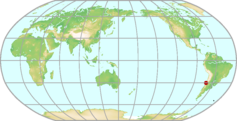 |
|---|---|---|
| GAW ID | TLL | |
| WIGOS ID | 0-20008-0-TLL | |
| Station name | El Tololo | |
| GAW category | GAW Regional | |
| WMO region | REGION III (South America) | |
| Country/territory | Chile | |
| Address 1 | ||
| Address 2 | ||
| Address 3 | ||
| Latitude (north: +; south: −) | -30.16833 | |
| Longitude (east: +; west: −) | -70.80361 | |
| Elevation (m a.s.l.) | 2154 | |
| Timezone | UTC-04:00 | |
| Category | fixed station | |
| Gawsis | https://gawsis.meteoswiss.ch/GAWSIS//index.html#/search/station/stationReportDetails/613 | |
| Climate Zone | BWk (Desert climate, cold arid) | |
| Website | ||
| Status | Operational | |
| Description | ||
| Contributor(s) |
|
|
| Gas Species |
|
|
Estevan Point Map
| WDCGG ID | ESP4013 |  |
|---|---|---|
| GAW ID | ESP | |
| WIGOS ID | 0-20008-0-ESP | |
| Station name | Estevan Point | |
| GAW category | GAW Regional | |
| WMO region | REGION IV (North and Central America) | |
| Country/territory | Canada | |
| Address 1 | ||
| Address 2 | ||
| Address 3 | ||
| Latitude (north: +; south: −) | 49.382935 | |
| Longitude (east: +; west: −) | -126.544097 | |
| Elevation (m a.s.l.) | 7 | |
| Timezone | UTC-07:00 | |
| Category | fixed station | |
| Gawsis | https://gawsis.meteoswiss.ch/GAWSIS//index.html#/search/station/stationReportDetails/679 | |
| Climate Zone | Cfb (Warm temperate climate, fully humid, warm summer) | |
| Website | ||
| Status | Operational | |
| Description | Estevan Point is a lighthouse station located in the midsection of Vancouver Islands west coast. The site can only be reached by boat or helicopter. The beach is about 100 m from the lighthouse. The lighthouse complex is surrounded to the north, east and south by forest and to the west by the Pacific Ocean. Currently, Environment and Climate Change Canada's Greenhouse Gas Monitoring Laboratory (GGML), measures ambient air for CO2, CH4 and CO using Cavity Ring Down Spectroscopy from a 40 m tower. Weekly flask samples were taken and analyzed for CO2, CH4, N2O from 2000-2017. These flasks were also analyzed for the isotopes of 13C and 18O in CO2 from 1998-2010. | |
| Contributor(s) |
|
|
| Gas Species |
|
|
Esther Map
| WDCGG ID | EST4178 |  |
|---|---|---|
| GAW ID | EST | |
| WIGOS ID | 0-20008-0-EST | |
| Station name | Esther | |
| GAW category | GAW Regional | |
| WMO region | REGION IV (North and Central America) | |
| Country/territory | Canada | |
| Address 1 | ||
| Address 2 | ||
| Address 3 | ||
| Latitude (north: +; south: −) | 51.67055 | |
| Longitude (east: +; west: −) | -110.206325 | |
| Elevation (m a.s.l.) | 707 | |
| Timezone | UTC-06:00 | |
| Category | fixed station | |
| Gawsis | https://gawsis.meteoswiss.ch/GAWSIS//index.html#/search/station/stationReportDetails/689 | |
| Climate Zone | Dfb (Snow climate, fully humid, warm summer) | |
| Website | ||
| Status | Operational | |
| Description | Esther is located in the Southeastern part of the province of Alberta in eastern Canada, 13.7 km west of the Alberta/Saskatchewan border. The immediate area is dominated by cattle ranches with a very low population. Rolling hills border the site to the southeast through west quadrants with the area to the east being primarily open prairie. Currently, Environment and Climate Change Canada's Greenhouse Gas Measurement Lab (GGML), continuously measures ambient CO2, CH4 and CO using Cavity Ring Down spectroscopy from a 50m tower. | |
| Contributor(s) |
|
|
| Gas Species |
|
|
Farafra Map
| WDCGG ID | FRF1012 |  |
|---|---|---|
| GAW ID | FRF | |
| WIGOS ID | 0-20008-0-FRF | |
| Station name | Farafra | |
| GAW category | GAW Regional | |
| WMO region | REGION I (Africa) | |
| Country/territory | Egypt | |
| Address 1 | ||
| Address 2 | ||
| Address 3 | ||
| Latitude (north: +; south: −) | 27.0581169128 | |
| Longitude (east: +; west: −) | 27.9901638031 | |
| Elevation (m a.s.l.) | 92 | |
| Timezone | UTC+02:00 | |
| Category | fixed station | |
| Gawsis | https://gawsis.meteoswiss.ch/GAWSIS//index.html#/search/station/stationReportDetails/771 | |
| Climate Zone | BWh (Desert climate, hot arid) | |
| Website | ||
| Status | Operational | |
| Description | ||
| Contributor(s) |
|
|
| Gas Species |
|
|
Finokalia Map
| WDCGG ID | FKL6052 |  |
|---|---|---|
| GAW ID | FKL | |
| WIGOS ID | 0-20008-0-FKL | |
| Station name | Finokalia | |
| GAW category | GAW Other elements | |
| WMO region | REGION VI (Europe) | |
| Country/territory | Greece | |
| Address 1 | ||
| Address 2 | ||
| Address 3 | ||
| Latitude (north: +; south: −) | 35.3377990723 | |
| Longitude (east: +; west: −) | 25.6693992615 | |
| Elevation (m a.s.l.) | 150 | |
| Timezone | UTC+02:00 | |
| Category | fixed station | |
| Gawsis | https://gawsis.meteoswiss.ch/GAWSIS//index.html#/search/station/stationReportDetails/764 | |
| Climate Zone | Csa (Warm temperate climate with dry and hot summer) | |
| Website | http://finokalia.chemistry.uoc.gr/ | |
| Status | Operational | |
| Description | ||
| Contributor(s) |
|
|
| Gas Species |
|
|
Fraserdale Map
| WDCGG ID | FSD4011 |  |
|---|---|---|
| GAW ID | FSD | |
| WIGOS ID | 0-20008-0-FSD | |
| Station name | Fraserdale | |
| GAW category | GAW Regional | |
| WMO region | REGION IV (North and Central America) | |
| Country/territory | Canada | |
| Address 1 | ||
| Address 2 | ||
| Address 3 | ||
| Latitude (north: +; south: −) | 49.8400001526 | |
| Longitude (east: +; west: −) | -81.5166702271 | |
| Elevation (m a.s.l.) | 210 | |
| Timezone | UTC-04:00 | |
| Category | fixed station | |
| Gawsis | https://gawsis.meteoswiss.ch/GAWSIS//index.html#/search/station/stationReportDetails/677 | |
| Climate Zone | Dfb (Snow climate, fully humid, warm summer) | |
| Website | ||
| Status | Operational | |
| Description | The Fraserdale observatory is located on the southern perimeter of the Hudson Bay Lowland and on the northern edge of the boreal forest at an elevation of 210m above sea level. The observatory is situated in a small clearing of approximately 1 km2 at the edge of a reservoir formed by a hydroelectric generating dam on the Abitibi River at the head of the Abitibi canyon. The station is located within a region that has extensive wetland coverage. The terrain in the surrounding area is slightly rolling with extensive areas of impeded drainage. It contains a mixture of black and white spruce, balsam fir, white birch, maple and trembling aspen. Currently, Environment and Climate Change Canada's Greenhouse Gas Measurement Lab (GGML), continuously measures ambient CO2, CH4 and CO via Cavity Ring Down spectroscopy. Weekly ambient flask samples were taken at the site and measured for CO2, CH4 and N2O from 1999- 2017 and 13C and 18O isotopes of CO2 from 2001-2010. | |
| Contributor(s) |
|
|
| Gas Species |
|
|
Fundata Map
| WDCGG ID | FDT6041 |  |
|---|---|---|
| GAW ID | FDT | |
| WIGOS ID | 0-20008-0-FDT | |
| Station name | Fundata | |
| GAW category | GAW Regional | |
| WMO region | REGION VI (Europe) | |
| Country/territory | Romania | |
| Address 1 | Statia Meteo Fundata comuna Fundata Jud.Brasov Romania | |
| Address 2 | ||
| Address 3 | ||
| Latitude (north: +; south: −) | 45.43147039 | |
| Longitude (east: +; west: −) | 25.2715382709 | |
| Elevation (m a.s.l.) | 1384 | |
| Timezone | UTC+02:00 | |
| Category | fixed station | |
| Gawsis | https://gawsis.meteoswiss.ch/GAWSIS//index.html#/search/station/stationReportDetails/539 | |
| Climate Zone | UNK (Unknown) | |
| Website | ||
| Status | Operational | |
| Description | Observation remarks: AUT; SOLRA; M; MONT; M/B; SUNDUR; GAW | |
| Contributor(s) |
|
|
| Gas Species |
|
|
Gartow Map
| WDCGG ID | GAT6058 |  |
|---|---|---|
| GAW ID | GAT | |
| WIGOS ID | 0-20008-0-GAT | |
| Station name | Gartow | |
| GAW category | GAW Regional | |
| WMO region | REGION VI (Europe) | |
| Country/territory | Germany | |
| Address 1 | ||
| Address 2 | ||
| Address 3 | ||
| Latitude (north: +; south: −) | 53.065514 | |
| Longitude (east: +; west: −) | 11.442733 | |
| Elevation (m a.s.l.) | 69 | |
| Timezone | UTC+01:00 | |
| Category | fixed station | |
| Gawsis | https://gawsis.meteoswiss.ch/GAWSIS//index.html#/search/station/stationReportDetails/32268 | |
| Climate Zone | Cfb (Warm temperate climate, fully humid, warm summer) | |
| Website | https://icos-atc.lsce.ipsl.fr/panelboard/gat; https://meta.icos-cp.eu/resources/stations/AS_GAT | |
| Status | Operational | |
| Description | Gartow is a small village in Lower Saxony, Germany. It is situated in the easternmost tip of Lower Saxony, on the river Elbe, approx. 30 km northeast of Salzwedel, and 20 km west of Wittenberge and approx. in the middle between Hamburg and Berlin. The surrounding area is very flat with elevations ranging from less t 9m a.s.l. (Elbe valley) up to 124m a.s.l. (Hill "Hoher Mechtin" - 35km west of GAT). The land use in this area is dominated by forest and agricultural fields (ca. 20 % and ca. 60 %), lakes cover about 2 %, villages and traffic about 12 %. Cities in the vicinity of the site: North of the Station: Schwerin (100000 inh., 65km), Parchim (20000 inh., 50km); East of the Station: Neuruppin (30000 inh., 90km); Southeast of the Station: Rathenow (25000 inh., 75km), Stendal (40000 inh., 55km), Brandenburg a.d. Havel (72000 inh., 100km); South of the Station: Gardelegen (25000 inh., 55km), Haldensleben (20000 inh., 85km), Wolfsburg (120000 inh., 80km); Southwest of theStation: Gifhorn (40000 inh., 85km), Celle (70000 inh., 85km); Northwest of the Station: Lüneburg (70000 inh., 70km) | |
| Contributor(s) |
|
|
| Gas Species |
|
|
Giordan Lighthouse Map
| WDCGG ID | GLH6049 |  |
|---|---|---|
| GAW ID | GLH | |
| WIGOS ID | 0-20008-0-GLH | |
| Station name | Giordan Lighthouse | |
| GAW category | GAW Regional | |
| WMO region | REGION VI (Europe) | |
| Country/territory | Malta | |
| Address 1 | Giordan Lighthouse, Gozo, Malta | |
| Address 2 | ||
| Address 3 | ||
| Latitude (north: +; south: −) | 36.0722 | |
| Longitude (east: +; west: −) | 14.2184 | |
| Elevation (m a.s.l.) | 167 | |
| Timezone | UTC+01:00 | |
| Category | fixed station | |
| Gawsis | https://gawsis.meteoswiss.ch/GAWSIS//index.html#/search/station/stationReportDetails/57 | |
| Climate Zone | Csa (Warm temperate climate with dry and hot summer) | |
| Website | ||
| Status | Operational | |
| Description | Lighthouse on top of a hill of Gozo set back 800 meters from cliff falling directly to the sea. Vegetation is very sparse except for some minor farming activity. Climate is typically Mediterranean. Exposed to prevailing NW winds. | |
| Contributor(s) |
|
|
| Gas Species |
|
|
Gobabeb Map
| WDCGG ID | NMB1008 |  |
|---|---|---|
| GAW ID | NMB | |
| WIGOS ID | 0-20008-0-NMB | |
| Station name | Gobabeb | |
| GAW category | GAW Regional | |
| WMO region | REGION I (Africa) | |
| Country/territory | Namibia | |
| Address 1 | ||
| Address 2 | ||
| Address 3 | ||
| Latitude (north: +; south: −) | -23.5699996948 | |
| Longitude (east: +; west: −) | 15.029999733 | |
| Elevation (m a.s.l.) | 408 | |
| Timezone | UTC+01:00 | |
| Category | fixed station | |
| Gawsis | https://gawsis.meteoswiss.ch/GAWSIS//index.html#/search/station/stationReportDetails/160 | |
| Climate Zone | BWh (Desert climate, hot arid) | |
| Website | ||
| Status | Operational | |
| Description | The station is located at the base of a linear sand dune, next to an interdune plain. NOAA takes flask samples here for "Carbon Cycle Surface Flask" project. | |
| Contributor(s) |
|
|
| Gas Species |
|
|
Grifton - Georgia Station (NC) Map
| WDCGG ID | ITN4027 |  |
|---|---|---|
| GAW ID | ITN | |
| WIGOS ID | 0-20008-0-ITN | |
| Station name | Grifton - Georgia Station (NC) | |
| GAW category | GAW Regional | |
| WMO region | REGION IV (North and Central America) | |
| Country/territory | United States of America | |
| Address 1 | ||
| Address 2 | ||
| Address 3 | ||
| Latitude (north: +; south: −) | 35.3499984741 | |
| Longitude (east: +; west: −) | -77.3799972534 | |
| Elevation (m a.s.l.) | 505 | |
| Timezone | UTC-05:00 | |
| Category | fixed station | |
| Gawsis | https://gawsis.meteoswiss.ch/GAWSIS//index.html#/search/station/stationReportDetails/166 | |
| Climate Zone | Cfa (Warm temperate climate, fully humid, hot summer) | |
| Website | ||
| Status | Operational | |
| Description | former NOAA flask sampling site | |
| Contributor(s) |
|
|
| Gas Species |
|
|
Guam (Mariana Island) Map
| WDCGG ID | GMI5004 |  |
|---|---|---|
| GAW ID | GMI | |
| WIGOS ID | 0-20008-0-GMI | |
| Station name | Guam (Mariana Island) | |
| GAW category | GAW Regional | |
| WMO region | REGION V (South-West Pacific) | |
| Country/territory | United States of America | |
| Address 1 | ||
| Address 2 | ||
| Address 3 | ||
| Latitude (north: +; south: −) | 13.4300003052 | |
| Longitude (east: +; west: −) | 144.7799987793 | |
| Elevation (m a.s.l.) | 2 | |
| Timezone | UTC+10:00 | |
| Category | fixed station | |
| Gawsis | https://gawsis.meteoswiss.ch/GAWSIS//index.html#/search/station/stationReportDetails/167 | |
| Climate Zone | Af (Equatorial rainforest, fully humid) | |
| Website | http://www.esrl.noaa.gov/gmd/dv/site/GMI.html | |
| Status | Operational | |
| Description | Guam is located at the southern end of the Northern Mariana Islands chain in the tropical western North Pacific Ocean. The Island is approximately 30 miles long with a population of ~150,000. The site is located on the roof of the College of Natural and Applied Sciences building at the University of Guam, on the eastern side of the island at a distance of ~250 meters from the Pacific Ocean. | |
| Contributor(s) |
|
|
| Gas Species |
|
|
Gunn Point Map
| WDCGG ID | GPA5008 |  |
|---|---|---|
| GAW ID | GPA | |
| WIGOS ID | 0-20008-0-GPA | |
| Station name | Gunn Point | |
| GAW category | GAW Regional | |
| WMO region | REGION V (South-West Pacific) | |
| Country/territory | Australia | |
| Address 1 | ||
| Address 2 | ||
| Address 3 | ||
| Latitude (north: +; south: −) | -12.2488002777 | |
| Longitude (east: +; west: −) | 131.0453033447 | |
| Elevation (m a.s.l.) | 25 | |
| Timezone | UTC+09:30 | |
| Category | fixed station | |
| Gawsis | https://gawsis.meteoswiss.ch/GAWSIS//index.html#/search/station/stationReportDetails/919 | |
| Climate Zone | UNK (Unknown) | |
| Website | ||
| Status | Operational | |
| Description | The station consists of a converted shipping container laboratory on a cleared site. It was formerly a prison farm, surrounded by grasslands, savannah and some small plots of pine trees. It is 2-3 kilometers from the coast and 70km via road from Darwin city centre (30km direct line). | |
| Contributor(s) |
|
|
| Gas Species |
|
|
Halley Map
| WDCGG ID | HBA7008 |  |
|---|---|---|
| GAW ID | HBA | |
| WIGOS ID | 0-20008-0-HBA | |
| Station name | Halley | |
| GAW category | GAW Global | |
| WMO region | ANTARCTICA | |
| Country/territory | United Kingdom of Great Britain and Northern Ireland | |
| Address 1 | ||
| Address 2 | ||
| Address 3 | ||
| Latitude (north: +; south: −) | -75.571509 | |
| Longitude (east: +; west: −) | -25.50386 | |
| Elevation (m a.s.l.) | 30 | |
| Timezone | UTC-02:00 | |
| Category | fixed station | |
| Gawsis | https://gawsis.meteoswiss.ch/GAWSIS//index.html#/search/station/stationReportDetails/583 | |
| Climate Zone | EF (Frost climate) | |
| Website | http://www.antarctica.ac.uk/living_and_working/research_stations/halley/ | |
| Status | Operational | |
| Description | Halley is on a floating ice shelf which moves roughly 500 m per year. In winter there is darkness for 105 days. Supplies are landed by ship onto the ice shelf and then towed on sledges to Halley VI, some 20 km distance from the ice edge. Total column ozone has been measured at Halley since 1956. Ground-based reactive gas measurements are made at Halley's Clean Air Sector Laboratory (CASLab) that is situated ~1 km from the station in a sector that receives minimal contamination from the generators. No routine vehicle access is permitted to the CASLab. The present station (the sixth near this location) consists of 8 purpose-built accommodation and science modules on hydraulic legs that are raised approximately annually to keep them clear of the accumulated snowfall. The station operates throughout the year with a population of roughly 65 in the summer and roughly 15 over winter. Internet access is available. | |
| Contributor(s) |
|
|
| Gas Species |
|
|
Hamamatsu Map
| WDCGG ID | HMM2024 |  |
|---|---|---|
| GAW ID | HMM | |
| WIGOS ID | 0-20008-0-HMM | |
| Station name | Hamamatsu | |
| GAW category | GAW Other elements | |
| WMO region | REGION II (Asia) | |
| Country/territory | Japan | |
| Address 1 | Shizuoka University, 3-5-1 Jyohoku, Hamamatsu 432-8561, Japan | |
| Address 2 | ||
| Address 3 | ||
| Latitude (north: +; south: −) | 34.7166671753 | |
| Longitude (east: +; west: −) | 137.7166595459 | |
| Elevation (m a.s.l.) | 29 | |
| Timezone | UTC+09:00 | |
| Category | fixed station | |
| Gawsis | https://gawsis.meteoswiss.ch/GAWSIS//index.html#/search/station/stationReportDetails/735 | |
| Climate Zone | Cfa (Warm temperate climate, fully humid, hot summer) | |
| Website | ||
| Status | Non-reporting | |
| Description | Urban area, about 80 km east of Nagoya | |
| Contributor(s) |
|
|
| Gas Species |
|
|
Harvard Forest (MA) Map
| WDCGG ID | HFM4020 |  |
|---|---|---|
| GAW ID | HFM | |
| WIGOS ID | 0-20008-0-HFM | |
| Station name | Harvard Forest (MA) | |
| GAW category | GAW Regional | |
| WMO region | REGION IV (North and Central America) | |
| Country/territory | United States of America | |
| Address 1 | ||
| Address 2 | ||
| Address 3 | ||
| Latitude (north: +; south: −) | 42.9000015259 | |
| Longitude (east: +; west: −) | -72.3000030518 | |
| Elevation (m a.s.l.) | 340 | |
| Timezone | UTC-05:00 | |
| Category | fixed station | |
| Gawsis | https://gawsis.meteoswiss.ch/GAWSIS//index.html#/search/station/stationReportDetails/173 | |
| Climate Zone | Dfb (Snow climate, fully humid, warm summer) | |
| Website | http://www.esrl.noaa.gov/gmd/dv/site/HFM.html | |
| Status | Operational | |
| Description | Harvard Forest is a 1200 hectares, aggrading, temperate, 50 to 70 year old, mixed deciduous forest with moderately hilly terrain. The physical plant includes Shaler Hall, a brick building with offices, research laboratories, seminar room, the Harvard Forest archives, a library of 22,000 volumes, and the Fisher Museum with panoramic displays. In addition, it has dormitory accomodations for twenty-five persons and dining room and kitchen facilities, photographic suite and darkroom, a graphics and mapping room, a projection and film analysis room for video microscopy, and micro computers. Also, there are two greenhouses, the Director's house (David Foster), and four residences for research staff and their families. Also, there's the woods crew of three men, the forest manager and their back-hoe, bulldozer, tractor, crawler, dump truck, flat bed truck, pick up and van, wood working shop, and a sawmill. | |
| Contributor(s) |
|
|
| Gas Species |
|
|
Hateruma Island Map
| WDCGG ID | HAT2031 |  |
|---|---|---|
| GAW ID | ||
| WIGOS ID | 0-20008-0-HAT | |
| Station name | Hateruma Island | |
| GAW category | GAW Other elements | |
| WMO region | REGION II (Asia) | |
| Country/territory | Japan | |
| Address 1 | Aza-Hateruma 4794, Taketomi-cho, Yaeyama-gun, OKINAWA, 907-1751, Japan | |
| Address 2 | ||
| Address 3 | ||
| Latitude (north: +; south: −) | 24.06069 | |
| Longitude (east: +; west: −) | 123.80939 | |
| Elevation (m a.s.l.) | 10 | |
| Timezone | UTC+09:00 | |
| Category | fixed station | |
| Gawsis | https://gawsis.meteoswiss.ch/GAWSIS//index.html#/search/station/stationReportDetails/639 | |
| Climate Zone | Cfa (Warm temperate climate, fully humid, hot summer) | |
| Website | https://db.cger.nies.go.jp/gem/en/warm/Ground/st02_hsinfo.html | |
| Status | Operational | |
| Description | Hateruma Island is located at the southern end of the Japanese Archipelago, 60km north of the Tropic of Cancer, 220 km east of Taiwan, and 460 km southwest of Okinawa. Hateruma island was formed by raised coral reef, and it is about 6 km east-west and 4 km north-south, with area of about 12.5 km2. The population of the island is about 600 and the sugar cane farming is the island's main industry. The station is located at the east end of the island, about 100 m from the coast and 10m above sea level, surrounded by the windbreak forest. The wind is northerly to northeasterly in autumn-winter and southerly to southeasterly in spring-summer The annual mean wind speed at the top of the tower (46.5 m above sea level) is about 8 m/s. The surface temperature is about 24oC and the annual rainfall is about 1900 mm. | |
| Contributor(s) |
|
|
| Gas Species |
|
|
Heathfield Map
| WDCGG ID | HFD6419 |  |
|---|---|---|
| GAW ID | HFD | |
| WIGOS ID | 0-20008-0-HFD | |
| Station name | Heathfield | |
| GAW category | GAW Regional | |
| WMO region | REGION VI (Europe) | |
| Country/territory | United Kingdom of Great Britain and Northern Ireland | |
| Address 1 | ||
| Address 2 | ||
| Address 3 | ||
| Latitude (north: +; south: −) | 50.976667 | |
| Longitude (east: +; west: −) | 0.230556 | |
| Elevation (m a.s.l.) | 160 | |
| Timezone | UTC | |
| Category | fixed station | |
| Gawsis | https://gawsis.meteoswiss.ch/GAWSIS//index.html#/search/station/stationReportDetails/73197 | |
| Climate Zone | Cfb (Warm temperate climate, fully humid, warm summer) | |
| Website | ||
| Status | Operational | |
| Description | ||
| Contributor(s) |
|
|
| Gas Species |
|
|
Hegyhátsál háttérszennyettség-mérő állomás Map
| WDCGG ID | HUN6034 |  |
|---|---|---|
| GAW ID | HUN | |
| WIGOS ID | 0-348-4-16307 | |
| Station name | Hegyhátsál háttérszennyettség-mérő állomás | |
| GAW category | GAW Regional | |
| WMO region | REGION VI (Europe) | |
| Country/territory | Hungary | |
| Address 1 | ||
| Address 2 | ||
| Address 3 | ||
| Latitude (north: +; south: −) | 46.9559 | |
| Longitude (east: +; west: −) | 16.6521 | |
| Elevation (m a.s.l.) | 248 | |
| Timezone | UTC+01:00 | |
| Category | fixed station | |
| Gawsis | https://gawsis.meteoswiss.ch/GAWSIS//index.html#/search/station/stationReportDetails/175 | |
| Climate Zone | Cfb (Warm temperate climate, fully humid, warm summer) | |
| Website | http://nimbus.elte.hu/hhs | |
| Status | Operational | |
| Description | The tower belongs to the developing European network of tall tower sites which will monitor all important greenhouse gases to support the Kyoto Protocol and climate research with high precision, spatially representative data. site properities: rural, regional background The measurements are carried out at four elevation levels (10 m, 48 m, 82 m, 115 m) on a 117 m tall, free-standing TV/radio transmitter tower owned by Antenna Hungaria Corp. Human habitations within 10 km of the tower are only small villages (100-400 inhabitants). The nearest village is Hegyhatsal (170 inhabitants) about 1 km to the northwest. There is no notable industrial activity in this dominantly agricultural region. Local roads have mostly low levels of traffic. One of the few main roads of the region, which carries 3600 vehicles per day on average, passes approximately 400 m to the southwest of the tower. Measurements of CO2 mixing ratio profiles, temperature, humidity and wind profiles began in September 1994. CO2 vertical flux measurements (82 m) began in April 1997. The tower is also a NOAA/CMDL global air sampling network site. | |
| Contributor(s) |
|
|
| Gas Species |
|
|
Helgoland Map
| WDCGG ID | HEL6415 |  |
|---|---|---|
| GAW ID | HEL | |
| WIGOS ID | 0-276-0-HEL | |
| Station name | Helgoland | |
| GAW category | GAW Regional | |
| WMO region | REGION VI (Europe) | |
| Country/territory | Germany | |
| Address 1 | ||
| Address 2 | ||
| Address 3 | ||
| Latitude (north: +; south: −) | 54.1804 | |
| Longitude (east: +; west: −) | 7.8832 | |
| Elevation (m a.s.l.) | 43 | |
| Timezone | UTC+01:00 | |
| Category | fixed station | |
| Gawsis | https://gawsis.meteoswiss.ch/GAWSIS//index.html#/search/station/stationReportDetails/56375 | |
| Climate Zone | Cfb (Warm temperate climate, fully humid, warm summer) | |
| Website | ||
| Status | Operational | |
| Description | The maritim station is located on Helgoland, an isle in the North Sea within the the German Bight. The area of the main Island is about 1km² and Its distance to the continent is about 50km (east to south). | |
| Contributor(s) |
|
|
| Gas Species |
|
|
Hohenpeissenberg Map
| WDCGG ID | HPB6028 |  |
|---|---|---|
| GAW ID | HPB | |
| WIGOS ID | 0-20008-0-HPB | |
| Station name | Hohenpeissenberg | |
| GAW category | GAW Global | |
| WMO region | REGION VI (Europe) | |
| Country/territory | Germany | |
| Address 1 | Albin-Schwaiger-Weg 10D-82383 HohenpeissenbergGermany | |
| Address 2 | ||
| Address 3 | ||
| Latitude (north: +; south: −) | 47.8014984131 | |
| Longitude (east: +; west: −) | 11.0096197128 | |
| Elevation (m a.s.l.) | 985 | |
| Timezone | UTC+01:00 | |
| Category | fixed station | |
| Gawsis | https://gawsis.meteoswiss.ch/GAWSIS//index.html#/search/station/stationReportDetails/482 | |
| Climate Zone | Cfb (Warm temperate climate, fully humid, warm summer) | |
| Website | www.dwd.de/mohp | |
| Status | Operational | |
| Description | Hohenpeissenberg is an isolated mountain 40 km north of Zugspitze. It rises 300 m above the surrounding area that is populated to an extent typical for Central Europe and partly covered with meadows (~70%) and forests (~30%). The observatory is situated on top of the mountain. It has a long history of meteorological and climatological observations (since 1781). | |
| Contributor(s) |
|
|
| Gas Species |
|
|
Hok Tsui / Cape d Aguilar Map
| WDCGG ID | HKG2034 |  |
|---|---|---|
| GAW ID | HKG | |
| WIGOS ID | 0-20008-0-HKG | |
| Station name | Hok Tsui / Cape d Aguilar | |
| GAW category | GAW Regional | |
| WMO region | REGION II (Asia) | |
| Country/territory | Hong Kong, China | |
| Address 1 | Submarine Cable Station, Hok Tsui Road, Cape D'Aguilar, Hong Kong. | |
| Address 2 | ||
| Address 3 | ||
| Latitude (north: +; south: −) | 22.2094 | |
| Longitude (east: +; west: −) | 114.2535 | |
| Elevation (m a.s.l.) | 53 | |
| Timezone | UTC+08:00 | |
| Category | fixed station | |
| Gawsis | https://gawsis.meteoswiss.ch/GAWSIS//index.html#/search/station/stationReportDetails/626 | |
| Climate Zone | Cwb (Warm temperate climate with dry winter and warm summer) | |
| Website | https://www.weather.gov.hk | |
| Status | Operational | |
| Description | Hong Kong’s climate is sub-tropical, tending towards temperate for nearly half of the year. The prevailing wind in Hong Kong is easterlies. For most of the time, Hok Tsui is upwind of the urban areas and receives air mass that comes mainly from the sea. Hok Tsui is a remote coastal site in Hong Kong with short grasses and shrubs in its vicinity. It is located at the southeastern tip of Hong Kong Island, and is about 9 km from the highly populated city centre of Hong Kong to its northwest. Hok Tsui PolyU Background Air Monitoring Station, established in 1993 at Hok Tsui, is the location where measurements of carbon dioxide, carbon monoxide, surface ozone, total column ozone and UV spectral are made. The measurement site is situated on the top of a cliff 60 m above mean sea level. It has a 240 degree view of the sea stretching from northeast to west. From November 2010 to December 2019, carbon dioxide concentration in ambient air measured at Hok Tsui PolyU Background Air Monitoring Station was reported to WDCGG. Since 1 January 2020, measurement of carbon dioxide was made at another location at Hok Tsui site. The measurement location, Cape D'Aguilar Supersite Air Quality Monitoring Station, was established at Hok Tsui in 2017. Since 1 January 2020, carbon dioxide concentration in dry air measured at the Cape D'Aguilar Supersite Air Quality Monitoring Station has been reported to WDCGG. | |
| Contributor(s) |
|
|
| Gas Species |
|
|
Huancayo Map
| WDCGG ID | HUA3002 |  |
|---|---|---|
| GAW ID | HUA | |
| WIGOS ID | 0-20008-0-HUA | |
| Station name | Huancayo | |
| GAW category | GAW Regional | |
| WMO region | REGION III (South America) | |
| Country/territory | Peru | |
| Address 1 | Apartado 46, Huancayo, Peru | |
| Address 2 | ||
| Address 3 | ||
| Latitude (north: +; south: −) | -12.1499996185 | |
| Longitude (east: +; west: −) | -75.5666656494 | |
| Elevation (m a.s.l.) | 4575 | |
| Timezone | UTC-05:00 | |
| Category | fixed station | |
| Gawsis | https://gawsis.meteoswiss.ch/GAWSIS//index.html#/search/station/stationReportDetails/5 | |
| Climate Zone | ET (Tundra climate) | |
| Website | ||
| Status | Closed | |
| Description | At observatory in open landscape, agricultural environment, very little traffic. Dobson #87 moved to Marcapomacocha in 2000. | |
| Contributor(s) |
|
|
| Gas Species |
|
|
Hyltemossa Map
| WDCGG ID | HTM6319 | 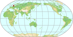 |
|---|---|---|
| GAW ID | HTM | |
| WIGOS ID | 0-20008-0-HTM | |
| Station name | Hyltemossa | |
| GAW category | GAW Regional | |
| WMO region | REGION VI (Europe) | |
| Country/territory | Sweden | |
| Address 1 | ||
| Address 2 | ||
| Address 3 | ||
| Latitude (north: +; south: −) | 56.09763 | |
| Longitude (east: +; west: −) | 13.41897 | |
| Elevation (m a.s.l.) | 115 | |
| Timezone | UTC+01:00 | |
| Category | fixed station | |
| Gawsis | https://gawsis.meteoswiss.ch/GAWSIS//index.html#/search/station/stationReportDetails/32401 | |
| Climate Zone | Cfb (Warm temperate climate, fully humid, warm summer) | |
| Website | http://www.icos-sweden.se/station_hyltemossa.html | |
| Status | Non-reporting | |
| Description | ||
| Contributor(s) |
|
|
| Gas Species |
|
|
Hyytiälä Map
| WDCGG ID | SMR6401 | 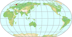 |
|---|---|---|
| GAW ID | SMR | |
| WIGOS ID | 0-20008-0-SMR | |
| Station name | Hyytiälä | |
| GAW category | GAW Regional | |
| WMO region | REGION VI (Europe) | |
| Country/territory | Finland | |
| Address 1 | ||
| Address 2 | ||
| Address 3 | ||
| Latitude (north: +; south: −) | 61.84738441 | |
| Longitude (east: +; west: −) | 24.2947798 | |
| Elevation (m a.s.l.) | 181 | |
| Timezone | UTC+02:00 | |
| Category | fixed station | |
| Gawsis | https://gawsis.meteoswiss.ch/GAWSIS//index.html#/search/station/stationReportDetails/926 | |
| Climate Zone | Dfc (Snow climate, fully humid, cool summer) | |
| Website | http://www.atm.helsinki.fi/SMEAR/ | |
| Status | Operational | |
| Description | Scotch pine forest planted in early sixties. Located on a hill around 20m higher than the surrounding areas. Rural area, mainly forest. Closest larger habitation Korkeakoski, about 6km SE from the station. Major city Tampere located 50km SW from the station. | |
| Contributor(s) |
|
|
| Gas Species |
|
|
Ile Grande Map
| WDCGG ID | LPO6026 |  |
|---|---|---|
| GAW ID | LPO | |
| WIGOS ID | 0-20008-0-LPO | |
| Station name | Ile Grande | |
| GAW category | GAW Other elements | |
| WMO region | REGION VI (Europe) | |
| Country/territory | France | |
| Address 1 | Station LPO de l'Ile Grande 22560 Pleumeur Bodou France Tel 02 96 91 91 40 Fax 02 96 91 91 05 Email: ile-grande@lpo.fr | |
| Address 2 | ||
| Address 3 | ||
| Latitude (north: +; south: −) | 48.8036003113 | |
| Longitude (east: +; west: −) | -3.5838999748 | |
| Elevation (m a.s.l.) | 20 | |
| Timezone | UTC+01:00 | |
| Category | fixed station | |
| Gawsis | https://gawsis.meteoswiss.ch/GAWSIS//index.html#/search/station/stationReportDetails/762 | |
| Climate Zone | Cfb (Warm temperate climate, fully humid, warm summer) | |
| Website | http://www.lpo.fr/reseau/ile-grande/ | |
| Status | Non-reporting | |
| Description | ||
| Contributor(s) |
|
|
| Gas Species |
|
|
Inuvik Map
| WDCGG ID | INU4176 |  |
|---|---|---|
| GAW ID | INU | |
| WIGOS ID | 0-20008-0-INU | |
| Station name | Inuvik | |
| GAW category | GAW Regional | |
| WMO region | REGION IV (North and Central America) | |
| Country/territory | Canada | |
| Address 1 | ||
| Address 2 | ||
| Address 3 | ||
| Latitude (north: +; south: −) | 68.317817 | |
| Longitude (east: +; west: −) | -133.534232 | |
| Elevation (m a.s.l.) | 107 | |
| Timezone | UTC-06:00 | |
| Category | fixed station | |
| Gawsis | https://gawsis.meteoswiss.ch/GAWSIS//index.html#/search/station/stationReportDetails/968 | |
| Climate Zone | UNK (Unknown) | |
| Website | ||
| Status | Operational | |
| Description | The town of Inuvik is located 200 km north the Arctic Circle and 117km south of the Arctic Ocean. It lies on the East Channel of the Mackenzie Delta, nestled between the treeless tundra and the northern boreal forest. Because of its location being in a discontinuous permafrost zone and within the tree line transition zone, this site provides an excellent platform for observing potential emissions of carbon from the high terrestrial/subarctic region. The location of the Inuvik site also provides an excellent opportunity to establish "baseline" conditions in advance of proposed fossil fuel activities in the immediate area. The sampling site is in an Environment and Climate Change (ECCC) upper air building facility located approximately 5 km southeast of the town and situated in a clearing on top of a 50m high ridge, overlooking the surrounding treetops. In March 2024, ECCC's Greenhouse Gas Measurement Lab (GGML), suspended the continuous measurements of ambient CO2, CH4 and CO using Cavity Ring Down spectroscopy via a 10m tower. Weekly ambient flask samples were also taken at the site and measured for CO2, CH4 and N2O from 2012-2017 by the GGML. | |
| Contributor(s) |
|
|
| Gas Species |
|
|
Ispra Map
| WDCGG ID | IPR6272 | 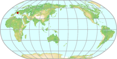 |
|---|---|---|
| GAW ID | IPR | |
| WIGOS ID | 0-20008-0-IPR | |
| Station name | Ispra | |
| GAW category | GAW Regional | |
| WMO region | REGION VI (Europe) | |
| Country/territory | Italy | |
| Address 1 | ||
| Address 2 | ||
| Address 3 | ||
| Latitude (north: +; south: −) | 45.8030014038 | |
| Longitude (east: +; west: −) | 8.626999855 | |
| Elevation (m a.s.l.) | 209 | |
| Timezone | UTC+01:00 | |
| Category | fixed station | |
| Gawsis | https://gawsis.meteoswiss.ch/GAWSIS//index.html#/search/station/stationReportDetails/510 | |
| Climate Zone | Cfb (Warm temperate climate, fully humid, warm summer) | |
| Website | https://abc-is.jrc.ec.europa.eu/ | |
| Status | Operational | |
| Description | The station is located in a semi-rural region inside the Joint Research Centre premises in Ispra, Italy. The main emission sources in the region are the city of Varese, about 20 km to the east, the city of Milano, about 60 km to the south-east, the city of Novara about 40 km to the south and the various industrial sites in the Po valley. | |
| Contributor(s) |
|
|
| Gas Species |
|
|
Issyk-Kul Map
| WDCGG ID | ISK2009 |  |
|---|---|---|
| GAW ID | ISK | |
| WIGOS ID | 0-20008-0-ISK | |
| Station name | Issyk-Kul | |
| GAW category | GAW Regional | |
| WMO region | REGION II (Asia) | |
| Country/territory | Kyrgyzstan | |
| Address 1 | Manas St. 101, Bishkek, 720033 Kyrgyz Republic | |
| Address 2 | ||
| Address 3 | ||
| Latitude (north: +; south: −) | 42.6166648865 | |
| Longitude (east: +; west: −) | 76.9833297729 | |
| Elevation (m a.s.l.) | 1640 | |
| Timezone | UTC+05:00 | |
| Category | fixed station | |
| Gawsis | https://gawsis.meteoswiss.ch/GAWSIS//index.html#/search/station/stationReportDetails/655 | |
| Climate Zone | Dfc (Snow climate, fully humid, cool summer) | |
| Website | ||
| Status | Operational | |
| Description | The Issyk Kul station located in the center of Eurasia (the Northern Tien Shan) on the north coast of Issyk-Kul lake. Issyk-Kul lake represents one from the largest intermountain hollows of Tien Shan, located on the northeast of Kyrgyzstan. It is enclosed by two large arcs of mountain circuits: in north that is Khungey Ala Tao and in the south that is Terskoy Ala Tao, converging in west and east and forming the closed space. The hollow is prolate west-to-east more than on 250 km and has a widthway from the south to north about 100 km. From the total area about 23000 km2 of the hollow a water surface of the lake, located at the height of 1609 m above a sea level, takes 6292 km2. Northern part of littoral valley located below 1800 m above a sea level, and it widthway changes from 2 up to 10 km. The foothill ridges are raised up to 1 km above lake, and enclosing mountain ridges have the heights up to 4,5 - 5,2 km above a sea level. Due to the heat stored during a warm season in surface layers, Issyk-Kul lake does not freeze in cold time. | |
| Contributor(s) |
|
|
| Gas Species |
|
|
Izaña (Tenerife) Map
| WDCGG ID | IZO1002 |  |
|---|---|---|
| GAW ID | IZO | |
| WIGOS ID | 0-20008-0-IZO | |
| Station name | Izaña (Tenerife) | |
| GAW category | GAW Global | |
| WMO region | REGION I (Africa) | |
| Country/territory | Spain | |
| Address 1 | ||
| Address 2 | ||
| Address 3 | ||
| Latitude (north: +; south: −) | 28.3090000153 | |
| Longitude (east: +; west: −) | -16.4993991852 | |
| Elevation (m a.s.l.) | 2373 | |
| Timezone | UTC | |
| Category | fixed station | |
| Gawsis | https://gawsis.meteoswiss.ch/GAWSIS//index.html#/search/station/stationReportDetails/455 | |
| Climate Zone | Csb (Warm temperate climate with dry and warm summer) | |
| Website | http://izana.aemet.es/ | |
| Status | Operational | |
| Description | The Izaña station is located on the Island of Tenerife, Spain, roughly 300 km west of the African coast. The meteorological observatory is situated on a mountain platform , 15 km north-east of the volcano Teide (3718 m a.s.l.). The local wind field at the site is dominated by north-westerly winds. A predominant meteorological attribute of the Canary Islands region is the presence of the trade wind inversion that persists through most of the year and is well below the altitude of the station. The ground in the vicinity around Izaña is loosely covered with light volcanic soil. The vegetation in the surrounding area is sparse, consisting mainly of broom. About 100 m south of the station a road leads to the meteorological observatory, and also serves the astrophysical institute of the Canaries and a nearby military camp. Because the road is closed to public traffic, only approximately 5 to 10 cars a day pass the vicinity. The complementary background urban pollution research Observatory at Santa Cruz de Tenerife (SCO, 28º 28’N; 16º15’ W) is located on the roof of the IARC’s headquarters at 52 m a.s.l. in the city of Santa Cruz de Tenerife, by the city harbour. This station is also part of GURME program. | |
| Contributor(s) |
|
|
| Gas Species |
|
|
Jeju Gosan Map
| WDCGG ID | GSN2025 |  |
|---|---|---|
| GAW ID | GSN | |
| WIGOS ID | 0-20008-0-GSN | |
| Station name | Jeju Gosan | |
| GAW category | GAW Regional | |
| WMO region | REGION II (Asia) | |
| Country/territory | Republic of Korea | |
| Address 1 | 3768 Gosan-Ri Hankyung-Myeon Bukjeju-Gun Jeju, Republic of Korea | |
| Address 2 | ||
| Address 3 | ||
| Latitude (north: +; south: −) | 33.29382 | |
| Longitude (east: +; west: −) | 126.16283 | |
| Elevation (m a.s.l.) | 71.39 | |
| Timezone | UTC+09:00 | |
| Category | fixed station | |
| Gawsis | https://gawsis.meteoswiss.ch/GAWSIS//index.html#/search/station/stationReportDetails/197 | |
| Climate Zone | Cfa (Warm temperate climate, fully humid, hot summer) | |
| Website | ||
| Status | Operational | |
| Description | The Gosan site on Jeju Island of South Korea is located at the northern part of the East China Sea, about 100 km south of the Korean peninsula, 500 km northeast of Shanghai, China, and 250 km west of Kyushu, Japan. The Gosan site is located at the western edge of the island at the top of a 72 m cliff, facing the East China Sea. Jeju Island is regarded as one of the cleanest areas in South Korea with low emissions of air pollutants. | |
| Contributor(s) |
|
|
| Gas Species |
|
|
Jubany Map
| WDCGG ID | JBN7002 |  |
|---|---|---|
| GAW ID | JBN | |
| WIGOS ID | 0-20008-0-JBN | |
| Station name | Jubany | |
| GAW category | GAW Regional | |
| WMO region | ANTARCTICA | |
| Country/territory | Argentina | |
| Address 1 | ||
| Address 2 | ||
| Address 3 | ||
| Latitude (north: +; south: −) | -62.2382011414 | |
| Longitude (east: +; west: −) | -58.6660003662 | |
| Elevation (m a.s.l.) | 15 | |
| Timezone | UTC-03:00 | |
| Category | fixed station | |
| Gawsis | https://gawsis.meteoswiss.ch/GAWSIS//index.html#/search/station/stationReportDetails/738 | |
| Climate Zone | EF (Frost climate) | |
| Website | http://www.geocities.com/ciat389/index.html | |
| Status | Non-reporting | |
| Description | Jubany station is situated in the King George Island , South Shetland archipelago , just North of the Antarctic peninsula. The ground is covered with snow through 10 months. The ice occupies the Potter bay approximately through 2 months. The station is managed by Argentine Antarctic Program and CO2 measurements is supported by CNR-ISAC through National Antarctic Program of Italy (PNRA). Jubany is one of three stations measuring CO2 continuously in Antarctica. | |
| Contributor(s) |
|
|
| Gas Species |
|
|
Jungfraujoch Map
| WDCGG ID | JFJ6036 |  |
|---|---|---|
| GAW ID | JFJ | |
| WIGOS ID | 0-20008-0-JFJ | |
| Station name | Jungfraujoch | |
| GAW category | GAW Global | |
| WMO region | REGION VI (Europe) | |
| Country/territory | Switzerland | |
| Address 1 | Hochalpine Forschungsstation Jungfraujoch, CH- 3801 Jungfraujoch, Switzerland | |
| Address 2 | ||
| Address 3 | ||
| Latitude (north: +; south: −) | 46.5474891663 | |
| Longitude (east: +; west: −) | 7.9850897789 | |
| Elevation (m a.s.l.) | 3580 | |
| Timezone | UTC+01:00 | |
| Category | fixed station | |
| Gawsis | https://gawsis.meteoswiss.ch/GAWSIS//index.html#/search/station/stationReportDetails/451 | |
| Climate Zone | ET (Tundra climate) | |
| Website | www.ifjungo.ch | |
| Status | Operational | |
| Description | The high alpine research station Jungfraujoch is situated on a mountain saddle between the two mountains Jungfrau (4158m asl) and Mönch (4099m asl). The station is located in the center of Europe at an altitude of 3580m asl and is surrounded by highly industrialized regions at much lower altitudes. This special geographical situation offers the opportunity to monitor background concentrations but also to investigate the transport of anthropogenic pollutants from the boundary layer to the free troposphere. | |
| Contributor(s) |
|
|
| Gas Species |
|
|
Jülich Map
| WDCGG ID | JUE6421 |  |
|---|---|---|
| GAW ID | JUE | |
| WIGOS ID | 0-20008-0-JUE | |
| Station name | Jülich | |
| GAW category | GAW Regional | |
| WMO region | REGION VI (Europe) | |
| Country/territory | Germany | |
| Address 1 | ||
| Address 2 | ||
| Address 3 | ||
| Latitude (north: +; south: −) | 50.910197 | |
| Longitude (east: +; west: −) | 6.409614 | |
| Elevation (m a.s.l.) | 98 | |
| Timezone | UTC+01:00 | |
| Category | fixed station | |
| Gawsis | https://gawsis.meteoswiss.ch/GAWSIS//index.html#/search/station/stationReportDetails/32675 | |
| Climate Zone | Cfb (Warm temperate climate, fully humid, warm summer) | |
| Website | ||
| Status | Operational | |
| Description | The tower is located in a semi-rural region next to the Research Center Jülich, near Cologne. The surrounding area of the tower is mostly flat. Northern foothills of the low mountain range Eifel, south of the Tower are about 500m in elevation. | |
| Contributor(s) |
|
|
| Gas Species |
|
|
Kaashidhoo (Male Atoll) Map
| WDCGG ID | KCO2037 |  |
|---|---|---|
| GAW ID | KCO | |
| WIGOS ID | 0-20008-0-KCO | |
| Station name | Kaashidhoo (Male Atoll) | |
| GAW category | GAW Regional | |
| WMO region | REGION II (Asia) | |
| Country/territory | Maldives | |
| Address 1 | ||
| Address 2 | ||
| Address 3 | ||
| Latitude (north: +; south: −) | 4.9699997902 | |
| Longitude (east: +; west: −) | 73.4700012207 | |
| Elevation (m a.s.l.) | 1 | |
| Timezone | UTC+05:00 | |
| Category | fixed station | |
| Gawsis | https://gawsis.meteoswiss.ch/GAWSIS//index.html#/search/station/stationReportDetails/190 | |
| Climate Zone | Am (Equatorial monsoon) | |
| Website | ||
| Status | Closed | |
| Description | This station was setup under a research project called INDOEX and has been closed since 1999. | |
| Contributor(s) |
|
|
| Gas Species |
|
|
Kaitorete Spit Map
| WDCGG ID | NZL5013 | 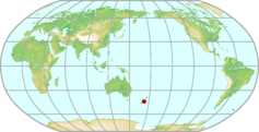 |
|---|---|---|
| GAW ID | NZL | |
| WIGOS ID | 0-20008-0-NZL | |
| Station name | Kaitorete Spit | |
| GAW category | GAW Regional | |
| WMO region | REGION V (South-West Pacific) | |
| Country/territory | New Zealand | |
| Address 1 | ||
| Address 2 | ||
| Address 3 | ||
| Latitude (north: +; south: −) | -43.8300018311 | |
| Longitude (east: +; west: −) | 172.6300048828 | |
| Elevation (m a.s.l.) | 3 | |
| Timezone | UTC+12:00 | |
| Category | fixed station | |
| Gawsis | https://gawsis.meteoswiss.ch/GAWSIS//index.html#/search/station/stationReportDetails/191 | |
| Climate Zone | Cfb (Warm temperate climate, fully humid, warm summer) | |
| Website | ||
| Status | Closed | |
| Description | former flask sampling site of NOAA | |
| Contributor(s) |
|
|
| Gas Species |
|
|
Karlsruhe Map
| WDCGG ID | KIT6084 |  |
|---|---|---|
| GAW ID | KIT | |
| WIGOS ID | 0-20008-0-KIT | |
| Station name | Karlsruhe | |
| GAW category | GAW Contributing networks | |
| WMO region | REGION VI (Europe) | |
| Country/territory | Germany | |
| Address 1 | ||
| Address 2 | ||
| Address 3 | ||
| Latitude (north: +; south: −) | 49.0999984741 | |
| Longitude (east: +; west: −) | 8.4379997253 | |
| Elevation (m a.s.l.) | 111 | |
| Timezone | UTC+01:00 | |
| Category | fixed station | |
| Gawsis | https://gawsis.meteoswiss.ch/GAWSIS//index.html#/search/station/stationReportDetails/879 | |
| Climate Zone | Cfb (Warm temperate climate, fully humid, warm summer) | |
| Website | https://tccon-wiki.caltech.edu/Sites/Karlsruhe | |
| Status | Operational | |
| Description | ||
| Contributor(s) |
|
|
| Gas Species |
|
|
Kasprowy Wierch Map
| WDCGG ID | KAS6445 | 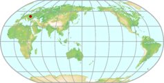 |
|---|---|---|
| GAW ID | KAS | |
| WIGOS ID | 0-616-0-KAS | |
| Station name | Kasprowy Wierch | |
| GAW category | GAW Regional | |
| WMO region | REGION VI (Europe) | |
| Country/territory | Poland | |
| Address 1 | ||
| Address 2 | ||
| Address 3 | ||
| Latitude (north: +; south: −) | 49.2325 | |
| Longitude (east: +; west: −) | 19.9818 | |
| Elevation (m a.s.l.) | 1989 | |
| Timezone | UTC+01:00 | |
| Category | fixed station | |
| Gawsis | https://gawsis.meteoswiss.ch/GAWSIS//index.html#/search/station/stationReportDetails/149811 | |
| Climate Zone | ET (Tundra climate) | |
| Website | http://rainbow.fis.agh.edu.pl/zfs/index.php/en/research-groups/19-kasprowy-wierch-greenhouse-gas-laboratory | |
| Status | Operational | |
| Description | The nearest town, Zakopane (27 000 inhabitants), is located approximately 1 km below, 7 km north of Kasprowy Wierch. This is a small tourist town. During winter period, from November to March, relatively large amounts of wood and fossil fuels are combusted in the Zakopane area. In the direct neighborhood of the observatory there is a cable car station located about 40 m below the observatory. Additionally during wintertime, diesel-operated snowcats are used in near-by valleys to maintain proper conditions for skiing. | |
| Contributor(s) |
|
|
| Gas Species |
|
|
Kecskemét K-puszta háttérszennyettség-mérő állomás Map
| WDCGG ID | KPS6033 |  |
|---|---|---|
| GAW ID | KPS | |
| WIGOS ID | 0-348-4-46316 | |
| Station name | Kecskemét K-puszta háttérszennyettség-mérő állomás | |
| GAW category | GAW Regional | |
| WMO region | REGION VI (Europe) | |
| Country/territory | Hungary | |
| Address 1 | ||
| Address 2 | ||
| Address 3 | ||
| Latitude (north: +; south: −) | 46.9666671753 | |
| Longitude (east: +; west: −) | 19.5833339691 | |
| Elevation (m a.s.l.) | 125 | |
| Timezone | UTC+01:00 | |
| Category | fixed station | |
| Gawsis | https://gawsis.meteoswiss.ch/GAWSIS//index.html#/search/station/stationReportDetails/505 | |
| Climate Zone | Cfb (Warm temperate climate, fully humid, warm summer) | |
| Website | www.met.hu | |
| Status | Operational | |
| Description | K-puszta, 70 km SE of Budapest, regional background air pollution monitoring station was established in a clearing in a mixed forest on the Hungarian Great Plain, in the middle of the Carpathian Basin, as far from the pollution sources as possible in the highly industrialized, densely populated Central Europe. Because of the growing vegetation the station was moved to a bigger clearing, also at the same elevation, approximately 500 m from the original one, in September, 1993. | |
| Contributor(s) |
|
|
| Gas Species |
|
|
Kennaook / Cape Grim Map
| WDCGG ID | CGO5011 |  |
|---|---|---|
| GAW ID | CGO | |
| WIGOS ID | 0-20008-0-CGO | |
| Station name | Kennaook / Cape Grim | |
| GAW category | GAW Global | |
| WMO region | REGION V (South-West Pacific) | |
| Country/territory | Australia | |
| Address 1 | Cape Grim Baseline Air Pollution Station, 159 Nelson Street, Smithton, Tasmania 7330, Australia. Postal address: P.O. Box 346, Smithton, Tasmania 7330, Australia | |
| Address 2 | ||
| Address 3 | ||
| Latitude (north: +; south: −) | -40.682220459 | |
| Longitude (east: +; west: −) | 144.6883392334 | |
| Elevation (m a.s.l.) | 94 | |
| Timezone | UTC+10:00 | |
| Category | fixed station | |
| Gawsis | https://gawsis.meteoswiss.ch/GAWSIS//index.html#/search/station/stationReportDetails/456 | |
| Climate Zone | Cfb (Warm temperate climate, fully humid, warm summer) | |
| Website | www.bom.gov.au/inside/cgbaps/index.shtml | |
| Status | Operational | |
| Description | The Kennaook / Cape Grim Baseline Air Pollution Station is located on a cliff-top (approximate elevation 90 m a.s.l.) near the northern end of the west coast of Tasmania, overlooking the Southern Ocean. The building is on a small block surrounded by a 25 ha buffer zone. A small area within and adjacent to the building is leased to a telecommunications company, whose 80 m tower is used by the station. The buffer zone is surrounded by 22,000 ha of regional land used for beef, dairy and wind farming. From the station, the baseline sector is 190-280 degrees. Winds from this sector occur about 35 % of the time. The station is supported by an office in Smithton and laboratories at Aspendale, Victoria. Station specifications, site plan, and program summaries are given in the station's annual report (Baseline), available on request. | |
| Contributor(s) |
|
|
| Gas Species |
|
|
Key Biscane (FL) Map
| WDCGG ID | KEY4033 |  |
|---|---|---|
| GAW ID | KEY | |
| WIGOS ID | 0-20008-0-KEY | |
| Station name | Key Biscane (FL) | |
| GAW category | GAW Regional | |
| WMO region | REGION IV (North and Central America) | |
| Country/territory | United States of America | |
| Address 1 | ||
| Address 2 | ||
| Address 3 | ||
| Latitude (north: +; south: −) | 25.6666660309 | |
| Longitude (east: +; west: −) | -80.1999969482 | |
| Elevation (m a.s.l.) | 3 | |
| Timezone | UTC-05:00 | |
| Category | fixed station | |
| Gawsis | https://gawsis.meteoswiss.ch/GAWSIS//index.html#/search/station/stationReportDetails/719 | |
| Climate Zone | Am (Equatorial monsoon) | |
| Website | ||
| Status | Operational | |
| Description | NOAA "Carbon Cycle Surface Flask" Project | |
| Contributor(s) |
|
|
| Gas Species |
|
|
King Sejong Map
| WDCGG ID | KSG7001 |  |
|---|---|---|
| GAW ID | KSG | |
| WIGOS ID | 0-20008-0-KSG | |
| Station name | King Sejong | |
| GAW category | GAW Regional | |
| WMO region | ANTARCTICA | |
| Country/territory | Republic of Korea | |
| Address 1 | ||
| Address 2 | ||
| Address 3 | ||
| Latitude (north: +; south: −) | -62.2166595459 | |
| Longitude (east: +; west: −) | -58.7832984924 | |
| Elevation (m a.s.l.) | 0 | |
| Timezone | UTC-03:00 | |
| Category | fixed station | |
| Gawsis | https://gawsis.meteoswiss.ch/GAWSIS//index.html#/search/station/stationReportDetails/772 | |
| Climate Zone | EF (Frost climate) | |
| Website | ||
| Status | Operational | |
| Description | The station is located in King George Island, the largest of the Shetland Islands, nesting near coast of Baton peninsula. Except for one or two month in summer, the station is covered by snow. Wind blows in general from between north and west while in winter easterly wind is dominant. | |
| Contributor(s) |
|
|
| Gas Species |
|
|
King's Park Map
| WDCGG ID | HKO2033 |  |
|---|---|---|
| GAW ID | HKO | |
| WIGOS ID | 0-20008-0-HKO | |
| Station name | King's Park | |
| GAW category | GAW Regional | |
| WMO region | REGION II (Asia) | |
| Country/territory | Hong Kong, China | |
| Address 1 | King’s Park Meteorological Station, 22 King’s Park Rise, Kowloon, Hong Kong, China | |
| Address 2 | ||
| Address 3 | ||
| Latitude (north: +; south: −) | 22.3118972778 | |
| Longitude (east: +; west: −) | 114.1728744507 | |
| Elevation (m a.s.l.) | 65 | |
| Timezone | UTC+08:00 | |
| Category | fixed station | |
| Gawsis | https://gawsis.meteoswiss.ch/GAWSIS//index.html#/search/station/stationReportDetails/618 | |
| Climate Zone | Cwa (Warm temperate climate with dry winter and hot summer) | |
| Website | https://www.hko.gov.hk/en/index.html | |
| Status | Operational | |
| Description | King's Park (WMO station number 45004) was established in 1951 as Hong Kong's upper air station from which radiosonde ascents are made. The measurement site is located on a small hill in Kowloon, Hong Kong, which is a major, highly populated city at the southern coast of China. The station is reasonably well exposed with a fairly typical outdoor setting of the city with short grass, trees and buildings in the vicinity. Ozonesonde operations began at King's Park in October 1993. The station was accepted by WMO into the GAW network in January 1996 for vertical ozone profile measurements. King's Park is also a GCOS Upper-Air Network (GUAN) station of the Global Climate Observing System (GCOS) since 1992 where upper air parameters, conventional meteorological elements as well as global solar radiation are measured. Carbon dioxide measurement commenced at King's Park in May 2009. In 2020, King's Park became a candidate site of the GCOS Reference Upper Air Network (GRUAN), and commencing October, cryogenic frost-point hygrometer was launched monthly to provide upper-air atmospheric water vapor content data to the meteorological community. | |
| Contributor(s) |
|
|
| Gas Species |
|
|
Kisai Map
| WDCGG ID | KIS2017 |  |
|---|---|---|
| GAW ID | ||
| WIGOS ID | 0-20008-0-KIS | |
| Station name | Kisai | |
| GAW category | GAW Other elements | |
| WMO region | REGION II (Asia) | |
| Country/territory | Japan | |
| Address 1 | 914 Kamitanadare,Kazo,Saitama,Japan | |
| Address 2 | ||
| Address 3 | ||
| Latitude (north: +; south: −) | 36.084519 | |
| Longitude (east: +; west: −) | 139.560514 | |
| Elevation (m a.s.l.) | 14 | |
| Timezone | UTC+09:00 | |
| Category | fixed station | |
| Gawsis | https://gawsis.meteoswiss.ch/GAWSIS//index.html#/search/station/stationReportDetails/748 | |
| Climate Zone | Cfa (Warm temperate climate, fully humid, hot summer) | |
| Website | ||
| Status | Operational | |
| Description | Rural area, about 50 km north-northwest of Tokyo. | |
| Contributor(s) |
|
|
| Gas Species |
|
|
Kitt Peak (AZ) Map
| WDCGG ID | KPA4031 |  |
|---|---|---|
| GAW ID | KPA | |
| WIGOS ID | 0-20008-0-KPA | |
| Station name | Kitt Peak (AZ) | |
| GAW category | GAW Regional | |
| WMO region | REGION IV (North and Central America) | |
| Country/territory | United States of America | |
| Address 1 | ||
| Address 2 | ||
| Address 3 | ||
| Latitude (north: +; south: −) | 31.9699993134 | |
| Longitude (east: +; west: −) | -111.5999984741 | |
| Elevation (m a.s.l.) | 2083 | |
| Timezone | UTC-07:00 | |
| Category | fixed station | |
| Gawsis | https://gawsis.meteoswiss.ch/GAWSIS//index.html#/search/station/stationReportDetails/195 | |
| Climate Zone | BSh (Steppe climate, hot arid) | |
| Website | http://www.noao.edu/kpno/ | |
| Status | Closed | |
| Description | former NOAA flask sampling site complete NDACC campaign: uvvis | |
| Contributor(s) |
|
|
| Gas Species |
|
|
Kloosterburen Map
| WDCGG ID | KTB6014 |  |
|---|---|---|
| GAW ID | KTB | |
| WIGOS ID | 0-20008-0-KTB | |
| Station name | Kloosterburen | |
| GAW category | GAW Regional | |
| WMO region | REGION VI (Europe) | |
| Country/territory | Kingdom of the Netherlands | |
| Address 1 | ||
| Address 2 | ||
| Address 3 | ||
| Latitude (north: +; south: −) | 53.4000015259 | |
| Longitude (east: +; west: −) | 6.4200000763 | |
| Elevation (m a.s.l.) | 0 | |
| Timezone | UTC+01:00 | |
| Category | fixed station | |
| Gawsis | https://gawsis.meteoswiss.ch/GAWSIS//index.html#/search/station/stationReportDetails/196 | |
| Climate Zone | Cfb (Warm temperate climate, fully humid, warm summer) | |
| Website | ||
| Status | Closed | |
| Description | ||
| Contributor(s) |
|
|
| Gas Species |
|
|
Kollumerwaard Map
| WDCGG ID | KMW6015 |  |
|---|---|---|
| GAW ID | KMW | |
| WIGOS ID | 0-20008-0-KMW | |
| Station name | Kollumerwaard | |
| GAW category | GAW Regional | |
| WMO region | REGION VI (Europe) | |
| Country/territory | Kingdom of the Netherlands | |
| Address 1 | ||
| Address 2 | ||
| Address 3 | ||
| Latitude (north: +; south: −) | 53.3333320618 | |
| Longitude (east: +; west: −) | 6.2666668892 | |
| Elevation (m a.s.l.) | 0 | |
| Timezone | UTC+01:00 | |
| Category | fixed station | |
| Gawsis | https://gawsis.meteoswiss.ch/GAWSIS//index.html#/search/station/stationReportDetails/523 | |
| Climate Zone | Cfb (Warm temperate climate, fully humid, warm summer) | |
| Website | ||
| Status | Operational | |
| Description | The station is jointly operated by three Dutch research institutes: the Electricity Companies joint Research Institute KEMA, the National Institute of Public Health and Environmental Research (RIVM), and the Netherlands Organisation for Applied Scientific Research (TNO). The station has been set up in 1991 to monitor radioactivity and several tracers associated with air pollution and ozone production. It is located in the Kollumerwaard polder, a rural area close to the Waddensea, about 10 km from the coast. The site is not affected by nearby emitters. Clean air from the Atlantic is received under NW flow. Continental background concentrations are seen in the wind sector between E and SW. The city of Groningen, which has circa 200,000 inhabitants, is located 30 km to the SE, and forms the largest industrialised area within a 130 km radius. Kollumerwaard is surrounded by farmland and some woodland. | |
| Contributor(s) |
|
|
| Gas Species |
|
|
Kosetice Observatory Map
| WDCGG ID | KOS6024 |  |
|---|---|---|
| GAW ID | KOS | |
| WIGOS ID | 0-20008-0-KOS | |
| Station name | Kosetice Observatory | |
| GAW category | GAW Regional | |
| WMO region | REGION VI (Europe) | |
| Country/territory | Czech Republic | |
| Address 1 | CZ 394 22 Kosetice, Czech Republic | |
| Address 2 | ||
| Address 3 | ||
| Latitude (north: +; south: −) | 49.5833320618 | |
| Longitude (east: +; west: −) | 15.0833330154 | |
| Elevation (m a.s.l.) | 534 | |
| Timezone | UTC+01:00 | |
| Category | fixed station | |
| Gawsis | https://gawsis.meteoswiss.ch/GAWSIS//index.html#/search/station/stationReportDetails/472 | |
| Climate Zone | Cfb (Warm temperate climate, fully humid, warm summer) | |
| Website | http://www.chmi.cz/files/kosetice_en.html | |
| Status | Operational | |
| Description | The Kosetice observatory, operated by the Czech Hydrometeorological Institute, is involved in GAW, EMEP and ICP IM programs as well as in long-term projects focused on air quality research (ACTRIS). The observatory is located in the agricultural countryside outside of settlement in Bohemian-Moravian Highlands. | |
| Contributor(s) |
|
|
| Gas Species |
|
|
Kotelnyj Island Map
| WDCGG ID | KOT2001 |  |
|---|---|---|
| GAW ID | KOT | |
| WIGOS ID | 0-20008-0-KOT | |
| Station name | Kotelnyj Island | |
| GAW category | GAW Regional | |
| WMO region | REGION II (Asia) | |
| Country/territory | Russian Federation | |
| Address 1 | ||
| Address 2 | ||
| Address 3 | ||
| Latitude (north: +; south: −) | 76 | |
| Longitude (east: +; west: −) | 137.8699951172 | |
| Elevation (m a.s.l.) | 5 | |
| Timezone | UTC+10:00 | |
| Category | fixed station | |
| Gawsis | https://gawsis.meteoswiss.ch/GAWSIS//index.html#/search/station/stationReportDetails/198 | |
| Climate Zone | Dfd (Snow climate, fully humid, extremely continental) | |
| Website | ||
| Status | Non-reporting | |
| Description | Island sea shore, Ozone measurements by the Main Geophysical Observatory of Russia | |
| Contributor(s) |
|
|
| Gas Species |
|
|
Kresin u Pacova Map
| WDCGG ID | KRE6379 | 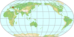 |
|---|---|---|
| GAW ID | ||
| WIGOS ID | 0-20008-0-KRE | |
| Station name | Kresin u Pacova | |
| GAW category | GAW Contributing networks | |
| WMO region | REGION VI (Europe) | |
| Country/territory | Czech Republic | |
| Address 1 | ||
| Address 2 | ||
| Address 3 | ||
| Latitude (north: +; south: −) | 49.58333 | |
| Longitude (east: +; west: −) | 15.08333 | |
| Elevation (m a.s.l.) | 534 | |
| Timezone | UTC+01:00 | |
| Category | fixed station | |
| Gawsis | https://gawsis.meteoswiss.ch/GAWSIS//index.html#/search/station/stationReportDetails/958 | |
| Climate Zone | Cfb (Warm temperate climate, fully humid, warm summer) | |
| Website | http://www.czechglobe.cz/en/home/ | |
| Status | Operational | |
| Description | The Atmospheric Station Kresin u Pacova, operated by the Global Change Research Centre, Academy of Sciences of the Czech Republic, was established as a station specialised in greenhouse gas and air quality monitoring and research at the regional scale. The observatory is involved in ICOS, ACTRIS, GMOS and EMEP programs and projects. The rural background station is located in Bohemian-Moravian Highlands. | |
| Contributor(s) |
|
|
| Gas Species |
|
|
Krvavec Map
| WDCGG ID | KVV6037 |  |
|---|---|---|
| GAW ID | KVV | |
| WIGOS ID | 0-20008-0-KVV | |
| Station name | Krvavec | |
| GAW category | GAW Regional | |
| WMO region | REGION VI (Europe) | |
| Country/territory | Slovenia | |
| Address 1 | Ministry of Environment and Spatial Planning Environmental Agency of Republic of Slovenia (ARSO) Vojkova 1b; SI-1000 Ljubljana Slovenia | |
| Address 2 | ||
| Address 3 | ||
| Latitude (north: +; south: −) | 46.2973494817 | |
| Longitude (east: +; west: −) | 14.5333143774 | |
| Elevation (m a.s.l.) | 1740 | |
| Timezone | UTC+01:00 | |
| Category | fixed station | |
| Gawsis | https://gawsis.meteoswiss.ch/GAWSIS//index.html#/search/station/stationReportDetails/560 | |
| Climate Zone | Cfb (Warm temperate climate, fully humid, warm summer) | |
| Website | ||
| Status | Operational | |
| Description | Krvavec monitoring site is located on a hillside of Alps, at 1720 m a.s.l. within Alpine climate zone. Monitoring site is surrounded mostly by short grass (above 1600 m) and partly by coniferous forest (below 1600 m). The surrounding mountain peaks are rocky (limestone). The site is situated about 30 km north of Ljubljana (capital of Slovenia), on the ridge of the south-eastern Alps (Karavanke mountain ridge with peaks of 1500-2500 m a.s.l.). The monitoring site is above the cold surface layer of air which forms in the Ljubljana basin. Sometimes, not very often, the inversion layer at the height of 2-3 km a.s.l. (caused by subsidence in a stable anticyclone) sinks below the height of the monitoring station. During such events the site is usually in the clouds. | |
| Contributor(s) |
|
|
| Gas Species |
|
|
Kyzylcha Map
| WDCGG ID | KYZ2010 |  |
|---|---|---|
| GAW ID | KYZ | |
| WIGOS ID | 0-20008-0-KYZ | |
| Station name | Kyzylcha | |
| GAW category | GAW Regional | |
| WMO region | REGION II (Asia) | |
| Country/territory | Uzbekistan | |
| Address 1 | ||
| Address 2 | ||
| Address 3 | ||
| Latitude (north: +; south: −) | 40.8699989319 | |
| Longitude (east: +; west: −) | 66.1500015259 | |
| Elevation (m a.s.l.) | 340 | |
| Timezone | UTC+05:00 | |
| Category | fixed station | |
| Gawsis | https://gawsis.meteoswiss.ch/GAWSIS//index.html#/search/station/stationReportDetails/202 | |
| Climate Zone | BSk (Steppe climate, cold arid) | |
| Website | ||
| Status | Closed | |
| Description | Desert region pine forest. | |
| Contributor(s) |
|
|
| Gas Species |
|
|
La Jolla (CA) Map
| WDCGG ID | SIO4028 | 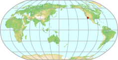 |
|---|---|---|
| GAW ID | SIO | |
| WIGOS ID | 0-20008-0-SIO | |
| Station name | La Jolla (CA) | |
| GAW category | GAW Regional | |
| WMO region | REGION IV (North and Central America) | |
| Country/territory | United States of America | |
| Address 1 | ||
| Address 2 | ||
| Address 3 | ||
| Latitude (north: +; south: −) | 32.8300018311 | |
| Longitude (east: +; west: −) | -117.2699966431 | |
| Elevation (m a.s.l.) | 14 | |
| Timezone | UTC-08:00 | |
| Category | fixed station | |
| Gawsis | https://gawsis.meteoswiss.ch/GAWSIS//index.html#/search/station/stationReportDetails/204 | |
| Climate Zone | BSk (Steppe climate, cold arid) | |
| Website | ||
| Status | Closed | |
| Description | former NOAA flask sampling site | |
| Contributor(s) |
|
|
| Gas Species |
|
|
La Réunion Map
| WDCGG ID | RUN1042 | 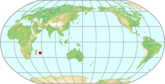 |
|---|---|---|
| GAW ID | RUN | |
| WIGOS ID | 0-20008-0-RUN | |
| Station name | La Réunion | |
| GAW category | GAW Global | |
| WMO region | REGION I (Africa) | |
| Country/territory | France | |
| Address 1 | ||
| Address 2 | ||
| Address 3 | ||
| Latitude (north: +; south: −) | -21.0796 | |
| Longitude (east: +; west: −) | 55.3841 | |
| Elevation (m a.s.l.) | 2160 | |
| Timezone | UTC+04:00 | |
| Category | fixed station | |
| Gawsis | https://gawsis.meteoswiss.ch/GAWSIS//index.html#/search/station/stationReportDetails/279 | |
| Climate Zone | Cfb (Warm temperate climate, fully humid, warm summer) | |
| Website | http://opar.univ-reunion.fr | |
| Status | Operational | |
| Description | La Réunion (21°S, 55°E), is a small tropical island located in the middle of the south-west Indian Ocean, affected by southeasterly trade winds near the ground, and westerlies in the free troposphere. La Réunion is far-off the main anthropogenic pollution sources and local pollution is very sparse. The STDENIS site is located close to the coast within the University Campus and is impacted by local urban pollution and marine emissions. The GILLOT site is located beside the main Reunion airport, close to the shore, and is mainly impacted by marine emissions. The MAIDO site is located on the Maïdo mount, which is a 2200m-high summit on the western part of the island, inside the National Parc inscribed on UNESCO’s World Heritage List. | |
| Contributor(s) |
|
|
| Gas Species |
|
|
Lac La Biche (Alberta) Map
| WDCGG ID | LLB4006 |  |
|---|---|---|
| GAW ID | LLB | |
| WIGOS ID | 0-20008-0-LLB | |
| Station name | Lac La Biche (Alberta) | |
| GAW category | GAW Regional | |
| WMO region | REGION IV (North and Central America) | |
| Country/territory | Canada | |
| Address 1 | ||
| Address 2 | ||
| Address 3 | ||
| Latitude (north: +; south: −) | 54.953809 | |
| Longitude (east: +; west: −) | -112.466649 | |
| Elevation (m a.s.l.) | 548 | |
| Timezone | UTC-06:00 | |
| Category | fixed station | |
| Gawsis | https://gawsis.meteoswiss.ch/GAWSIS//index.html#/search/station/stationReportDetails/775 | |
| Climate Zone | Dfb (Snow climate, fully humid, warm summer) | |
| Website | ||
| Status | Operational | |
| Description | Insitu CO2, CH4 and CO measurements program began at Lac la Biche, Alberta in April 2007 using an NDIR and Gas Chromatograph, and a 10m tower. Environment and Climate Change Canada (ECCC), through a collaboration with Fluxnet Canada, initiated the measurements program at Lac La Biche. The site was initially established in 2003 by the University of Lethbridge, Alberta. The initial objective of the site was to study the role of peatlands in the global carbon budget and climate change. In 2009, the University of Lethbridge terminated their flux measurement program and ECCC purchased the building and assumed overall responsibility of the site. The Lac la Biche measurement site is located in a region of peatlands and forest, approximately 200 km NE of Edmonton, Alberta and 230 km due south of Fort McMurray. The primary goal of the insitu observational program at Lac Labiche is to apply data assimilation modelling techniques, together with long-term monitoring of CO2 and CH4 to independently quantify anthropogenic emissions for southern Alberta. In June, 2009, ECCC installed a 50m tower, in order to draw ambient air that was higher above the tree canopy. Currently, ECCC's Greenhouse gas measurement lab continuously measures CO2, CH4 and CO using Cavity Ring Down Spectroscopy from the 50m tower. | |
| Contributor(s) |
|
|
| Gas Species |
|
|
Lamezia Terme Map
| WDCGG ID | LMT6054 |  |
|---|---|---|
| GAW ID | LMT | |
| WIGOS ID | 0-20008-0-LMT | |
| Station name | Lamezia Terme | |
| GAW category | GAW Regional | |
| WMO region | REGION VI (Europe) | |
| Country/territory | Italy | |
| Address 1 | ||
| Address 2 | ||
| Address 3 | ||
| Latitude (north: +; south: −) | 38.8763 | |
| Longitude (east: +; west: −) | 16.2322 | |
| Elevation (m a.s.l.) | 6 | |
| Timezone | UTC+01:00 | |
| Category | fixed station | |
| Gawsis | https://gawsis.meteoswiss.ch/GAWSIS//index.html#/search/station/stationReportDetails/987 | |
| Climate Zone | Cfa (Warm temperate climate, fully humid, hot summer) | |
| Website | http://www.i-amica.it/i-amica/?page_id=671&lang=en | |
| Status | Operational | |
| Description | Lamezia Terme CNR-ISAC station is located in a strategic and isolated position, 600 m from the coastline of the Lamezia Terme plane, outside the only valley in Calabria which allows the Tyrrhenian Sea to connect with the Ionio Sea. Its complex orography and its long and narrow shape create a complex interaction of breezes which develop perpendicularly the two coasts with the synoptic circulation, that mainly goes west. In detail, breezes from the sea go mainly W-WSW, while breezes from the earth go mainly E-ENE. Breezes are characterized by seasonal cycles modulated by the temperature gradient between sea and land in addition to the synoptic circulation (more prevalent in determining local circulation in late fall and winter). In particular, while during the summer, there are strong breezes from the sea during the day, in winter there are, at night, intense breezes coming from the land. It was also demonstrated how the breeze system dominated atmospheric circulation in Lamezia Terme and it has an important role in defining local climates. The area presents polluting emissions coming from transportation, (airport, cruises from/to Gioia Tauro, local and highway traffic), houses and agriculture in addition to the deposits of a natural particulate like Saharan sand, and volcanic particulate coming from the two active volcanoes in the Mediterranean (Stromboli and Etna situated 80 km west and around 200 km south-east of the measurement site respectively). Studying atmospheric circulation becomes particularly relevant in order to characterize variability of atmospheric composition, for researches regarding renewable (solar and wind) energy and for the coast characterization to prevent fires and erosion. | |
| Contributor(s) |
|
|
| Gas Species |
|
|
Lampedusa Map
| WDCGG ID | LMP6051 |  |
|---|---|---|
| GAW ID | LMP | |
| WIGOS ID | 0-20008-0-LMP | |
| Station name | Lampedusa | |
| GAW category | GAW Regional | |
| WMO region | REGION VI (Europe) | |
| Country/territory | Italy | |
| Address 1 | ENEA laboratory, Capo Grecale, 92010 Lampedusa-Italy | |
| Address 2 | ||
| Address 3 | ||
| Latitude (north: +; south: −) | 35.5182 | |
| Longitude (east: +; west: −) | 12.6305 | |
| Elevation (m a.s.l.) | 45 | |
| Timezone | UTC+01:00 | |
| Category | fixed station | |
| Gawsis | https://gawsis.meteoswiss.ch/GAWSIS//index.html#/search/station/stationReportDetails/517 | |
| Climate Zone | Cfa (Warm temperate climate, fully humid, hot summer) | |
| Website | www.lampedusa.enea.it | |
| Status | Operational | |
| Description | Lampedusa is a small island in the Mediterranean sea, WSW of Malta and 120 km or more far from large islands or continents. The island is rocky, relatively flat (maximum altitude is 130 m) with very poor vegetation. Prevailing winds are N/NW and S. Climate is temperate, annual precipitation is low, with maximum in winter. | |
| Contributor(s) |
|
|
| Gas Species |
|
|
Lauder Map
| WDCGG ID | LAU5014 |  |
|---|---|---|
| GAW ID | LAU | |
| WIGOS ID | 0-20008-0-LAU | |
| Station name | Lauder | |
| GAW category | GAW Global | |
| WMO region | REGION V (South-West Pacific) | |
| Country/territory | New Zealand | |
| Address 1 | NIWA Lauder ObservatoryPrivate Bag 50061Omakau, Central Otago9182 New Zealand | |
| Address 2 | ||
| Address 3 | ||
| Latitude (north: +; south: −) | -45.0379981995 | |
| Longitude (east: +; west: −) | 169.6840057373 | |
| Elevation (m a.s.l.) | 370 | |
| Timezone | UTC+12:00 | |
| Category | fixed station | |
| Gawsis | https://gawsis.meteoswiss.ch/GAWSIS//index.html#/search/station/stationReportDetails/488 | |
| Climate Zone | Cfb (Warm temperate climate, fully humid, warm summer) | |
| Website | http://www.niwa.co.nz/our-science/atmosphere/lauder | |
| Status | Operational | |
| Description | Lauder is located in a sparsely populated rural environment on the South Island of New Zealand at 45.0ºS, 169.7ºE, altitude 370 m asl. It is located in a broad valley in Central Otago, approximately 40 km north of Alexandra on State Highway 85. The site is surrounded by pastoral farms running low stock numbers of mainly sheep and cattle. The Atmospheric Research facility was established by DSIR in 1960 to facilitate research of the upper atmosphere (mainly ionospheric), but changed to research into stratospheric composition and UV radiation in the 1980s. Over the last decade the focus has increasingly moved to include climate change and full spectrum radiation research. The site was originally chosen for its clear skies, low pollution, and low stray light levels; and these qualities continue to make Lauder a valuable atmospheric measurement site with a combination of ground-based, balloon-sonde and in-situ measurements. Lauder is maintained by New Zealand’s Institute of Water & Atmospheric Research (NIWA), and has a staff of approximately 15. There is on-site housing for visiting researchers. Lauder is an NDACC affiliated station with UVvis, FTIR, Microwave, Lidar, ozone + Frost Point Hygrometer sonde, UV radiation, and Dobson ozone measurements. Lauder is also a BSRN station that contributes to knowledge on radiation, cloud and aerosol and is a ground station for receiving satellite imagery. Lauder is a GRUAN-certified site (RS-92 measurement program). | |
| Contributor(s) |
|
|
| Gas Species |
|
|
Lecce Environmental-Climate Observatory Map
| WDCGG ID | ECO6055 |  |
|---|---|---|
| GAW ID | ECO | |
| WIGOS ID | 0-20008-0-ECO | |
| Station name | Lecce Environmental-Climate Observatory | |
| GAW category | GAW Regional | |
| WMO region | REGION VI (Europe) | |
| Country/territory | Italy | |
| Address 1 | ||
| Address 2 | ||
| Address 3 | ||
| Latitude (north: +; south: −) | 40.3358 | |
| Longitude (east: +; west: −) | 18.1245 | |
| Elevation (m a.s.l.) | 36 | |
| Timezone | UTC+01:00 | |
| Category | fixed station | |
| Gawsis | https://gawsis.meteoswiss.ch/GAWSIS//index.html#/search/station/stationReportDetails/986 | |
| Climate Zone | UNK (Unknown) | |
| Website | http://www.i-amica.it/i-amica/?page_id=661 | |
| Status | Operational | |
| Description | The Environmental-Climate Observatory is located in the south-eastern part of Italy in proximity of the Adriatic coast in the Mediterranean area that is an hotspot for climatic changes and secondary pollution. The station is about 4 km (SW) of the urban area of Lecce and it could be characterized as an urban background station, located at about 30 km and 80 km from the most important industrial centres of the Puglia Region (Taranto and Brindisi). Further, the area is frequently subjected to advection of desert dust from Africa and marine contribution to atmospheric particulate matter. | |
| Contributor(s) |
|
|
| Gas Species |
|
|
Lerwick Map
| WDCGG ID | SIS6008 | 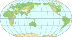 |
|---|---|---|
| GAW ID | SIS | |
| WIGOS ID | 0-20008-0-SIS | |
| Station name | Lerwick | |
| GAW category | GAW Regional | |
| WMO region | REGION VI (Europe) | |
| Country/territory | United Kingdom of Great Britain and Northern Ireland | |
| Address 1 | ||
| Address 2 | ||
| Address 3 | ||
| Latitude (north: +; south: −) | 60.1333351135 | |
| Longitude (east: +; west: −) | -1.1833332777 | |
| Elevation (m a.s.l.) | 84 | |
| Timezone | UTC | |
| Category | fixed station | |
| Gawsis | https://gawsis.meteoswiss.ch/GAWSIS//index.html#/search/station/stationReportDetails/579 | |
| Climate Zone | Cfb (Warm temperate climate, fully humid, warm summer) | |
| Website | ||
| Status | Non-reporting | |
| Description | Shetland islands. 24/7 manual input surface observations programme. Full radiosonde ascents twice daily at 11.15 and 23.15 UTC. | |
| Contributor(s) |
|
|
| Gas Species |
|
|
Lindenberg Map
| WDCGG ID | LIN6057 |  |
|---|---|---|
| GAW ID | LIN | |
| WIGOS ID | 0-20008-0-LIN | |
| Station name | Lindenberg | |
| GAW category | GAW Contributing networks | |
| WMO region | REGION VI (Europe) | |
| Country/territory | Germany | |
| Address 1 | ||
| Address 2 | ||
| Address 3 | ||
| Latitude (north: +; south: −) | 52.2166671753 | |
| Longitude (east: +; west: −) | 14.1166667938 | |
| Elevation (m a.s.l.) | 112 | |
| Timezone | UTC+01:00 | |
| Category | fixed station | |
| Gawsis | https://gawsis.meteoswiss.ch/GAWSIS//index.html#/search/station/stationReportDetails/44 | |
| Climate Zone | Cfb (Warm temperate climate, fully humid, warm summer) | |
| Website | http://www.dwd.de/mol/ | |
| Status | Operational | |
| Description | The village of Lindenberg is located about 50 km southeast of the outskirts of Berlin. Lindenberg is part of the municipality of Tauche, on the south-western side of the partly wooded Kalkberge hills. The observatory itself and the weather station are located north of the village of Lindenberg. The terrain south-west of the weather station is flat with moderately sloping parts. It inclines in the northern and eastern directions and is open to the south and west. The average height of the surrounding is about 80 m, varying between 40 m and 130 m above sea level. The area consists of plateaus, hills and lowlands. The terrain generally slopes down in southern and western directions. The lowlands in the west (around the lake Scharmützelsee), in the south (lakes Kossenblatter Seen and the lowland of the river Spree) and in the east (lowland of the river Spree) are approximately 40 m above sea level. Lindenberg represents moderate mid-latitude climate conditions at the transition between marine and continental influences . Monthly mean temperatures (1961– 1990) vary between –1.2 °C (January) and 17.9 °C (July), and the mean annual precipitation is 563 mm. The annual precipitation pattern shows a main maximum during summertime and a secondary maximum in December with minima on February and October. | |
| Contributor(s) |
|
|
| Gas Species |
|
|
Lulin Map
| WDCGG ID | LLN2032 |  |
|---|---|---|
| GAW ID | LLN | |
| WIGOS ID | 0-20008-0-LLN | |
| Station name | Lulin | |
| GAW category | GAW Other elements | |
| WMO region | REGION II (Asia) | |
| Country/territory | Taiwan, province of China | |
| Address 1 | ||
| Address 2 | ||
| Address 3 | ||
| Latitude (north: +; south: −) | 23.4699993134 | |
| Longitude (east: +; west: −) | 120.8700027466 | |
| Elevation (m a.s.l.) | 2862 | |
| Timezone | UTC+08:00 | |
| Category | fixed station | |
| Gawsis | https://gawsis.meteoswiss.ch/GAWSIS//index.html#/search/station/stationReportDetails/749 | |
| Climate Zone | Cfb (Warm temperate climate, fully humid, warm summer) | |
| Website | ||
| Status | Operational | |
| Description | Flask sampling site for NOAA "Carbon Cycle Surface Flask" project Station Organizer: National Central University Aerosol optical property measurements began at Lulin in October 2008. These measurements are a collaboration with NOAA/ESRL/GMD's aerosol group. | |
| Contributor(s) |
|
|
| Gas Species |
|
|
Lutjewad Map
| WDCGG ID | LUT6420 | 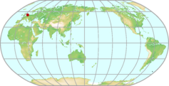 |
|---|---|---|
| GAW ID | LUT | |
| WIGOS ID | 0-528-0-LUT | |
| Station name | Lutjewad | |
| GAW category | GAW Regional | |
| WMO region | REGION VI (Europe) | |
| Country/territory | Kingdom of the Netherlands | |
| Address 1 | ||
| Address 2 | ||
| Address 3 | ||
| Latitude (north: +; south: −) | 53.4036 | |
| Longitude (east: +; west: −) | 6.3528 | |
| Elevation (m a.s.l.) | 1 | |
| Timezone | UTC+01:00 | |
| Category | fixed station | |
| Gawsis | https://gawsis.meteoswiss.ch/GAWSIS//index.html#/search/station/stationReportDetails/65967 | |
| Climate Zone | Cfb (Warm temperate climate, fully humid, warm summer) | |
| Website | ||
| Status | Operational | |
| Description | ||
| Contributor(s) |
|
|
| Gas Species |
|
|
Mace Head Map
| WDCGG ID | MHD6016 |  |
|---|---|---|
| GAW ID | MHD | |
| WIGOS ID | 0-20008-0-MHD | |
| Station name | Mace Head | |
| GAW category | GAW Global | |
| WMO region | REGION VI (Europe) | |
| Country/territory | Ireland | |
| Address 1 | ||
| Address 2 | ||
| Address 3 | ||
| Latitude (north: +; south: −) | 53.326614 | |
| Longitude (east: +; west: −) | -9.904419 | |
| Elevation (m a.s.l.) | 8.4 | |
| Timezone | UTC | |
| Category | fixed station | |
| Gawsis | https://gawsis.meteoswiss.ch/GAWSIS//index.html#/search/station/stationReportDetails/479 | |
| Climate Zone | Cfb (Warm temperate climate, fully humid, warm summer) | |
| Website | http://macehead.org/ | |
| Status | Operational | |
| Description | Mace Head Research Station is located on the west coast of Ireland, County Galway. The site offers excellent exposure to the North Atlantic (clean air sector, 180° through west to 300°). The nearest major conurbation is Galway city, approximately 55 km to the east of Mace Head, with a population of approximately 80000 (2016 census). The hilly area around Mace Head is wet and boggy with a lot of exposed rock and vegetation which consists mainly of grasses, heathers and gorse. There are three small uninhabited islands offshore which are within the clean air sector. The facilities at the site consist of three laboratory buildings, two aluminium walk-up towers, (20m and 10m) a converted 20 ft cargo container office and a 3-phase backup generator. The two shore laboratories, ca. 70m (8masl) from the shore, house gas and aerosol measurement equipment. The cottage laboratory, ca. 350m(21masl) from the shore primarily houses equipment for measurement of atmospheric structure, meteorological and solar radiation parameters. | |
| Contributor(s) |
|
|
| Gas Species |
|
|
Macquarie Island Map
| WDCGG ID | MQA5015 |  |
|---|---|---|
| GAW ID | MQA | |
| WIGOS ID | 0-20008-0-MQA | |
| Station name | Macquarie Island | |
| GAW category | GAW Regional | |
| WMO region | REGION V (South-West Pacific) | |
| Country/territory | Australia | |
| Address 1 | Macquarie Island Clean Air Laboratory | |
| Address 2 | Macquaire Island | |
| Address 3 | Postal address: CSIRO Oceans & Atmosphere, Private Bag 1, Aspendale, VIC, 3195, AUSTRALIA | |
| Latitude (north: +; south: −) | -54.498500824 | |
| Longitude (east: +; west: −) | 158.9385070801 | |
| Elevation (m a.s.l.) | 6 | |
| Timezone | UTC+10:00 | |
| Category | fixed station | |
| Gawsis | https://gawsis.meteoswiss.ch/GAWSIS//index.html#/search/station/stationReportDetails/671 | |
| Climate Zone | ET (Tundra climate) | |
| Website | http://www.aad.gov.au/default.asp?casid=7151 | |
| Status | Operational | |
| Description | Macquarie Island is a subantarctic island located in the Southern Ocean, approximately half way between Australia and Antarctica. Macquarie Island, or "Macca" as it is generally referred to, is a Tasmanian State Reserve managed by the Tasmanian Parks and Wildlife Service. Australia operates a research station at the northern end of the island from which a wide range of research is carried out. | |
| Contributor(s) |
|
|
| Gas Species |
|
|
Madonie - Piano Battaglia Map
| WDCGG ID | MDN6418 |  |
|---|---|---|
| GAW ID | MDN | |
| WIGOS ID | 0-380-0-MDN | |
| Station name | Madonie - Piano Battaglia | |
| GAW category | GAW Regional | |
| WMO region | REGION VI (Europe) | |
| Country/territory | Italy | |
| Address 1 | ||
| Address 2 | ||
| Address 3 | ||
| Latitude (north: +; south: −) | 37.880311 | |
| Longitude (east: +; west: −) | 14.025635 | |
| Elevation (m a.s.l.) | 1650 | |
| Timezone | UTC+01:00 | |
| Category | fixed station | |
| Gawsis | https://gawsis.meteoswiss.ch/GAWSIS//index.html#/search/station/stationReportDetails/63199 | |
| Climate Zone | Csa (Warm temperate climate with dry and hot summer) | |
| Website | ||
| Status | Operational | |
| Description | ||
| Contributor(s) |
|
|
| Gas Species |
|
|
Mahé Map
| WDCGG ID | SEY1006 | 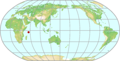 |
|---|---|---|
| GAW ID | SEY | |
| WIGOS ID | 0-20008-0-SEY | |
| Station name | Mahé | |
| GAW category | GAW Regional | |
| WMO region | REGION I (Africa) | |
| Country/territory | Seychelles | |
| Address 1 | ||
| Address 2 | ||
| Address 3 | ||
| Latitude (north: +; south: −) | -4.6700000763 | |
| Longitude (east: +; west: −) | 55.1699981689 | |
| Elevation (m a.s.l.) | 3 | |
| Timezone | UTC+04:00 | |
| Category | fixed station | |
| Gawsis | https://gawsis.meteoswiss.ch/GAWSIS//index.html#/search/station/stationReportDetails/218 | |
| Climate Zone | Af (Equatorial rainforest, fully humid) | |
| Website | http://www.esrl.noaa.gov/gmd/dv/site/SEY.html | |
| Status | Operational | |
| Description | Sampling site 1 (southeast of Mahe): The site is situated at the southern part of the runway of the international airport. It is just approx. two meters from the sea. It is a flat and forms part of the drudged land on which the airport has been constructed. There is no vegetation. Sampling site 2 (northwest of Mahe): The site is situated on a built swimming pool of the Sunset Hotel. It is above the sea on a rocky environment. | |
| Contributor(s) |
|
|
| Gas Species |
|
|
Mauna Kea (HI) Map
| WDCGG ID | MKO5026 |  |
|---|---|---|
| GAW ID | MKO | |
| WIGOS ID | 0-20008-0-MKO | |
| Station name | Mauna Kea (HI) | |
| GAW category | GAW Other elements | |
| WMO region | REGION V (South-West Pacific) | |
| Country/territory | United States of America | |
| Address 1 | ||
| Address 2 | ||
| Address 3 | ||
| Latitude (north: +; south: −) | 19.8299999237 | |
| Longitude (east: +; west: −) | -155.4799957275 | |
| Elevation (m a.s.l.) | 4204 | |
| Timezone | UTC-10:00 | |
| Category | fixed station | |
| Gawsis | https://gawsis.meteoswiss.ch/GAWSIS//index.html#/search/station/stationReportDetails/369 | |
| Climate Zone | Cfb (Warm temperate climate, fully humid, warm summer) | |
| Website | http://www.ifa.hawaii.edu/mko/ | |
| Status | Operational | |
| Description | Mauna Kea ("White Mountain") is a dormant volcano on the island of Hawaii, the largest and southernmost of the Hawaiian Islands. It is located about 300 km (190 miles) from Honolulu, which lies on the island of Oahu. The highest point in the Pacific Basin, and the highest island-mountain in the world, Mauna Kea rises 9,750 meters (32,000 ft) from the ocean floor to an altitude of 4,205 meters (13,796 ft) above sea level, which places its summit above 40 percent of the Earth's atmosphere. The broad volcanic landscape of the summit area is made up of cinder cones on a lava plateau. The lower slopes of Mauna Kea are popular for hunting, hiking, sightseeing, and bird watching in an environment that is less hostile than the barren summit area. NDACC station: mwave | |
| Contributor(s) |
|
|
| Gas Species |
|
|
Mauna Loa (HI) Map
| WDCGG ID | MLO5002 |  |
|---|---|---|
| GAW ID | MLO | |
| WIGOS ID | 0-20008-0-MLO | |
| Station name | Mauna Loa (HI) | |
| GAW category | GAW Global | |
| WMO region | REGION V (South-West Pacific) | |
| Country/territory | United States of America | |
| Address 1 | P.O. Box 275 Hilo, HI 96720 HAWAII | |
| Address 2 | ||
| Address 3 | ||
| Latitude (north: +; south: −) | 19.5362300873 | |
| Longitude (east: +; west: −) | -155.5761566162 | |
| Elevation (m a.s.l.) | 3397 | |
| Timezone | UTC-10:00 | |
| Category | fixed station | |
| Gawsis | https://gawsis.meteoswiss.ch/GAWSIS//index.html#/search/station/stationReportDetails/490 | |
| Climate Zone | Cfb (Warm temperate climate, fully humid, warm summer) | |
| Website | https://gml.noaa.gov/obop/mlo/ | |
| Status | Operational | |
| Description | Mauna Loa Observatory is located on the Island of Hawaii at an elevation of 3397 m on the northern flank of Mauna Loa volcano at 200 north. Established in 1957, Mauna Lao Observatory has grown to become the premier long-term atmospheric monitoring facility on earth and is the site where the ever-increasing concentrations of global atmospheric carbon dioxide were determined. The observatory consists of 10 buildings from which up to 250 different atmospheric parameters are measured by a complement of 12 NOAA/ESRL and other agency scientists and engineers. | |
| Contributor(s) |
|
|
| Gas Species |
|
|
Maunga Kākaramea Map
| WDCGG ID | MGK5058 | 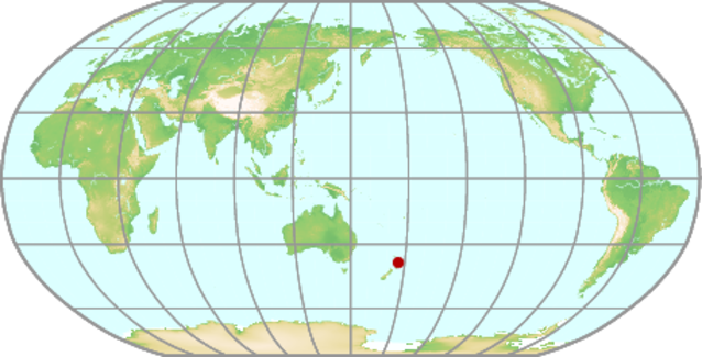 |
|---|---|---|
| GAW ID | MGK | |
| WIGOS ID | 0-554-0-MGK | |
| Station name | Maunga Kākaramea | |
| GAW category | GAW Regional | |
| WMO region | REGION V (South-West Pacific) | |
| Country/territory | New Zealand | |
| Address 1 | ||
| Address 2 | ||
| Address 3 | ||
| Latitude (north: +; south: −) | -38.3194 | |
| Longitude (east: +; west: −) | 176.3883 | |
| Elevation (m a.s.l.) | 743 | |
| Timezone | UTC+12:00 | |
| Category | fixed station | |
| Gawsis | https://gawsis.meteoswiss.ch/GAWSIS//index.html#/search/station/stationReportDetails/160646 | |
| Climate Zone | Cfb (Warm temperate climate, fully humid, warm summer) | |
| Website | ||
| Status | Operational | |
| Description | ||
| Contributor(s) |
|
|
| Gas Species |
|
|
Mawson Map
| WDCGG ID | MAA7005 |  |
|---|---|---|
| GAW ID | MAA | |
| WIGOS ID | 0-20008-0-MAA | |
| Station name | Mawson | |
| GAW category | GAW Regional | |
| WMO region | ANTARCTICA | |
| Country/territory | Australia | |
| Address 1 | ||
| Address 2 | ||
| Address 3 | ||
| Latitude (north: +; south: −) | -67.6047210693 | |
| Longitude (east: +; west: −) | 62.8705558777 | |
| Elevation (m a.s.l.) | 20 | |
| Timezone | UTC+04:00 | |
| Category | fixed station | |
| Gawsis | https://gawsis.meteoswiss.ch/GAWSIS//index.html#/search/station/stationReportDetails/740 | |
| Climate Zone | EF (Frost climate) | |
| Website | http://www.aad.gov.au/default.asp?casid=6909 | |
| Status | Operational | |
| Description | Mawson is situated on an isolated outcrop of rock on the coast in Mac.Robertson Land, at the edge of the Antarctic plateau. It is Australia's first continental station and the longest continuously operating station south of the Antarctic Circle. It is located on rock overlooking Horseshoe Harbour. Mawson has active atmospheric research programs in Meteorology, Clean air monitoring, Cosmic Ray research and Atmospheric and Space Physics. It also has a Riometer (Ionospheric Radio Absorption) | |
| Contributor(s) |
|
|
| Gas Species |
|
|
McMurdo Map
| WDCGG ID | MCM7010 |  |
|---|---|---|
| GAW ID | MCM | |
| WIGOS ID | 0-20008-0-MCM | |
| Station name | McMurdo | |
| GAW category | GAW Regional | |
| WMO region | ANTARCTICA | |
| Country/territory | United States of America | |
| Address 1 | ||
| Address 2 | ||
| Address 3 | ||
| Latitude (north: +; south: −) | -77.85 | |
| Longitude (east: +; west: −) | 166.6666667 | |
| Elevation (m a.s.l.) | 11 | |
| Timezone | UTC+11:00 | |
| Category | fixed station | |
| Gawsis | https://gawsis.meteoswiss.ch/GAWSIS//index.html#/search/station/stationReportDetails/228 | |
| Climate Zone | EF (Frost climate) | |
| Website | http://astro.uchicago.edu/cara/vtour/mcmurdo/ | |
| Status | Non-reporting | |
| Description | McMurdo Station is Antarctica's largest community. It is built on the bare volcanic rock of Hut Point Peninsula on Ross Island, the farthest south solid ground that is accessible by ship. NDACC station: lidar, uvvis, o3sonde | |
| Contributor(s) |
|
|
| Gas Species |
|
|
Memanbetsu Map
| WDCGG ID | MMB2006 |  |
|---|---|---|
| GAW ID | MMB | |
| WIGOS ID | 0-20008-0-MMB | |
| Station name | Memanbetsu | |
| GAW category | GAW Other elements | |
| WMO region | REGION II (Asia) | |
| Country/territory | Japan | |
| Address 1 | Memanbetsu, Hokkaido 099-2356, Japan | |
| Address 2 | ||
| Address 3 | ||
| Latitude (north: +; south: −) | 43.9199981689 | |
| Longitude (east: +; west: −) | 144.1999969482 | |
| Elevation (m a.s.l.) | 33 | |
| Timezone | UTC+09:00 | |
| Category | fixed station | |
| Gawsis | https://gawsis.meteoswiss.ch/GAWSIS//index.html#/search/station/stationReportDetails/230 | |
| Climate Zone | Dfb (Snow climate, fully humid, warm summer) | |
| Website | ||
| Status | Closed | |
| Description | ||
| Contributor(s) |
|
|
| Gas Species |
|
|
Mex High Altitude Global Climate Observation Center Map
| WDCGG ID | MEX4034 |  |
|---|---|---|
| GAW ID | MEX | |
| WIGOS ID | 0-20008-0-MEX | |
| Station name | Mex High Altitude Global Climate Observation Center | |
| GAW category | GAW Other elements | |
| WMO region | REGION IV (North and Central America) | |
| Country/territory | Mexico | |
| Address 1 | ||
| Address 2 | ||
| Address 3 | ||
| Latitude (north: +; south: −) | 18.985842 | |
| Longitude (east: +; west: −) | -97.314433 | |
| Elevation (m a.s.l.) | 4560 | |
| Timezone | UTC-06:00 | |
| Category | fixed station | |
| Gawsis | https://gawsis.meteoswiss.ch/GAWSIS//index.html#/search/station/stationReportDetails/876 | |
| Climate Zone | UNK (Unknown) | |
| Website | ||
| Status | Operational | |
| Description | ||
| Contributor(s) |
|
|
| Gas Species |
|
|
Mikawa-Ichinomiya Map
| WDCGG ID | MKW2022 |  |
|---|---|---|
| GAW ID | MKW | |
| WIGOS ID | 0-20008-0-MKW | |
| Station name | Mikawa-Ichinomiya | |
| GAW category | GAW Other elements | |
| WMO region | REGION II (Asia) | |
| Country/territory | Japan | |
| Address 1 | 33-4 Kamishinkiri, Ichinomiya, Ichinomiya-cho, Hoi-gun,Aichi 441-1231, Japan | |
| Address 2 | ||
| Address 3 | ||
| Latitude (north: +; south: −) | 34.8499984741 | |
| Longitude (east: +; west: −) | 137.4299926758 | |
| Elevation (m a.s.l.) | 50 | |
| Timezone | UTC+09:00 | |
| Category | fixed station | |
| Gawsis | https://gawsis.meteoswiss.ch/GAWSIS//index.html#/search/station/stationReportDetails/232 | |
| Climate Zone | Cfa (Warm temperate climate, fully humid, hot summer) | |
| Website | ||
| Status | Non-reporting | |
| Description | Plain suburban area surrounded by mountains in the north and northeast, and located about 60 km southeast of Nagoya which is the biggest city in central Japan. | |
| Contributor(s) |
|
|
| Gas Species |
|
|
Minamitorishima Map
| WDCGG ID | MNM2029 |  |
|---|---|---|
| GAW ID | MNM | |
| WIGOS ID | 0-20008-0-MNM | |
| Station name | Minamitorishima | |
| GAW category | GAW Global | |
| WMO region | REGION II (Asia) | |
| Country/territory | Japan | |
| Address 1 | Minamitorishima | |
| Address 2 | Ogasawara-mura | |
| Address 3 | TOKYO, Japan ( post service not available ) | |
| Latitude (north: +; south: −) | 24.2883 | |
| Longitude (east: +; west: −) | 153.9833 | |
| Elevation (m a.s.l.) | 7.1 | |
| Timezone | UTC+09:00 | |
| Category | fixed station | |
| Gawsis | https://gawsis.meteoswiss.ch/GAWSIS//index.html#/search/station/stationReportDetails/486 | |
| Climate Zone | Am (Equatorial monsoon) | |
| Website | ||
| Status | Operational | |
| Description | Minamitorishima is an isolated island in the Pacific located about 2,000 km southeast of Tokyo. The observatory is surrounded by insignificant shrubs and grass. The island has an area of about 1.4 km² and a coast of about 5.5 km long. The climate is semi-humid tropical with a dry season in early spring and the average monthly temperatures exceed 20°C throughout the year. Annual normal rainfall amount is about 1150 mm. Annual mean temperature is about 26 °C. Prevailing wind direction is easterly. | |
| Contributor(s) |
|
|
| Gas Species |
|
|
Monte Cimone Map
| WDCGG ID | CMN6042 |  |
|---|---|---|
| GAW ID | CMN | |
| WIGOS ID | 0-20008-0-CMN | |
| Station name | Monte Cimone | |
| GAW category | GAW Global | |
| WMO region | REGION VI (Europe) | |
| Country/territory | Italy | |
| Address 1 | Via delle Ville, 40 41029 Sestola (MO) - Italy | |
| Address 2 | ||
| Address 3 | ||
| Latitude (north: +; south: −) | 44.193425 | |
| Longitude (east: +; west: −) | 10.700963 | |
| Elevation (m a.s.l.) | 2165 | |
| Timezone | UTC+01:00 | |
| Category | fixed station | |
| Gawsis | https://gawsis.meteoswiss.ch/GAWSIS//index.html#/search/station/stationReportDetails/1 | |
| Climate Zone | Cfa (Warm temperate climate, fully humid, hot summer) | |
| Website | https://www.meteoam.it/it/centro-aeronautica-militare-montagna | |
| Status | Operational | |
| Description | The Operative Base of the Mountain Air Force Center (CAMM - Monte Cimone) is on a North Appenine mountain peak with completly free horizon. No local sources of contamination. No access by road. Operational activity starts in 1978 with the beginning of CO2 concentration measurement. It is the second longer data serie worldwide. Prevaling wind directions: SSW and NE. The Center hosts since 1983 the "Ottavio Vittori" observatory which is managed by CNR-ISAC (National Research Council of Italy/Institute of Atmospheric Sciences and Climate). | |
| Contributor(s) |
|
|
| Gas Species |
|
|
Monte Curcio Map
| WDCGG ID | CUR6056 |  |
|---|---|---|
| GAW ID | CUR | |
| WIGOS ID | 0-20008-0-CUR | |
| Station name | Monte Curcio | |
| GAW category | GAW Regional | |
| WMO region | REGION VI (Europe) | |
| Country/territory | Italy | |
| Address 1 | ||
| Address 2 | ||
| Address 3 | ||
| Latitude (north: +; south: −) | 39.315972 | |
| Longitude (east: +; west: −) | 16.42325 | |
| Elevation (m a.s.l.) | 1796 | |
| Timezone | UTC+01:00 | |
| Category | fixed station | |
| Gawsis | https://gawsis.meteoswiss.ch/GAWSIS//index.html#/search/station/stationReportDetails/988 | |
| Climate Zone | Csa (Warm temperate climate with dry and hot summer) | |
| Website | http://mtcurcio.iia.cnr.it/ | |
| Status | Operational | |
| Description | The Monte Curcio CNR-IIA station is a Climatic-Environmental Observatory located in a strategic and isolated position within the Sila Grande area, one of the main three areas making-up the Sila National Park, which is officially recognized, since June 2014, as the Tenth Reserve of Italian Biosphere. It is characterized by no local sources of contamination and no access by road and it is 200 m from a ski resort and from the cable car arrival point of the surrounding ski area. The operative station is situated at 1796 m a.s.l. on a southern Appenine mountain peak with completely free horizon, thus allowing to gain atmospheric monitoring measurements with a large spatial representativeness. It is interestingly placed on the middle of the Mediterranean basin, around 30 and 60 km from the Tyrrenian and the Ionian Sea, respectively. Due to its elevation and position, the Mt. Curcio station is even able to intercept dust plumes from the Saharan desert as well as volcanic ashes and gases from Stromboli and Mt. Etna volcanoes, located at around 120 km south-easterly and 220 km south-south easterly from the atmospheric monitoring site, respectively. | |
| Contributor(s) |
|
|
| Gas Species |
|
|
Moody (TX) Map
| WDCGG ID | WKT4032 |  |
|---|---|---|
| GAW ID | WKT | |
| WIGOS ID | 0-20008-0-WKT | |
| Station name | Moody (TX) | |
| GAW category | GAW Regional | |
| WMO region | REGION IV (North and Central America) | |
| Country/territory | United States of America | |
| Address 1 | ||
| Address 2 | ||
| Address 3 | ||
| Latitude (north: +; south: −) | 31.3199996948 | |
| Longitude (east: +; west: −) | -97.6200027466 | |
| Elevation (m a.s.l.) | 723 | |
| Timezone | UTC-06:00 | |
| Category | fixed station | |
| Gawsis | https://gawsis.meteoswiss.ch/GAWSIS//index.html#/search/station/stationReportDetails/236 | |
| Climate Zone | Cfa (Warm temperate climate, fully humid, hot summer) | |
| Website | ||
| Status | Non-reporting | |
| Description | NOAA projects "Carbon Cycle Surface Flask" and "Carbon Cycle In Situ Tall Tower" | |
| Contributor(s) |
|
|
| Gas Species |
|
|
Mould Bay Map
| WDCGG ID | MBC4002 |  |
|---|---|---|
| GAW ID | MBC | |
| WIGOS ID | 0-20008-0-MBC | |
| Station name | Mould Bay | |
| GAW category | GAW Regional | |
| WMO region | REGION IV (North and Central America) | |
| Country/territory | Canada | |
| Address 1 | ||
| Address 2 | ||
| Address 3 | ||
| Latitude (north: +; south: −) | 76.25 | |
| Longitude (east: +; west: −) | -119.3499984741 | |
| Elevation (m a.s.l.) | 58 | |
| Timezone | UTC-07:00 | |
| Category | fixed station | |
| Gawsis | https://gawsis.meteoswiss.ch/GAWSIS//index.html#/search/station/stationReportDetails/238 | |
| Climate Zone | ET (Tundra climate) | |
| Website | ||
| Status | Closed | |
| Description | Former NOAA flask sampling site | |
| Contributor(s) |
|
|
| Gas Species |
|
|
Mt. Dodaira Map
| WDCGG ID | DDR2019 |  |
|---|---|---|
| GAW ID | ||
| WIGOS ID | 0-20008-0-DDR | |
| Station name | Mt. Dodaira | |
| GAW category | GAW Other elements | |
| WMO region | REGION II (Asia) | |
| Country/territory | Japan | |
| Address 1 | 601-2 Shiraishi, Higashichichibu-mura, Chichibu-gun, Saitama 355-0377, Japan | |
| Address 2 | ||
| Address 3 | ||
| Latitude (north: +; south: −) | 36.000275 | |
| Longitude (east: +; west: −) | 139.186386 | |
| Elevation (m a.s.l.) | 832 | |
| Timezone | UTC+09:00 | |
| Category | fixed station | |
| Gawsis | https://gawsis.meteoswiss.ch/GAWSIS//index.html#/search/station/stationReportDetails/2 | |
| Climate Zone | Cfa (Warm temperate climate, fully humid, hot summer) | |
| Website | ||
| Status | Operational | |
| Description | Near mountain top, Mt. Dodaira is located about 60 km north-west of Tokyo, and located east-end of Soto Chichibu mountain range. | |
| Contributor(s) |
|
|
| Gas Species |
|
|
Mt. Kenya Map
| WDCGG ID | MKN1005 |  |
|---|---|---|
| GAW ID | MKN | |
| WIGOS ID | 0-20008-0-MKN | |
| Station name | Mt. Kenya | |
| GAW category | GAW Global | |
| WMO region | REGION I (Africa) | |
| Country/territory | Kenya | |
| Address 1 | ||
| Address 2 | ||
| Address 3 | ||
| Latitude (north: +; south: −) | -0.0621999986 | |
| Longitude (east: +; west: −) | 37.2971992493 | |
| Elevation (m a.s.l.) | 3678 | |
| Timezone | UTC+03:00 | |
| Category | fixed station | |
| Gawsis | https://gawsis.meteoswiss.ch/GAWSIS//index.html#/search/station/stationReportDetails/483 | |
| Climate Zone | Cfb (Warm temperate climate, fully humid, warm summer) | |
| Website | http://www.meteo.go.ke/obsv/gaw/ | |
| Status | Operational | |
| Description | The station is situated above Moses Camp on the northern upper slopes of Mt. Kenya in a wildlife preserve above the tree line and provides measurements of the tropical mid-troposphere as well as air from the lower humid boundary layer. Access is along Sirimon Route, a distance of 21km from the Nanyuki-Timau tarmac. The turn-off is about 16km from Nanyuki. A new settlement has been created in the former forest land after the turn-off. | |
| Contributor(s) |
|
|
| Gas Species |
|
|
Mt. Waliguan Map
| WDCGG ID | WLG2015 |  |
|---|---|---|
| GAW ID | WLG | |
| WIGOS ID | 0-20008-0-WLG | |
| Station name | Mt. Waliguan | |
| GAW category | GAW Global | |
| WMO region | REGION II (Asia) | |
| Country/territory | China | |
| Address 1 | No. 19, Wusi Street, Xining, 810001 Qinghai Province, the People's Republic of China | |
| Address 2 | ||
| Address 3 | ||
| Latitude (north: +; south: −) | 36.2874984741 | |
| Longitude (east: +; west: −) | 100.8963012695 | |
| Elevation (m a.s.l.) | 3810 | |
| Timezone | UTC+08:00 | |
| Category | fixed station | |
| Gawsis | https://gawsis.meteoswiss.ch/GAWSIS//index.html#/search/station/stationReportDetails/457 | |
| Climate Zone | Dwc (Snow climate with dry winter and cool summer) | |
| Website | ||
| Status | Operational | |
| Description | The station is situated on the top of Mt. Waligaun, on the Tibetan plateau in Western China. The annual average temperature is -0.9°C. The predominant wind directions are from SW to NW (summer) and from ESE to NE (winter). Yearly average wind speed is 4.6 m/s. Annual precipitation (mostly in summer months) averages 350 mm. Mt. Waligaun is a remote site, located away from major industrial sources. The closest major settlement is Quiapuqia with a population of 30000, located 30 km to the west. The surrounding area is covered with grass (no trees), and the overall region is sparsely covered with vegetation. The building was reconstructed in 1999. | |
| Contributor(s) |
|
|
| Gas Species |
|
|
Nagoya Map
| WDCGG ID | NGY2021 |  |
|---|---|---|
| GAW ID | NGY | |
| WIGOS ID | 0-20008-0-NGY | |
| Station name | Nagoya | |
| GAW category | GAW Other elements | |
| WMO region | REGION II (Asia) | |
| Country/territory | Japan | |
| Address 1 | Furo-cho, Chikusaku, Nagoya 464-8603, Japan | |
| Address 2 | ||
| Address 3 | ||
| Latitude (north: +; south: −) | 35.1500015259 | |
| Longitude (east: +; west: −) | 136.9700012207 | |
| Elevation (m a.s.l.) | 35 | |
| Timezone | UTC+09:00 | |
| Category | fixed station | |
| Gawsis | https://gawsis.meteoswiss.ch/GAWSIS//index.html#/search/station/stationReportDetails/243 | |
| Climate Zone | Cfa (Warm temperate climate, fully humid, hot summer) | |
| Website | ||
| Status | Closed | |
| Description | Heights in urban | |
| Contributor(s) |
|
|
| Gas Species |
|
|
Natal Map
| WDCGG ID | NAT3001 |  |
|---|---|---|
| GAW ID | NAT | |
| WIGOS ID | 0-20008-0-NAT | |
| Station name | Natal | |
| GAW category | GAW Regional | |
| WMO region | REGION III (South America) | |
| Country/territory | Brazil | |
| Address 1 | ||
| Address 2 | ||
| Address 3 | ||
| Latitude (north: +; south: −) | -6 | |
| Longitude (east: +; west: −) | -35.2000007629 | |
| Elevation (m a.s.l.) | 0 | |
| Timezone | UTC-03:00 | |
| Category | fixed station | |
| Gawsis | https://gawsis.meteoswiss.ch/GAWSIS//index.html#/search/station/stationReportDetails/609 | |
| Climate Zone | As (Equatorial savannah with dry winter) | |
| Website | ||
| Status | Operational | |
| Description | Natal is located in the easternmost corner of South America. NDACC station with ozone- and aerosolsonde | |
| Contributor(s) |
|
|
| Gas Species |
|
|
Nepal Climate Observatory - Pyramid Map
| WDCGG ID | PYR2026 |  |
|---|---|---|
| GAW ID | PYR | |
| WIGOS ID | 0-20008-0-PYR | |
| Station name | Nepal Climate Observatory - Pyramid | |
| GAW category | GAW Global | |
| WMO region | REGION II (Asia) | |
| Country/territory | Nepal | |
| Address 1 | ||
| Address 2 | ||
| Address 3 | ||
| Latitude (north: +; south: −) | 27.9577999115 | |
| Longitude (east: +; west: −) | 86.8149032593 | |
| Elevation (m a.s.l.) | 5079 | |
| Timezone | ||
| Category | fixed station | |
| Gawsis | https://gawsis.meteoswiss.ch/GAWSIS//index.html#/search/station/stationReportDetails/443 | |
| Climate Zone | ET (Tundra climate) | |
| Website | http://evk2.isac.cnr.it/ | |
| Status | Operational | |
| Description | The Everest - Pyramid station, founded by EV-K2-CNR Commitee in the framework of SHARE (Stations at High Altitude for the Research on the Environment) project, is located in the southern Himalayan region at the confluence of the secondary valley of Lobuche (oriented NNW-SSE) and the main Khumbu Valley. The station was placed not far from the Pyramid International Laboratory/Observatory and in proximity of the Mt. Everest base camp. All the instrumentation is housed in a wood and aluminium shelter consisting of two rooms, one for the instruments and a smaller one where batteries for the power supply are stored. The power needed to carry out the experimental activity (~ 3 kW) is provided by 96 photovoltaic panels with 120 electric storage cells. Through the aluminium roof, four sampling lines allow the sampling of gases and aerosol particles. | |
| Contributor(s) |
|
|
| Gas Species |
|
|
Neuglobsow Map
| WDCGG ID | NGL6017 |  |
|---|---|---|
| GAW ID | NGL | |
| WIGOS ID | 0-20008-0-NGL | |
| Station name | Neuglobsow | |
| GAW category | GAW Regional | |
| WMO region | REGION VI (Europe) | |
| Country/territory | Germany | |
| Address 1 | Federal Environmental Agency Monitoring site Neuglobsow Zur alten Fischerhuette 1 D-16775 Neuglobsow | |
| Address 2 | ||
| Address 3 | ||
| Latitude (north: +; south: −) | 53.1427764893 | |
| Longitude (east: +; west: −) | 13.0333337784 | |
| Elevation (m a.s.l.) | 62 | |
| Timezone | UTC+01:00 | |
| Category | fixed station | |
| Gawsis | https://gawsis.meteoswiss.ch/GAWSIS//index.html#/search/station/stationReportDetails/13 | |
| Climate Zone | Cfb (Warm temperate climate, fully humid, warm summer) | |
| Website | ||
| Status | Operational | |
| Description | The station is run by the Federal Environmental Agency. It also contributes to the EMEP programme. It is situated in the Noth German lowlands on the lakefront of lake Stechlin in a forested protected landscape without agricultural or industrial use. It was used as a background station for air, precipitation, biological and lake water samples from 1979 to 1991. It is also a regional GAW station in a forest, situated in a Natural Park, about 7 km southwest of the small town Fürstenberg. Annual mean sum of precipitation amount is about 515 mm. Annual mean temperature is about 8.6 °C. Prevailing wind is southeasterly and southwesterly | |
| Contributor(s) |
|
|
| Gas Species |
|
|
Niwot Ridge - T-van (CO) Map
| WDCGG ID | NWR4023 |  |
|---|---|---|
| GAW ID | NWR | |
| WIGOS ID | 0-20008-0-NWR | |
| Station name | Niwot Ridge - T-van (CO) | |
| GAW category | GAW Regional | |
| WMO region | REGION IV (North and Central America) | |
| Country/territory | United States of America | |
| Address 1 | ||
| Address 2 | ||
| Address 3 | ||
| Latitude (north: +; south: −) | 40.0499992371 | |
| Longitude (east: +; west: −) | -105.5899963379 | |
| Elevation (m a.s.l.) | 3523 | |
| Timezone | UTC-07:00 | |
| Category | fixed station | |
| Gawsis | https://gawsis.meteoswiss.ch/GAWSIS//index.html#/search/station/stationReportDetails/723 | |
| Climate Zone | Dfc (Snow climate, fully humid, cool summer) | |
| Website | http://culter.colorado.edu/NWT/ | |
| Status | Operational | |
| Description | Niwot Ridge is located approximately 35 km west of Boulder, Colorado, with the entire study site lying above 3000 m elevation. There is a cirque glacier (Arikaree Glacier), extensive alpine tundra, a variety of glacial landforms, glacial lakes and moraines, cirques and talus slopes, patterned ground, and permafrost. The research area is bounded on the west by the Continental Divide, with runoff on the two sides being destined for the Colorado and Mississippi Rivers. The alpine study area is reached by an unimproved road from the Mountain Research Station (2895 m) which leads to within 2 km of the main tundra research site, the Saddle (3528 m). The D-1 research site (3739 m), for which climate records are continuous from 1952, lies a farther 3 km from the road head. The Martinelli study area (3380 m) is located 1 km southwest of the Saddle, in the forest-tundra ecotone. The Green Lakes Valley lies immediately south of the western half of Niwot Ridge. It includes the Arikaree Glacier at its head (3798 m), and the wetland, Green Lake 4, and Albion research sites. The Green Lakes Valley and Martinelli sites are all within the City of Boulder Watershed which is closed to public access. Niwot Ridge, including the main alpine study site, is part of the Roosevelt National Forest and has been designated a Biosphere Reserve (United Nations Educational, Scientific and Cultural Organization, UNESCO) and an Experimental Ecology Reserve (USDA Forest Service). A context-sensitive topographic relief map can be used to access the scenic views of the areas indicated above, as well as several others. Topographic setting: Ridge top, but on south facing slope. Air samples have been taken here, in flasks, for NOAA CMDL since 1963. These flasks are analysed for the same compounds as at C1 | |
| Contributor(s) |
|
|
| Gas Species |
|
|
Norunda Map
| WDCGG ID | NOR6260 | 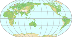 |
|---|---|---|
| GAW ID | NOR | |
| WIGOS ID | 0-20008-0-NOR | |
| Station name | Norunda | |
| GAW category | GAW Regional | |
| WMO region | REGION VI (Europe) | |
| Country/territory | Sweden | |
| Address 1 | ||
| Address 2 | ||
| Address 3 | ||
| Latitude (north: +; south: −) | 60.086441 | |
| Longitude (east: +; west: −) | 17.479455 | |
| Elevation (m a.s.l.) | 46 | |
| Timezone | UTC+01:00 | |
| Category | fixed station | |
| Gawsis | https://gawsis.meteoswiss.ch/GAWSIS//index.html#/search/station/stationReportDetails/32409 | |
| Climate Zone | Dfb (Snow climate, fully humid, warm summer) | |
| Website | http://icos-sweden.se/station_norunda.html | |
| Status | Operational | |
| Description | ||
| Contributor(s) |
|
|
| Gas Species |
|
|
Ny Ålesund Map
| WDCGG ID | NYA6066 |  |
|---|---|---|
| GAW ID | NYA | |
| WIGOS ID | 0-20008-0-NYA | |
| Station name | Ny Ålesund | |
| GAW category | GAW Global | |
| WMO region | REGION VI (Europe) | |
| Country/territory | Norway | |
| Address 1 | ||
| Address 2 | ||
| Address 3 | ||
| Latitude (north: +; south: −) | 78.923576355 | |
| Longitude (east: +; west: −) | 11.9236602783 | |
| Elevation (m a.s.l.) | 0 | |
| Timezone | UTC+01:00 | |
| Category | fixed station | |
| Gawsis | https://gawsis.meteoswiss.ch/GAWSIS//index.html#/search/station/stationReportDetails/84 | |
| Climate Zone | ET (Tundra climate) | |
| Website | http://www.npolar.no/en/about-us/stations-vessels/sverdrup/ | |
| Status | Operational | |
| Description | The research village Ny-Aalesund in the European Arctic is one of the world's northernmost human settlements. It is situated in Kongsfjorden on north-western Spitsbergen, which is the largest of the Svalbard islands. The village is surrounded by mountains and glaciers, which at several places stretch well out into the sea. Large areas of Svalbard (about 60 %) are covered with glaciers. Svalbard, with an area of 62049 km2 is very sparsely populated, and the about 2500 inhabitants are living in one of the five small settlements on Spitsbergen. The Norwegian research village Ny-Aalesund is permanently inhabited by about 30 people year-round and additional approx. 150 scientists during summer peak season. | |
| Contributor(s) |
|
|
| Gas Species |
|
|
Observatoire Pérenne de l'Environnement Map
| WDCGG ID | OPE6437 | 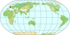 |
|---|---|---|
| GAW ID | OPE | |
| WIGOS ID | 0-250-0-OPE | |
| Station name | Observatoire Pérenne de l'Environnement | |
| GAW category | GAW Regional | |
| WMO region | REGION VI (Europe) | |
| Country/territory | France | |
| Address 1 | ||
| Address 2 | ||
| Address 3 | ||
| Latitude (north: +; south: −) | 48.5619 | |
| Longitude (east: +; west: −) | 5.5036 | |
| Elevation (m a.s.l.) | 390 | |
| Timezone | UTC+01:00 | |
| Category | fixed station | |
| Gawsis | https://gawsis.meteoswiss.ch/GAWSIS//index.html#/search/station/stationReportDetails/90957 | |
| Climate Zone | Cfb (Warm temperate climate, fully humid, warm summer) | |
| Website | https://meusehautemarne.andra.fr/landra-en-meusehaute-marne/installations/lobservatoire-perenne-de-lenvironnement | |
| Status | Operational | |
| Description | The Observatoire Pérenne de l’Environnement (OPE) is located in the East of France (250 km from Paris) in a deep rural area ( less than 15 inhab/km2). It is a 100 years multi-disciplinary project including biotic and abiotic state variables, flux, functions and dynamics monitoring. It is planned to do sites network of periodic sampling, measurements and observations for water and soil characterization and biodiversity monitoring. Ecosystem stations are dedicated to biogeochemical cycles monitoring (process oriented, ICOS compliant). | |
| Contributor(s) |
|
|
| Gas Species |
|
|
Ocean Station Charlie Map
| WDCGG ID | STC6013 | 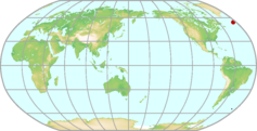 |
|---|---|---|
| GAW ID | STC | |
| WIGOS ID | 0-20008-0-STC | |
| Station name | Ocean Station Charlie | |
| GAW category | GAW Regional | |
| WMO region | REGION VI (Europe) | |
| Country/territory | United States of America | |
| Address 1 | ||
| Address 2 | ||
| Address 3 | ||
| Latitude (north: +; south: −) | 54 | |
| Longitude (east: +; west: −) | -35 | |
| Elevation (m a.s.l.) | 0 | |
| Timezone | UTC-02:00 | |
| Category | fixed station | |
| Gawsis | https://gawsis.meteoswiss.ch/GAWSIS//index.html#/search/station/stationReportDetails/251 | |
| Climate Zone | UNK (Unknown) | |
| Website | http://www.esrl.noaa.gov/gmd/ccgg/iadv/ | |
| Status | Closed | |
| Description | Ocean station Charlie was a marine area defined by a 10 mile square grid around the nominal position. It was first used and maintained by the U.S. Coast Guard, then later on also by Russian vessels. Ocean station vessels normally maintained position, operations and weather permitting [Hannon, 1974]. | |
| Contributor(s) |
|
|
| Gas Species |
|
|
Ocean Station M Map
| WDCGG ID | STM6006 | 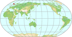 |
|---|---|---|
| GAW ID | STM | |
| WIGOS ID | 0-20008-0-STM | |
| Station name | Ocean Station M | |
| GAW category | GAW Regional | |
| WMO region | REGION VI (Europe) | |
| Country/territory | Norway | |
| Address 1 | ||
| Address 2 | ||
| Address 3 | ||
| Latitude (north: +; south: −) | 66 | |
| Longitude (east: +; west: −) | 2 | |
| Elevation (m a.s.l.) | 4 | |
| Timezone | UTC | |
| Category | fixed station | |
| Gawsis | https://gawsis.meteoswiss.ch/GAWSIS//index.html#/search/station/stationReportDetails/732 | |
| Climate Zone | UNK (Unknown) | |
| Website | ||
| Status | Non-reporting | |
| Description | NOAA "Carbon Cycle Surface Flask" Project, flask sampling site | |
| Contributor(s) |
|
|
| Gas Species |
|
|
Ochsenkopf Map
| WDCGG ID | OXK6022 | 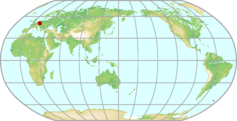 |
|---|---|---|
| GAW ID | OXK | |
| WIGOS ID | 0-20008-0-OXK | |
| Station name | Ochsenkopf | |
| GAW category | GAW Contributing networks | |
| WMO region | REGION VI (Europe) | |
| Country/territory | Germany | |
| Address 1 | ||
| Address 2 | ||
| Address 3 | ||
| Latitude (north: +; south: −) | 50.0301 | |
| Longitude (east: +; west: −) | 11.8084 | |
| Elevation (m a.s.l.) | 1185 | |
| Timezone | UTC+01:00 | |
| Category | fixed station | |
| Gawsis | https://gawsis.meteoswiss.ch/GAWSIS//index.html#/search/station/stationReportDetails/750 | |
| Climate Zone | Cfb (Warm temperate climate, fully humid, warm summer) | |
| Website | https://www.bgc-jena.mpg.de/bgc-systems/pmwiki2/pmwiki.php/TAG/Ochsenkopf | |
| Status | Operational | |
| Description | Flask sampling site for NOAA "Carbon Cycle Surface Flask" project Station Organizer: Max Planck Institute for Biogeochemistry | |
| Contributor(s) |
|
|
| Gas Species |
|
|
Olympic Peninsula (WA) Map
| WDCGG ID | OPW4014 | 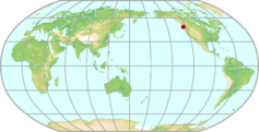 |
|---|---|---|
| GAW ID | OPW | |
| WIGOS ID | 0-20008-0-OPW | |
| Station name | Olympic Peninsula (WA) | |
| GAW category | GAW Regional | |
| WMO region | REGION IV (North and Central America) | |
| Country/territory | United States of America | |
| Address 1 | ||
| Address 2 | ||
| Address 3 | ||
| Latitude (north: +; south: −) | 48.25 | |
| Longitude (east: +; west: −) | -124.4199981689 | |
| Elevation (m a.s.l.) | 488 | |
| Timezone | UTC-08:00 | |
| Category | fixed station | |
| Gawsis | https://gawsis.meteoswiss.ch/GAWSIS//index.html#/search/station/stationReportDetails/724 | |
| Climate Zone | Cfb (Warm temperate climate, fully humid, warm summer) | |
| Website | ||
| Status | Closed | |
| Description | former NOAA "Carbon Cycle Surface Flask" Project relates to or might be identical with 'Olympic' | |
| Contributor(s) |
|
|
| Gas Species |
|
|
Pallas Map
| WDCGG ID | PAL6004 | 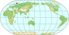 |
|---|---|---|
| GAW ID | PAL | |
| WIGOS ID | 0-20008-0-PAL | |
| Station name | Pallas | |
| GAW category | GAW Global | |
| WMO region | REGION VI (Europe) | |
| Country/territory | Finland | |
| Address 1 | Finnish Meteorological Institute (FMI) P.O. BOX 503 FI-00101 HELSINKI FINLAND | |
| Address 2 | ||
| Address 3 | ||
| Latitude (north: +; south: −) | 67.9736099243 | |
| Longitude (east: +; west: −) | 24.1158332825 | |
| Elevation (m a.s.l.) | 560 | |
| Timezone | UTC+02:00 | |
| Category | fixed station | |
| Gawsis | https://gawsis.meteoswiss.ch/GAWSIS//index.html#/search/station/stationReportDetails/454 | |
| Climate Zone | Dfc (Snow climate, fully humid, cool summer) | |
| Website | https://en.ilmatieteenlaitos.fi/pallas-atmosphere-ecosystem-supersite | |
| Status | Operational | |
| Description | Most of the stations at Pallas that are part of the global station Pallas-Sodankylä are located within the Pallas-Yllästunturi National Park, inside the northern boreal forest zone. The Pallas area is free of large local and regional pollution sources with the nearest town, Muonio with some 2500 inhabitants, being 19 km to the west. The second-nearest town, Kittilä, with 6000 inhabitants, is 46 km to the south-east. The main station, Sammaltunturi (67°58'N 24°07'E, 560 m a.s.l.) is on top of a fjeld (a subarctic hill), ca. 300 m above the surrounding area and some 100 m above the tree line. The vegetation on the fjeld top consists mainly of low vascular plants, moss, and lichen. The region is hilly with the highest elevations of 600-800 m within 3-6 km from the station. The sectors 180°-330° and 100-130° are very open. Also part of this global station is the observatory Sodankylä (67°22'N 26°38'E, 178 m a.s.l.). | |
| Contributor(s) |
|
|
| Gas Species |
|
|
Palmer Station Map
| WDCGG ID | PSA7003 | 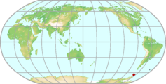 |
|---|---|---|
| GAW ID | PSA | |
| WIGOS ID | 0-20008-0-PSA | |
| Station name | Palmer Station | |
| GAW category | GAW Regional | |
| WMO region | ANTARCTICA | |
| Country/territory | United States of America | |
| Address 1 | ||
| Address 2 | ||
| Address 3 | ||
| Latitude (north: +; south: −) | -64.7743301392 | |
| Longitude (east: +; west: −) | -64.0544204712 | |
| Elevation (m a.s.l.) | 10 | |
| Timezone | UTC-04:00 | |
| Category | fixed station | |
| Gawsis | https://gawsis.meteoswiss.ch/GAWSIS//index.html#/search/station/stationReportDetails/258 | |
| Climate Zone | EF (Frost climate) | |
| Website | http://www.antarcticconnection.com/antarctic/stations/palmer.shtml | |
| Status | Operational | |
| Description | Palmer Station is located on a protected harbor on the southwestern coast of Anvers Island off the Antarctica Peninsula. Palmer is the only U.S. Antarctic station north of the Antarctic Circle. The station, built on solid rock, consists of two major buildings and three small ones, plus two large fuel tanks, a helicopter pad, and a dock. Somewhat over 40 people can occupy Palmer in the summer. Wintering population is about 10, although Palmer does not have a long period of winter isolation as do McMurdo and South Pole. - NOAA "Carbon Cycle Surface Flasks" project | |
| Contributor(s) |
|
|
| Gas Species |
|
|
Park Falls (WI) Map
| WDCGG ID | LEF4015 |  |
|---|---|---|
| GAW ID | LEF | |
| WIGOS ID | 0-20008-0-LEF | |
| Station name | Park Falls (WI) | |
| GAW category | GAW Regional | |
| WMO region | REGION IV (North and Central America) | |
| Country/territory | United States of America | |
| Address 1 | ||
| Address 2 | ||
| Address 3 | ||
| Latitude (north: +; south: −) | 45.9300003052 | |
| Longitude (east: +; west: −) | -90.2699966431 | |
| Elevation (m a.s.l.) | 868 | |
| Timezone | UTC-06:00 | |
| Category | fixed station | |
| Gawsis | https://gawsis.meteoswiss.ch/GAWSIS//index.html#/search/station/stationReportDetails/262 | |
| Climate Zone | Dfb (Snow climate, fully humid, warm summer) | |
| Website | ||
| Status | Operational | |
| Description | NOAA "Carbon Cycle Surface Flasks" and "Carbon Cycle In Situ Tall Tower" Project site | |
| Contributor(s) |
|
|
| Gas Species |
|
|
Payerne Map
| WDCGG ID | PAY6035 | 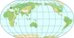 |
|---|---|---|
| GAW ID | PAY | |
| WIGOS ID | 0-20008-0-PAY | |
| Station name | Payerne | |
| GAW category | GAW Regional | |
| WMO region | REGION VI (Europe) | |
| Country/territory | Switzerland | |
| Address 1 | ||
| Address 2 | ||
| Address 3 | ||
| Latitude (north: +; south: −) | 46.8129081726 | |
| Longitude (east: +; west: −) | 6.943500042 | |
| Elevation (m a.s.l.) | 490 | |
| Timezone | UTC+01:00 | |
| Category | fixed station | |
| Gawsis | https://gawsis.meteoswiss.ch/GAWSIS//index.html#/search/station/stationReportDetails/571 | |
| Climate Zone | Cfb (Warm temperate climate, fully humid, warm summer) | |
| Website | www.meteoswiss.admin.ch/web/en/weather/ozone_layer.html | |
| Status | Operational | |
| Description | The site is located on the premises of the national weather service, MeteoSwiss, about 1 km south-east of the small rural town of Payerne. The main road circumventing Payerne passes several hundred meters away south-east of the site. NDACC station: mwave, o3sonde | |
| Contributor(s) |
|
|
| Gas Species |
|
|
Pha Din Map
| WDCGG ID | PDI2035 | 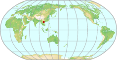 |
|---|---|---|
| GAW ID | PDI | |
| WIGOS ID | 0-20008-0-PDI | |
| Station name | Pha Din | |
| GAW category | GAW Regional | |
| WMO region | REGION II (Asia) | |
| Country/territory | Viet Nam | |
| Address 1 | ||
| Address 2 | ||
| Address 3 | ||
| Latitude (north: +; south: −) | 21.5731 | |
| Longitude (east: +; west: −) | 103.5157 | |
| Elevation (m a.s.l.) | 1466 | |
| Timezone | UTC+07:00 | |
| Category | fixed station | |
| Gawsis | https://gawsis.meteoswiss.ch/GAWSIS//index.html#/search/station/stationReportDetails/959 | |
| Climate Zone | UNK (Unknown) | |
| Website | ||
| Status | Operational | |
| Description | Prevailing wind directions: NE in winter and SW in summer. Temperature: 25-30 °C in summer and down to 3 °C in winter. No snow or ice in winter. Rainfall and humidity: The site is in clouds a considerable fraction of the year with a correspondingly high relative humidity all year long. Population: No residents at the station except for the custodians. No relevant residential areas within 10-20 km, except for sparse individual farm houses. The closest farm house is located in 1 km distance in NE direction. Land cover: Mountain hill area covered with forest. The station itself is above the canopy. Possible influence of local and regional emissions: Occasional corn plant burning in March and April. Staff housing (gas cooking, electrical heating, occasional trash burning) is at the station. No coal power plants and other industrial activities in the region. | |
| Contributor(s) |
|
|
| Gas Species |
|
|
Pic du Midi Map
| WDCGG ID | PDM6044 | 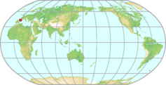 |
|---|---|---|
| GAW ID | PDM | |
| WIGOS ID | 0-20008-0-PDM | |
| Station name | Pic du Midi | |
| GAW category | GAW Regional | |
| WMO region | REGION VI (Europe) | |
| Country/territory | France | |
| Address 1 | Observatoire du Pic du Midi 57 avenue d'Azereix - BP 826 65008 TARBES Cedex France | |
| Address 2 | ||
| Address 3 | ||
| Latitude (north: +; south: −) | 42.9371986389 | |
| Longitude (east: +; west: −) | 0.1411000043 | |
| Elevation (m a.s.l.) | 2877 | |
| Timezone | UTC+01:00 | |
| Category | fixed station | |
| Gawsis | https://gawsis.meteoswiss.ch/GAWSIS//index.html#/search/station/stationReportDetails/761 | |
| Climate Zone | Cfb (Warm temperate climate, fully humid, warm summer) | |
| Website | http://p2oa.aero.obs-mip.fr | |
| Status | Operational | |
| Description | Pic du Midi (2877 m asl, 42.93642N, 0.14260E) is a high-altitude observatory for astronomy and atmospheric sciences on top of an isolated summit in the Pyrenees. The summit is situated well to the north of the Pyrenean watershed and thus forms a promontory over the French plain. This site is 150 km to the east of the Atlantic coast, and is most often exposed to oceanic westerlies or north-westerlies. Advection of continental air from the Iberian Peninsula flowing over the Pyrenees is also frequent. In the context of the GEOmon programme (www.geomon.eu), a study was conducted to characterize and compare the areas of influence ("footprints") of various atmospheric background measurement sites in Europe (Henne et al., Atmospheric Chemistry and Physics, 2010). In this study, Pic du Midi (PDM) was categorized as ``mostly remote'' (see http://geomon.empa.ch/index.php?id=PDM). Pic du Midi is located away from major urban or industrial areas. The population in radii of 10 and 50 km amount to about 13,000 and 412,000 inhabitants, respectively, concentrated in two main cities: Pau (217,000 inhabitants) and Tarbes (110,000 inhabitants, Fig. 2), situated 55 km and 30 km away to the northwest, respectively. Outside of these two main cities, countryside and mountain areas are sparsely inhabited, with exception of the small town of Bagnères-de-Bigorre (9000 inhabitants) located 14 km north of PDM. Beyond greenhouse gas measurements (carbon dioxide, methane, carbon monoxide, water vapor) following the ICOS standard operation procedure, permanent monitoring of other gaseous species (ozone, carbon monoxide, mercury), aerosol particles and meteorology is also being performed at PDM (http://p2oa.aero.obs-mip.fr). | |
| Contributor(s) |
|
|
| Gas Species |
|
|
Plateau Assy Map
| WDCGG ID | KZM2007 |  |
|---|---|---|
| GAW ID | KZM | |
| WIGOS ID | 0-20008-0-KZM | |
| Station name | Plateau Assy | |
| GAW category | GAW Regional | |
| WMO region | REGION II (Asia) | |
| Country/territory | Kazakhstan | |
| Address 1 | ||
| Address 2 | ||
| Address 3 | ||
| Latitude (north: +; south: −) | 43.25 | |
| Longitude (east: +; west: −) | 77.8799972534 | |
| Elevation (m a.s.l.) | 2519 | |
| Timezone | UTC+06:00 | |
| Category | fixed station | |
| Gawsis | https://gawsis.meteoswiss.ch/GAWSIS//index.html#/search/station/stationReportDetails/266 | |
| Climate Zone | Dfb (Snow climate, fully humid, warm summer) | |
| Website | ||
| Status | Non-reporting | |
| Description | NOAA "Carbon Cycle Surface Flask" project | |
| Contributor(s) |
|
|
| Gas Species |
|
|
Plateau Rosa Map
| WDCGG ID | PRS6039 | 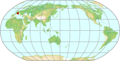 |
|---|---|---|
| GAW ID | PRS | |
| WIGOS ID | 0-20008-0-PRS | |
| Station name | Plateau Rosa | |
| GAW category | GAW Regional | |
| WMO region | REGION VI (Europe) | |
| Country/territory | Italy | |
| Address 1 | Testa Grigia Laboratory | |
| Address 2 | ||
| Address 3 | ||
| Latitude (north: +; south: −) | 45.9353408813 | |
| Longitude (east: +; west: −) | 7.7073101997 | |
| Elevation (m a.s.l.) | 3480 | |
| Timezone | UTC+01:00 | |
| Category | fixed station | |
| Gawsis | https://gawsis.meteoswiss.ch/GAWSIS//index.html#/search/station/stationReportDetails/267 | |
| Climate Zone | ET (Tundra climate) | |
| Website | http://oasi.erse-web.it/ | |
| Status | Operational | |
| Description | It is a monitorig station collocated at a very high mountain site (3480 m asl). For this reason it is often out of the planetary boundary layer and the sinks and sources are not close to the station (except for a funicular railway operating during the central hours of the day and some motor vehicles utilized to prepare the snow to ski). | |
| Contributor(s) |
|
|
| Gas Species |
|
|
Point Arena (CA) Map
| WDCGG ID | PTA4025 |  |
|---|---|---|
| GAW ID | PTA | |
| WIGOS ID | 0-20008-0-PTA | |
| Station name | Point Arena (CA) | |
| GAW category | GAW Regional | |
| WMO region | REGION IV (North and Central America) | |
| Country/territory | United States of America | |
| Address 1 | ||
| Address 2 | ||
| Address 3 | ||
| Latitude (north: +; south: −) | 38.9500007629 | |
| Longitude (east: +; west: −) | -123.7300033569 | |
| Elevation (m a.s.l.) | 17 | |
| Timezone | UTC-08:00 | |
| Category | fixed station | |
| Gawsis | https://gawsis.meteoswiss.ch/GAWSIS//index.html#/search/station/stationReportDetails/268 | |
| Climate Zone | Csb (Warm temperate climate with dry and warm summer) | |
| Website | ||
| Status | Non-reporting | |
| Description | NOAA "Carbon Cycle Surface Flask" project site | |
| Contributor(s) |
|
|
| Gas Species |
|
|
Puijo Map
| WDCGG ID | PUI6325 | 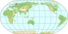 |
|---|---|---|
| GAW ID | PUI | |
| WIGOS ID | 0-246-0-PUI | |
| Station name | Puijo | |
| GAW category | GAW Contributing networks | |
| WMO region | REGION VI (Europe) | |
| Country/territory | Finland | |
| Address 1 | ||
| Address 2 | ||
| Address 3 | ||
| Latitude (north: +; south: −) | 62.90944 | |
| Longitude (east: +; west: −) | 27.65528 | |
| Elevation (m a.s.l.) | 306 | |
| Timezone | UTC+02:00 | |
| Category | fixed station | |
| Gawsis | https://gawsis.meteoswiss.ch/GAWSIS//index.html#/search/station/stationReportDetails/32676 | |
| Climate Zone | Dfc (Snow climate, fully humid, cool summer) | |
| Website | ||
| Status | Operational | |
| Description | The Puijo site is located in the town of Kuopio on the top of an observation tower on Puijo hill. Measurements are made at the height of 306 m above sea level and 230 m above the surrounding lake level. The Puijo site is supported by observations in a nearby Savilahti station (87 m above sea level and 5 m above the surrounding lake level). The Puijo station is operated by Finnish Meteorological Institute (FMI) and University of Eastern Finland (UEF). The present instrumentation covers several meteorological parameters, aerosol size distribution and number concentration, light scattering from and absorption to aerosol particles, cloud droplet size distribution, and trace gas concentration (O3, NOx, SO2). The aerosol properties are measured through two inlets: a cloud interstitial and a total air inlet, in order to study aerosol-cloud interactions. The Puijo station is a candidate for a Class 2 station in the ICOS RI, with measurements of methane and carbon dioxide from the top of the tower. There are urban or suburban areas and certain point emission sources in some wind directions, and the extensive set of aerosol and air pollution species measured makes it easy to flag the samples from the local emission sources. Another wind sector is with very few local sources, providing background air masses for comparison with the polluted air masses. | |
| Contributor(s) |
|
|
| Gas Species |
|
|
Puy de Dôme Map
| WDCGG ID | PUY6040 | 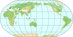 |
|---|---|---|
| GAW ID | PUY | |
| WIGOS ID | 0-20008-0-PUY | |
| Station name | Puy de Dôme | |
| GAW category | GAW Global | |
| WMO region | REGION VI (Europe) | |
| Country/territory | France | |
| Address 1 | OPGC 24 Avenue des Landais 63177 Aubière Cedex France | |
| Address 2 | ||
| Address 3 | ||
| Latitude (north: +; south: −) | 45.7723 | |
| Longitude (east: +; west: −) | 2.9658 | |
| Elevation (m a.s.l.) | 1465 | |
| Timezone | UTC+01:00 | |
| Category | fixed station | |
| Gawsis | https://gawsis.meteoswiss.ch/GAWSIS//index.html#/search/station/stationReportDetails/757 | |
| Climate Zone | Cfb (Warm temperate climate, fully humid, warm summer) | |
| Website | http://wwwobs.univ-bpclermont.fr/SO/mesures/instru.php | |
| Status | Operational | |
| Description | The puy de Dôme Research Station (1465 m asl), central France, is located on the first mountain chain facing dominant western winds. Puy de Dôme is the highest point of the Chaîne des Puys, which comprises 80 volcanoes aligned north to south on a 3 to 5 km wide strip of land, a little over 45 kilometres in length. The station is exposed to an oceanic climate. It is surrounded by a protected area where fields and forests are predominant. The city of Clermont-Ferrand (150 000 inhabitants) is located 16 km east of the station at 396m a.s.l. . The moderate altitude of the station allows for the identification of the part of the atmosphere that the station is sampling (Planetary Boundary Layer, Lower Free troposphere, Nocturnal residual layer, Interfaces). Furthermore, the station is more than 50% of the time in cloud and offers natural cloud microphysical characterization both on the roof plateform. The PUY station is measuring a complete set of in situ measurements of the gas (9 parameters) and particulate (11 parameters) phases at 1465 m, coupled with co-located RADAR, LIDAR and sun photometer measurements at its base (400 m a.s.l.). | |
| Contributor(s) |
|
|
| Gas Species |
|
|
Ragged Point Map
| WDCGG ID | RPB4036 | 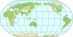 |
|---|---|---|
| GAW ID | RPB | |
| WIGOS ID | 0-20008-0-RPB | |
| Station name | Ragged Point | |
| GAW category | GAW Regional | |
| WMO region | REGION IV (North and Central America) | |
| Country/territory | Barbados | |
| Address 1 | ||
| Address 2 | ||
| Address 3 | ||
| Latitude (north: +; south: −) | 13.1700000763 | |
| Longitude (east: +; west: −) | -59.4300003052 | |
| Elevation (m a.s.l.) | 45 | |
| Timezone | UTC-04:00 | |
| Category | fixed station | |
| Gawsis | https://gawsis.meteoswiss.ch/GAWSIS//index.html#/search/station/stationReportDetails/276 | |
| Climate Zone | Am (Equatorial monsoon) | |
| Website | http://agage.eas.gatech.edu/Stations/barbados.htm | |
| Status | Operational | |
| Description | The northern tropical atmospheric research station at Ragged Point, Barbados is located on the eastern edge of the island with direct exposure to the Atlantic Ocean. It experiences generally easterly winds disrupted routinely by the passage of cyclones and anticyclones. The ALE/GAGE/AGAGE has operated continuously at this location since 1978. There are two in-situ instruments there. The GC-MD instrument started measuring atmospheric CFC-11, CFC-12, CH3CCl3, CCl4 and N2O in 1978, CFC-113 in 1985, and CH4 and CHCl3 in 1996. A state of the art Medusa GC-MS instrument, with capability of measuring more than 40 trace gases, was installed in May 2005. Also AERONET and MPLNET site. | |
| Contributor(s) |
|
|
| Gas Species |
|
|
Ridge Hill Map
| WDCGG ID | RGL6020 | 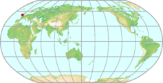 |
|---|---|---|
| GAW ID | RGL | |
| WIGOS ID | 0-20008-0-RGL | |
| Station name | Ridge Hill | |
| GAW category | GAW Regional | |
| WMO region | REGION VI (Europe) | |
| Country/territory | United Kingdom of Great Britain and Northern Ireland | |
| Address 1 | ||
| Address 2 | ||
| Address 3 | ||
| Latitude (north: +; south: −) | 51.9975585938 | |
| Longitude (east: +; west: −) | -2.5400300026 | |
| Elevation (m a.s.l.) | 204 | |
| Timezone | UTC | |
| Category | fixed station | |
| Gawsis | https://gawsis.meteoswiss.ch/GAWSIS//index.html#/search/station/stationReportDetails/920 | |
| Climate Zone | UNK (Unknown) | |
| Website | http://www.metoffice.gov.uk/research/monitoring/atmospheric-trends/sites/ridge-hill | |
| Status | Operational | |
| Description | Ridge Hill is a rural UK site located 13 km south-east of Hereford (population ~55,000), and 32 miles south-west of Worcester (population ~94,000), in Herefordshire, UK. This station is part of the UK DECC (Deriving Emissions related to Climate Change) Network . Air samples are taken from a line sampling 90 meters up a tall tower. Due to the sites location, far from strong sources of local pollution, measurements from this site will be used to calculate emission maps of trace gas species in the UK in combination with other measurement stations in the UK and Ireland. | |
| Contributor(s) |
|
|
| Gas Species |
|
|
Rigi Map
| WDCGG ID | RIG6038 | 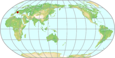 |
|---|---|---|
| GAW ID | RIG | |
| WIGOS ID | 0-20008-0-RIG | |
| Station name | Rigi | |
| GAW category | GAW Regional | |
| WMO region | REGION VI (Europe) | |
| Country/territory | Switzerland | |
| Address 1 | ||
| Address 2 | ||
| Address 3 | ||
| Latitude (north: +; south: −) | 47.06739 | |
| Longitude (east: +; west: −) | 8.46333 | |
| Elevation (m a.s.l.) | 1031 | |
| Timezone | UTC+01:00 | |
| Category | fixed station | |
| Gawsis | https://gawsis.meteoswiss.ch/GAWSIS//index.html#/search/station/stationReportDetails/433 | |
| Climate Zone | Cfb (Warm temperate climate, fully humid, warm summer) | |
| Website | http://www.umwelt-schweiz.ch/buwal/de/fachgebiete/fg_luft/luftbelastung/nabel/ | |
| Status | Operational | |
| Description | The station is located some 300 m south-west of the upper platform of Seebodenalpbahn (cable car) on the crest of Mühlimannsegg, 600 m above Vierwaldstättersee (Lake Lucerne). In this low-alpine setting, grass-land and forest areas alternate. The small cities of Zug (pop. 100’000 including suburbs) and Lucerne (pop. 180’000 including suburbs) are approximately 12 km away. The site became operational in 1991 as part of the Swiss National Air Pollution Monitoring network (NABEL). It is also the primary Swiss contribution to EMEP. The existing station building will be enlarged in the near future to accomodate an even more extended measurement program including PM2.5, PM1, aerosol number concentration, EC/OC, as well as continuous ammonia/ammonium measurements. | |
| Contributor(s) |
|
|
| Gas Species |
|
|
Ryori Map
| WDCGG ID | RYO2012 | 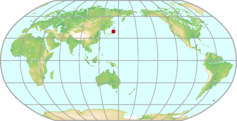 |
|---|---|---|
| GAW ID | RYO | |
| WIGOS ID | 0-20008-0-RYO | |
| Station name | Ryori | |
| GAW category | GAW Regional | |
| WMO region | REGION II (Asia) | |
| Country/territory | Japan | |
| Address 1 | 1-25,Tahamashimo, Ryori | |
| Address 2 | Sanriku-cho, Ofunato-shi | |
| Address 3 | Iwate 022-0211, Japan | |
| Latitude (north: +; south: −) | 39.0319 | |
| Longitude (east: +; west: −) | 141.8222 | |
| Elevation (m a.s.l.) | 260 | |
| Timezone | UTC+09:00 | |
| Category | fixed station | |
| Gawsis | https://gawsis.meteoswiss.ch/GAWSIS//index.html#/search/station/stationReportDetails/642 | |
| Climate Zone | Cfb (Warm temperate climate, fully humid, warm summer) | |
| Website | ||
| Status | Operational | |
| Description | Ryori Station is sited on a hilly cape on the Pacific coast in the nothern part of the Japanese main island, Honshu. The surrounding area is sparsely populated, about 120 km apart from Sendai, the largest city of the region with a population of one million. The area has a temperate climate with distinct four seasons. The annual temperature is about 10 °C and annual precipitation is about 1,300 mm. The observatory is surrounded by insignificant woods and grass. Prevailing wind direction is westerly. | |
| Contributor(s) |
|
|
| Gas Species |
|
|
Sable Island Map
| WDCGG ID | WSA4019 | 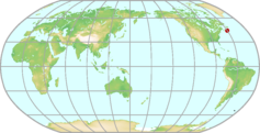 |
|---|---|---|
| GAW ID | WSA | |
| WIGOS ID | 0-20008-0-WSA | |
| Station name | Sable Island | |
| GAW category | GAW Regional | |
| WMO region | REGION IV (North and Central America) | |
| Country/territory | Canada | |
| Address 1 | ||
| Address 2 | ||
| Address 3 | ||
| Latitude (north: +; south: −) | 43.932638 | |
| Longitude (east: +; west: −) | -60.008608 | |
| Elevation (m a.s.l.) | 2 | |
| Timezone | UTC-04:00 | |
| Category | fixed station | |
| Gawsis | https://gawsis.meteoswiss.ch/GAWSIS//index.html#/search/station/stationReportDetails/678 | |
| Climate Zone | Cfb (Warm temperate climate, fully humid, warm summer) | |
| Website | ||
| Status | Operational | |
| Description | Sable Island is a remote crescent-shaped “sandbar” located in the Atlantic Ocean, approximately 275 km east-southeast of Halifax, Nova Scotia. The Island is about 44 km long with little over 1 km wide at its widest point, and has maximum elevation of about 10 m. The terrain along the shoreline is flat with the interior containing two large saltwater ponds and a series of rolling sand dunes covered with small patches of grass and shrubs. Vegetation on the Island is very sparse. Public access is restricted. The Island is also a refuge for wild horses, seals and migratory birds. The weather station and air chemistry observatory is located approximately 8 km from the western end of the Island, 100 m from the north beach and 800 m from the south beach. Sable island is predominantly influenced by airflow originating from the North American continent and thus provides an excellent platform to assess the influence of anthropogenic and terrestrial emissions from the North American continent to the troposphere. Currently, Environment and Climate Change Canada's Greenhouse Gas Measurement Lab (GGML), continuously measures ambient CO2, CH4 and CO via Cavity Ring Down spectroscopy. Weekly ambient flask samples were taken at the site and measured for CO2, CH4 and N2O from 1999-2017 and 13C and 18O isotopes of CO2 from 2003-2010. | |
| Contributor(s) |
|
|
| Gas Species |
|
|
Saclay Map
| WDCGG ID | SAC6423 | 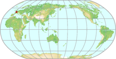 |
|---|---|---|
| GAW ID | ||
| WIGOS ID | 0-250-0-SAC | |
| Station name | Saclay | |
| GAW category | GAW Contributing networks | |
| WMO region | REGION VI (Europe) | |
| Country/territory | France | |
| Address 1 | ||
| Address 2 | ||
| Address 3 | ||
| Latitude (north: +; south: −) | 48.7227 | |
| Longitude (east: +; west: −) | 2.142 | |
| Elevation (m a.s.l.) | 160 | |
| Timezone | UTC+01:00 | |
| Category | fixed station | |
| Gawsis | https://gawsis.meteoswiss.ch/GAWSIS//index.html#/search/station/stationReportDetails/113451 | |
| Climate Zone | UNK (Unknown) | |
| Website | ||
| Status | Operational | |
| Description | ||
| Contributor(s) |
|
|
| Gas Species |
|
|
Samoa (Cape Matatula) Map
| WDCGG ID | SMO5009 | 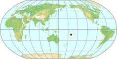 |
|---|---|---|
| GAW ID | SMO | |
| WIGOS ID | 0-20008-0-SMO | |
| Station name | Samoa (Cape Matatula) | |
| GAW category | GAW Global | |
| WMO region | REGION V (South-West Pacific) | |
| Country/territory | United States of America | |
| Address 1 | P.O. Box 2568 Pago Pago, American Samoa 96799 | |
| Address 2 | ||
| Address 3 | ||
| Latitude (north: +; south: −) | -14.2474746704 | |
| Longitude (east: +; west: −) | -170.5645141602 | |
| Elevation (m a.s.l.) | 77 | |
| Timezone | UTC-11:00 | |
| Category | fixed station | |
| Gawsis | https://gawsis.meteoswiss.ch/GAWSIS//index.html#/search/station/stationReportDetails/491 | |
| Climate Zone | Af (Equatorial rainforest, fully humid) | |
| Website | https://gml.noaa.gov/obop/smo/ | |
| Status | Operational | |
| Description | The American Samoa Observatory (SMO) at Cape Matatula is located on the northeastern tip of Tutuila Island, American Samoa, on a ridge overlooking the South Pacific Ocean. Established in 1974 on a 26.7 acre site, the observatory is the fourth of the GML Atmospheric Baseline Observatories. Cape Matatula is approx. 1 km from the village of Tula. Prevailing winds are marine. Since its construction, the American Samoa Observatory has survived three major hurricanes with only minor damage. A staff of 2 operates the year-round facility. This observatory has the distinction of obtaining 30% of its daytime power from solar panels. | |
| Contributor(s) |
|
|
| Gas Species |
|
|
Sand Island Map
| WDCGG ID | MID5001 |  |
|---|---|---|
| GAW ID | MID | |
| WIGOS ID | 0-20008-0-MID | |
| Station name | Sand Island | |
| GAW category | GAW Regional | |
| WMO region | REGION V (South-West Pacific) | |
| Country/territory | United States of America | |
| Address 1 | ||
| Address 2 | ||
| Address 3 | ||
| Latitude (north: +; south: −) | 28.2199993134 | |
| Longitude (east: +; west: −) | -177.3699951172 | |
| Elevation (m a.s.l.) | 4 | |
| Timezone | UTC-11:00 | |
| Category | fixed station | |
| Gawsis | https://gawsis.meteoswiss.ch/GAWSIS//index.html#/search/station/stationReportDetails/289 | |
| Climate Zone | Am (Equatorial monsoon) | |
| Website | ||
| Status | Operational | |
| Description | This flask sampling site is located at Midway Atoll National Wildlife Refuge. The Refuge is approximately 2,012 km NW of Honolulu, HI and consists of three islands (Sand, Eastern, and Spit) which are surrounded by a fringing coral reef. The entire Refuge is 120,749 ha in size and is home to over 2 million seabirds. | |
| Contributor(s) |
|
|
| Gas Species |
|
|
Sary Taukum Map
| WDCGG ID | KZD2005 |  |
|---|---|---|
| GAW ID | KZD | |
| WIGOS ID | 0-20008-0-KZD | |
| Station name | Sary Taukum | |
| GAW category | GAW Regional | |
| WMO region | REGION II (Asia) | |
| Country/territory | Kazakhstan | |
| Address 1 | ||
| Address 2 | ||
| Address 3 | ||
| Latitude (north: +; south: −) | 44.4500007629 | |
| Longitude (east: +; west: −) | 77.5699996948 | |
| Elevation (m a.s.l.) | 412 | |
| Timezone | UTC+06:00 | |
| Category | fixed station | |
| Gawsis | https://gawsis.meteoswiss.ch/GAWSIS//index.html#/search/station/stationReportDetails/291 | |
| Climate Zone | Dfa (Snow climate, fully humid, hot summer) | |
| Website | ||
| Status | Non-reporting | |
| Description | NOAA "Carbon Cycle Surface Flask" project | |
| Contributor(s) |
|
|
| Gas Species |
|
|
Schauinsland Map
| WDCGG ID | SSL6027 | 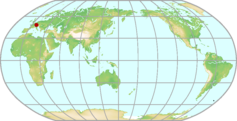 |
|---|---|---|
| GAW ID | SSL | |
| WIGOS ID | 0-20008-0-SSL | |
| Station name | Schauinsland | |
| GAW category | GAW Regional | |
| WMO region | REGION VI (Europe) | |
| Country/territory | Germany | |
| Address 1 | Federal Environmental AgencyMonitoring site SchauinslandPostfach 1229D-79196 Kirchzarten | |
| Address 2 | ||
| Address 3 | ||
| Latitude (north: +; south: −) | 47.9000015259 | |
| Longitude (east: +; west: −) | 7.9166665077 | |
| Elevation (m a.s.l.) | 1205 | |
| Timezone | UTC+01:00 | |
| Category | fixed station | |
| Gawsis | https://gawsis.meteoswiss.ch/GAWSIS//index.html#/search/station/stationReportDetails/502 | |
| Climate Zone | Cfb (Warm temperate climate, fully humid, warm summer) | |
| Website | http://www.env-it.de/umweltbundesamt/luftdaten/index.html | |
| Status | Operational | |
| Description | The continental station is run by the German Federal Environment Agency (Umweltbundesamt), Dessau. The station is situated on a mountain ridge in the Black Forest, southwest Germany, at an elevation of about 1000 m above the polluted Rhine valley. During night the station is usually above the boundary layer, while at daytime, particularly in summer, Schauinsland station mostly lies within the convective boundary layer. It is a regional GAW station, situated about 15 km southsouthwest of Freiburg and west to the Upper Rhine rift and the French boarder. Annual mean sum of precipitation amount is about 1780 mm. Annual mean temperature is about 5.6 °C. Prevailing wind is southwesterly. The monitoring site "Schauinsland" (1205m a.s.l.) is located in the southern part of the Black Forest mountain range near the top of mount Schauinsland, surrounded by forests and meadows. | |
| Contributor(s) |
|
|
| Gas Species |
|
|
Sede Boker Map
| WDCGG ID | WIS6053 | 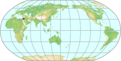 |
|---|---|---|
| GAW ID | WIS | |
| WIGOS ID | 0-20008-0-WIS | |
| Station name | Sede Boker | |
| GAW category | GAW Regional | |
| WMO region | REGION VI (Europe) | |
| Country/territory | Israel | |
| Address 1 | ||
| Address 2 | ||
| Address 3 | ||
| Latitude (north: +; south: −) | 31.1299991608 | |
| Longitude (east: +; west: −) | 34.8800010681 | |
| Elevation (m a.s.l.) | 400 | |
| Timezone | UTC+02:00 | |
| Category | fixed station | |
| Gawsis | https://gawsis.meteoswiss.ch/GAWSIS//index.html#/search/station/stationReportDetails/294 | |
| Climate Zone | BSh (Steppe climate, hot arid) | |
| Website | ||
| Status | Operational | |
| Description | NOAA Project "Carbon Cycle Surface Flask". MPLNET and AERONET site. | |
| Contributor(s) |
|
|
| Gas Species |
|
|
Serreta (Terceira) Map
| WDCGG ID | AZR6047 |  |
|---|---|---|
| GAW ID | AZR | |
| WIGOS ID | 0-20008-0-AZR | |
| Station name | Serreta (Terceira) | |
| GAW category | GAW Regional | |
| WMO region | REGION VI (Europe) | |
| Country/territory | Portugal | |
| Address 1 | ||
| Address 2 | ||
| Address 3 | ||
| Latitude (north: +; south: −) | 38.7700004578 | |
| Longitude (east: +; west: −) | -27.3799991608 | |
| Elevation (m a.s.l.) | 40 | |
| Timezone | UTC-01:00 | |
| Category | fixed station | |
| Gawsis | https://gawsis.meteoswiss.ch/GAWSIS//index.html#/search/station/stationReportDetails/296 | |
| Climate Zone | Csb (Warm temperate climate with dry and warm summer) | |
| Website | ||
| Status | Operational | |
| Description | Station located in the western point of the Terceira island (Azores) at a rocky soil. Part of NOAA "Carbon Cycle Surface Flask" project. | |
| Contributor(s) |
|
|
| Gas Species |
|
|
Shangdianzi Map
| WDCGG ID | SDZ2011 | 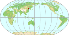 |
|---|---|---|
| GAW ID | SDZ | |
| WIGOS ID | 0-20008-0-SDZ | |
| Station name | Shangdianzi | |
| GAW category | GAW Regional | |
| WMO region | REGION II (Asia) | |
| Country/territory | China | |
| Address 1 | ||
| Address 2 | ||
| Address 3 | ||
| Latitude (north: +; south: −) | 40.6500015259 | |
| Longitude (east: +; west: −) | 117.1166000366 | |
| Elevation (m a.s.l.) | 287 | |
| Timezone | UTC+08:00 | |
| Category | fixed station | |
| Gawsis | https://gawsis.meteoswiss.ch/GAWSIS//index.html#/search/station/stationReportDetails/622 | |
| Climate Zone | Dwa (Snow climate with dry winter and hot summer) | |
| Website | ||
| Status | Operational | |
| Description | The Shangdianzi GAW Regional Station (Global Atmosphere Watch programme of the World Meteorological Organization) 150km northeast of urban Beijing is part of the domain of the China Meteorological Administration (CMA). It is jointly operated by the Beijing Meteorological Bureau (BMB) and the Chinese Academy of Meteorological Sciences (CAMS). | |
| Contributor(s) |
|
|
| Gas Species |
|
|
Shemya Island Map
| WDCGG ID | SHM4009 | 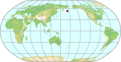 |
|---|---|---|
| GAW ID | SHM | |
| WIGOS ID | 0-20008-0-SHM | |
| Station name | Shemya Island | |
| GAW category | GAW Regional | |
| WMO region | REGION IV (North and Central America) | |
| Country/territory | United States of America | |
| Address 1 | ||
| Address 2 | ||
| Address 3 | ||
| Latitude (north: +; south: −) | 52.7200012207 | |
| Longitude (east: +; west: −) | 174.1000061035 | |
| Elevation (m a.s.l.) | 40 | |
| Timezone | UTC-10:00 | |
| Category | fixed station | |
| Gawsis | https://gawsis.meteoswiss.ch/GAWSIS//index.html#/search/station/stationReportDetails/297 | |
| Climate Zone | Dfc (Snow climate, fully humid, cool summer) | |
| Website | ||
| Status | Operational | |
| Description | NOAA "Carbon Cycle Surface Flask" Project | |
| Contributor(s) |
|
|
| Gas Species |
|
|
SONNBLICK Observatory Map
| WDCGG ID | SNB6032 | 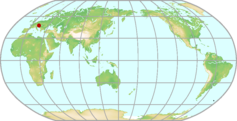 |
|---|---|---|
| GAW ID | SNB | |
| WIGOS ID | 0-20000-0-11343 | |
| Station name | SONNBLICK Observatory | |
| GAW category | GAW Global | |
| WMO region | REGION VI (Europe) | |
| Country/territory | Austria | |
| Address 1 | ||
| Address 2 | ||
| Address 3 | ||
| Latitude (north: +; south: −) | 47.054018786 | |
| Longitude (east: +; west: −) | 12.9576927483 | |
| Elevation (m a.s.l.) | 3106 | |
| Timezone | UTC+01:00 | |
| Category | fixed station | |
| Gawsis | https://gawsis.meteoswiss.ch/GAWSIS//index.html#/search/station/stationReportDetails/460 | |
| Climate Zone | ET (Tundra climate) | |
| Website | http://www.sonnblick.net | |
| Status | Operational | |
| Description | The station was originally registered based on WMO Pub 9 Vol A information containing these observation remarks: AUT;SUNDUR;TOTRA (see code table A for explanations). These remarks imply the following additional observations that could not be registered automatically: Total radiation measurements. | |
| Contributor(s) |
|
|
| Gas Species |
|
|
South Pole Map
| WDCGG ID | SPO7011 | 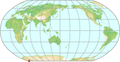 |
|---|---|---|
| GAW ID | SPO | |
| WIGOS ID | 0-20008-0-SPO | |
| Station name | South Pole | |
| GAW category | GAW Global | |
| WMO region | ANTARCTICA | |
| Country/territory | United States of America | |
| Address 1 | PSC 468 Box 402 FPO AP 96598-5402 | |
| Address 2 | ||
| Address 3 | ||
| Latitude (north: +; south: −) | -89.9969482422 | |
| Longitude (east: +; west: −) | -24.7999992371 | |
| Elevation (m a.s.l.) | 2841 | |
| Timezone | UTC-02:00 | |
| Category | fixed station | |
| Gawsis | https://gawsis.meteoswiss.ch/GAWSIS//index.html#/search/station/stationReportDetails/492 | |
| Climate Zone | EF (Frost climate) | |
| Website | https://gml.noaa.gov/obop/spo/ | |
| Status | Operational | |
| Description | The South Pole Observatory (SPO) was established at the geographical south pole at 2837 m above sea level in 1957 as part of the International Geophysical Year. The SPO site is one of four Atmospheric Baseline Observatories for NOAA's Global Monitoring Laboratory (GML). The National Science Foundation provides the infrastructure for the NOAA GML scientific operations including a state of the art science building named the Atmospheric Research Observatory opened in 1997. ARO was built to house current atmospheric research and replaced NOAA's Clean Air Facility in operation from 1977 to 1997. Two GML observatory staff spend one year tours of duty at the station which includes a 9 month period of isolation and six months of darkness. Atmospheric data has been collected from South Pole since the International Geophysical Year (IGY), 1957 - 1958. | |
| Contributor(s) |
|
|
| Gas Species |
|
|
Southern Great Plains E13 (OK) Map
| WDCGG ID | SGP4026 | 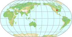 |
|---|---|---|
| GAW ID | SGP | |
| WIGOS ID | 0-20008-0-SGP | |
| Station name | Southern Great Plains E13 (OK) | |
| GAW category | GAW Contributing networks | |
| WMO region | REGION IV (North and Central America) | |
| Country/territory | United States of America | |
| Address 1 | ||
| Address 2 | ||
| Address 3 | ||
| Latitude (north: +; south: −) | 36.5999984741 | |
| Longitude (east: +; west: −) | -97.5 | |
| Elevation (m a.s.l.) | 318 | |
| Timezone | UTC-06:00 | |
| Category | fixed station | |
| Gawsis | https://gawsis.meteoswiss.ch/GAWSIS//index.html#/search/station/stationReportDetails/357 | |
| Climate Zone | Cfa (Warm temperate climate, fully humid, hot summer) | |
| Website | http://www.arm.gov/sites/sgp.stm | |
| Status | Operational | |
| Description | The sampling site is located in the Southern Great Plains, within the US DOE Atmospheric Radiation Measurement Program testbed. The testbed is a 350 km x 350 km area studied and modeled by ARM. It is officially called the ARM-CART (cloud and radiation testbed). The local topography is very flat. Land use is mostly agriculture; main land cover is winter wheat and pasture. Scientists are using the information obtained from the SGP site to improve cloud and radiative models and parameterizations and, thereby, the performance of atmospheric general circulation models used for climate research. There are 30 scientists and technicians who collect and monitor data from the central facility instruments and from remote instruments throughout the site. The SGP is the largest and most extensive climate research field site in the world. | |
| Contributor(s) |
|
|
| Gas Species |
|
|
Southern Ocean Ship of Opportunity Map
| WDCGG ID | SOO5059 | 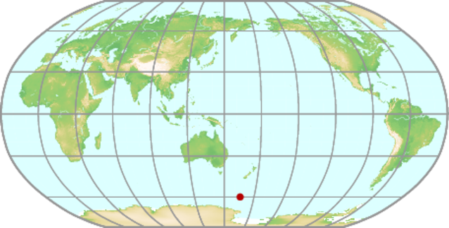 |
|---|---|---|
| GAW ID | SOO | |
| WIGOS ID | 0-554-0-SOO | |
| Station name | Southern Ocean Ship of Opportunity | |
| GAW category | GAW Regional | |
| WMO region | REGION V (South-West Pacific) | |
| Country/territory | New Zealand | |
| Address 1 | ||
| Address 2 | ||
| Address 3 | ||
| Latitude (north: +; south: −) | -60 | |
| Longitude (east: +; west: −) | 166 | |
| Elevation (m a.s.l.) | 20 | |
| Timezone | UTC+12:00 | |
| Category | fixed station | |
| Gawsis | https://gawsis.meteoswiss.ch/GAWSIS//index.html#/search/station/stationReportDetails/160798 | |
| Climate Zone | Dfd (Snow climate, fully humid, extremely continental) | |
| Website | ||
| Status | Operational | |
| Description | ||
| Contributor(s) |
|
|
| Gas Species |
|
|
St. Croix Map
| WDCGG ID | AVI4035 |  |
|---|---|---|
| GAW ID | AVI | |
| WIGOS ID | 0-20008-0-AVI | |
| Station name | St. Croix | |
| GAW category | GAW Regional | |
| WMO region | REGION IV (North and Central America) | |
| Country/territory | United States of America | |
| Address 1 | ||
| Address 2 | ||
| Address 3 | ||
| Latitude (north: +; south: −) | 17.75 | |
| Longitude (east: +; west: −) | -64.75 | |
| Elevation (m a.s.l.) | 3 | |
| Timezone | UTC-04:00 | |
| Category | fixed station | |
| Gawsis | https://gawsis.meteoswiss.ch/GAWSIS//index.html#/search/station/stationReportDetails/303 | |
| Climate Zone | Aw (Equatorial savannah with dry summer) | |
| Website | ||
| Status | Closed | |
| Description | former NOAA flask sampling site Carbon Cycle Surface Flasks Project | |
| Contributor(s) |
|
|
| Gas Species |
|
|
St. David's Head Map
| WDCGG ID | BME4029 |  |
|---|---|---|
| GAW ID | BME | |
| WIGOS ID | 0-20008-0-BME | |
| Station name | St. David's Head | |
| GAW category | GAW Regional | |
| WMO region | REGION IV (North and Central America) | |
| Country/territory | United Kingdom of Great Britain and Northern Ireland | |
| Address 1 | ||
| Address 2 | ||
| Address 3 | ||
| Latitude (north: +; south: −) | 32.3699989319 | |
| Longitude (east: +; west: −) | -64.6500015259 | |
| Elevation (m a.s.l.) | 30 | |
| Timezone | UTC-04:00 | |
| Category | fixed station | |
| Gawsis | https://gawsis.meteoswiss.ch/GAWSIS//index.html#/search/station/stationReportDetails/304 | |
| Climate Zone | UNK (Unknown) | |
| Website | ||
| Status | Closed | |
| Description | NOAA "Carbon Cycle Surface Flask" Project | |
| Contributor(s) |
|
|
| Gas Species |
|
|
Station Nord Map
| WDCGG ID | SNO4065 | 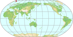 |
|---|---|---|
| GAW ID | SNO | |
| WIGOS ID | 0-20008-0-SNO | |
| Station name | Station Nord | |
| GAW category | GAW Regional | |
| WMO region | REGION IV (North and Central America) | |
| Country/territory | Denmark | |
| Address 1 | ||
| Address 2 | ||
| Address 3 | ||
| Latitude (north: +; south: −) | 81.6015 | |
| Longitude (east: +; west: −) | -16.662 | |
| Elevation (m a.s.l.) | 24 | |
| Timezone | UTC-04:00 | |
| Category | fixed station | |
| Gawsis | https://gawsis.meteoswiss.ch/GAWSIS//index.html#/search/station/stationReportDetails/934 | |
| Climate Zone | UNK (Unknown) | |
| Website | ||
| Status | Non-reporting | |
| Description | Station Nord is a small military base with an air strip. It is manned year round by the Danish military. The station is at North Greenland on a small peninsula “Prinsesse Ingeborgs Halvø”. The measurements are performed in Flyger’s Hytte, a laboratory hut located approximately 2 km south of the central complex of buildings and thus the influence of local air pollution is at a minimum. Measurements were started at Station Nord in 1989. The station is located close to a lake. The peninsula is formed from marine sediments so the area around the station is flat with a slow decline towards the sea. Thus the station is most of the time within the marine boundary layer and due to the high altitude it is north of the polar circle year round. | |
| Contributor(s) |
|
|
| Gas Species |
|
|
Steinkimmen Map
| WDCGG ID | STE6422 | 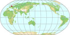 |
|---|---|---|
| GAW ID | STE | |
| WIGOS ID | 0-20008-0-STE | |
| Station name | Steinkimmen | |
| GAW category | GAW Regional | |
| WMO region | REGION VI (Europe) | |
| Country/territory | Germany | |
| Address 1 | ||
| Address 2 | ||
| Address 3 | ||
| Latitude (north: +; south: −) | 53.043081 | |
| Longitude (east: +; west: −) | 8.458761 | |
| Elevation (m a.s.l.) | 29 | |
| Timezone | UTC+01:00 | |
| Category | fixed station | |
| Gawsis | https://gawsis.meteoswiss.ch/GAWSIS//index.html#/search/station/stationReportDetails/32677 | |
| Climate Zone | Cfb (Warm temperate climate, fully humid, warm summer) | |
| Website | ||
| Status | Operational | |
| Description | The Tall Tower Steinkimmen is situated near the city of Ganderkesee in Lower Saxony, Germany approx. 20km west of Bremen. The surrounding area is very flat with elevations rarely exceeding 100m a.s.l. The land use in this area is dominated by forest and agricultural fields (ca. 20 % and ca. 60 %), lakes cover about 2 %, villages and traffic about 12 %. | |
| Contributor(s) |
|
|
| Gas Species |
|
|
Storhofdi Map
| WDCGG ID | ICE6007 |  |
|---|---|---|
| GAW ID | ICE | |
| WIGOS ID | 0-20008-0-ICE | |
| Station name | Storhofdi | |
| GAW category | GAW Regional | |
| WMO region | REGION VI (Europe) | |
| Country/territory | Iceland | |
| Address 1 | ||
| Address 2 | ||
| Address 3 | ||
| Latitude (north: +; south: −) | 63.4000015259 | |
| Longitude (east: +; west: −) | -20.2833328247 | |
| Elevation (m a.s.l.) | 118 | |
| Timezone | UTC | |
| Category | fixed station | |
| Gawsis | https://gawsis.meteoswiss.ch/GAWSIS//index.html#/search/station/stationReportDetails/508 | |
| Climate Zone | Cfc (Warm temperate climate, fully humid, cool summer) | |
| Website | ||
| Status | Operational | |
| Description | Location and surroundings: At the southern tip of the island Heimaey, which is the largest of the Vestmannaeyjar islands 12 km off the south coast of Iceland. The latitude of the station is 63° 24' north and the longitude is 20° 17' west. The elevation is 118 m. Distance from the fishing town on the island (4500 inhabitants) is 4.5 km; distance to the nearest village (700 inhabitants) on shore is 40 km; distance to the nearest town (4000 inhabitants) on shore is 70 km. | |
| Contributor(s) |
|
|
| Gas Species |
|
|
Suita Map
| WDCGG ID | SUI2023 | 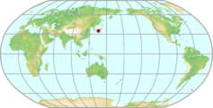 |
|---|---|---|
| GAW ID | SUI | |
| WIGOS ID | 0-20008-0-SUI | |
| Station name | Suita | |
| GAW category | GAW Other elements | |
| WMO region | REGION II (Asia) | |
| Country/territory | Japan | |
| Address 1 | Green Engineering Lab | |
| Address 2 | Division of Sustainable Energy and Environmental Engineering, Graduate School of Engineering, Osaka University, Japan | |
| Address 3 | 2-1 Yamadaoka, Suita, Osaka 565-0871 Japan | |
| Latitude (north: +; south: −) | 34.8199996948 | |
| Longitude (east: +; west: −) | 135.5200042725 | |
| Elevation (m a.s.l.) | 63 | |
| Timezone | UTC+09:00 | |
| Category | fixed station | |
| Gawsis | https://gawsis.meteoswiss.ch/GAWSIS//index.html#/search/station/stationReportDetails/751 | |
| Climate Zone | Cfa (Warm temperate climate, fully humid, hot summer) | |
| Website | ||
| Status | Closed | |
| Description | Our site is located in Osaka University Suita Campus. It it situated approximately 10 km north of the city center in Osaka, the second most populated region in Japan. It is mainly surrounded by a suburban residential area and partly by small woodlands. Annual precipitation was 1493 mm. Annual mean temperature was 16.3 C in 2006 at a JMA automated meteorological station (AMeDAS) approximately 8 km west of the site. Ambient air was introduced from a sample inlet installed at 23.6 m above ground on the north-faced wall of a seven-story building. | |
| Contributor(s) |
|
|
| Gas Species |
|
|
Summit Map
| WDCGG ID | SUM6002 | 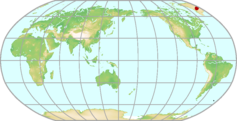 |
|---|---|---|
| GAW ID | SUM | |
| WIGOS ID | 0-20008-0-SUM | |
| Station name | Summit | |
| GAW category | GAW Regional | |
| WMO region | REGION VI (Europe) | |
| Country/territory | Denmark | |
| Address 1 | ||
| Address 2 | ||
| Address 3 | ||
| Latitude (north: +; south: −) | 72.5800018311 | |
| Longitude (east: +; west: −) | -38.4799995422 | |
| Elevation (m a.s.l.) | 3238 | |
| Timezone | UTC-03:00 | |
| Category | fixed station | |
| Gawsis | https://gawsis.meteoswiss.ch/GAWSIS//index.html#/search/station/stationReportDetails/312 | |
| Climate Zone | EF (Frost climate) | |
| Website | www.geosummit.org | |
| Status | Operational | |
| Description | The Greenland Environmental Observatory at Summit (GEOSummit) is a year-round Arctic sampling station funded by the National Science Foundation. GEOSummit is located at the top of the Greenland Ice Sheet (72º N, 38º W) and provides unique opportunities for investigation of atmospheric processes. In 1993 the GISP 2 drilling project completed drilling 3054 m. of ice. Beginning the following year and continuing to the present, intensive field campaigns were conducted at the site to characterize the atmosphere-to-firn dynamics in order to enable more comprehensive analysis of the ice core record. A baseline measurement program was established in 2003 to provide year round measurements of key site-specific variables. Currently the suite of baseline measurements available to researchers includes station meteorology, accumulation measurements from a 100-stake array and a 12 km transect, weekly surface snow chemistry, monthly snowpit chemistry and stratigraphy, and filter sampled radionuclides. Also available are aerosols measured continuously with an eight-drum impactor sampler. NOAA Global Monitoring Laboratory (NOAA-GML) instrumentation is onsite to provide continuous ozone, continuous aerosol absorption and aerosol scattering coefficients, carbon cycle gas, and greenhouse gas sampling. Flasks are collected weekly for carbon cycle gasses and halocarbon flasks are collected bi-weekly. | |
| Contributor(s) |
|
|
| Gas Species |
|
|
Svartberget Map
| WDCGG ID | SVB6392 | 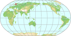 |
|---|---|---|
| GAW ID | SVB | |
| WIGOS ID | 0-20008-0-SVB | |
| Station name | Svartberget | |
| GAW category | GAW Regional | |
| WMO region | REGION VI (Europe) | |
| Country/territory | Sweden | |
| Address 1 | ||
| Address 2 | ||
| Address 3 | ||
| Latitude (north: +; south: −) | 64.25609 | |
| Longitude (east: +; west: −) | 19.77457 | |
| Elevation (m a.s.l.) | 267 | |
| Timezone | UTC+01:00 | |
| Category | fixed station | |
| Gawsis | https://gawsis.meteoswiss.ch/GAWSIS//index.html#/search/station/stationReportDetails/32408 | |
| Climate Zone | Dfc (Snow climate, fully humid, cool summer) | |
| Website | ||
| Status | Operational | |
| Description | ||
| Contributor(s) |
|
|
| Gas Species |
|
|
Syowa Map
| WDCGG ID | SYO7006 | 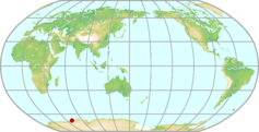 |
|---|---|---|
| GAW ID | SYO | |
| WIGOS ID | 0-20008-0-SYO | |
| Station name | Syowa | |
| GAW category | GAW Regional | |
| WMO region | ANTARCTICA | |
| Country/territory | Japan | |
| Address 1 | East Ongul Island, Lützow-Holm Bay, East Queen Maude Land, East Antarctica. | |
| Address 2 | ||
| Address 3 | ||
| Latitude (north: +; south: −) | -69.0053 | |
| Longitude (east: +; west: −) | 39.5811 | |
| Elevation (m a.s.l.) | 29.1 | |
| Timezone | UTC+03:00 | |
| Category | fixed station | |
| Gawsis | https://gawsis.meteoswiss.ch/GAWSIS//index.html#/search/station/stationReportDetails/644 | |
| Climate Zone | EF (Frost climate) | |
| Website | ||
| Status | Operational | |
| Description | Syowa Station is located on the East Ongle Island in the Eastern Antarctica, or south of the western Indian Ocean. The island is about 4 km distant from the Antarctic Continent, and because of this distance, the climate is less severe in comparison to other Antarctic stations. Ozone measurements have been made since 1961. The ground is covered with snow through 10 months and it supports some very hardy vegetation. Mosses, lichens and liverwort grow when the ice retreats. Annual mean temperature is about -10 °C Annual mean wind speed is 6.7 m/s Height in location was changed from 21m to 16m above sea level with moving of the system in May, 2008. NDACC station, uvvis, ndacc complete | |
| Contributor(s) |
|
|
| Gas Species |
|
|
Tacolneston Tall Tower Map
| WDCGG ID | TAC6019 | 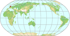 |
|---|---|---|
| GAW ID | TAC | |
| WIGOS ID | 0-20008-0-TAC | |
| Station name | Tacolneston Tall Tower | |
| GAW category | GAW Regional | |
| WMO region | REGION VI (Europe) | |
| Country/territory | United Kingdom of Great Britain and Northern Ireland | |
| Address 1 | ||
| Address 2 | ||
| Address 3 | ||
| Latitude (north: +; south: −) | 52.5177 | |
| Longitude (east: +; west: −) | 1.1386 | |
| Elevation (m a.s.l.) | 56 | |
| Timezone | UTC | |
| Category | fixed station | |
| Gawsis | https://gawsis.meteoswiss.ch/GAWSIS//index.html#/search/station/stationReportDetails/954 | |
| Climate Zone | Cfb (Warm temperate climate, fully humid, warm summer) | |
| Website | http://www.metoffice.gov.uk/research/monitoring/atmospheric-trends/sites/tacolneston | |
| Status | Non-reporting | |
| Description | Tacolneston is a rural UK site located on the in the east of England, 16 km south-west of Norwich (population ~200,000), and 32 km east of Thetford (population ~20,000), in Norfolk, UK. Air samples are taken from lines sampling 100 meters up a tall tower for all gases. CO2 and CH4 are also measured at a height of 185 m and 54 m above ground level. Due to the sites location, far from strong sources of local pollution, measurements from this site are used to calculate emission maps of trace gas species in the UK in combination with other measurement stations in the UK (Ridge Hill and Angus) and Ireland (Mace Head). Operated by the University of Bristol and the University of East Anglia. | |
| Contributor(s) |
|
|
| Gas Species |
|
|
Tae-ahn Peninsula Map
| WDCGG ID | TAP2013 |  |
|---|---|---|
| GAW ID | TAP | |
| WIGOS ID | 0-20008-0-TAP | |
| Station name | Tae-ahn Peninsula | |
| GAW category | GAW Regional | |
| WMO region | REGION II (Asia) | |
| Country/territory | Republic of Korea | |
| Address 1 | ||
| Address 2 | ||
| Address 3 | ||
| Latitude (north: +; south: −) | 36.7299995422 | |
| Longitude (east: +; west: −) | 126.1299972534 | |
| Elevation (m a.s.l.) | 20 | |
| Timezone | UTC+09:00 | |
| Category | fixed station | |
| Gawsis | https://gawsis.meteoswiss.ch/GAWSIS//index.html#/search/station/stationReportDetails/315 | |
| Climate Zone | Cfa (Warm temperate climate, fully humid, hot summer) | |
| Website | http://www.esrl.noaa.gov/gmd/dv/site/TAP.html | |
| Status | Operational | |
| Description | The sampling site is located on the western tip of central Korea. GMD Projects at Tae-ahn Peninsula: Carbon Cycle Surface Flasks, Trajectories | |
| Contributor(s) |
|
|
| Gas Species |
|
|
Takayama Map
| WDCGG ID | TKY2016 |  |
|---|---|---|
| GAW ID | ||
| WIGOS ID | 0-20008-0-TKY | |
| Station name | Takayama | |
| GAW category | GAW Other elements | |
| WMO region | REGION II (Asia) | |
| Country/territory | Japan | |
| Address 1 | Iwai-cho, Takayama, Gifu, Japan(Post service not available) | |
| Address 2 | ||
| Address 3 | ||
| Latitude (north: +; south: −) | 36.14616667 | |
| Longitude (east: +; west: −) | 137.4231111 | |
| Elevation (m a.s.l.) | 1420 | |
| Timezone | UTC+09:00 | |
| Category | fixed station | |
| Gawsis | https://gawsis.meteoswiss.ch/GAWSIS//index.html#/search/station/stationReportDetails/434 | |
| Climate Zone | Dfb (Snow climate, fully humid, warm summer) | |
| Website | https://unit.aist.go.jp/env-mri/117aerg/en/index-e.html | |
| Status | Operational | |
| Description | The observation site is located in a cool-temperate deciduous forest in a mountainous area in the central part of the main island of Japan and is situated about 15 km east of Takayama City. The main tree species at the site are deciduous broad-leaved trees such as birch and oak, whose average height is about 17 m. The ground surface is covered with bamboo grass. This forest has been protected for at least 60-70 years (as of 2023). Budding and defoliation occur in May and October, respectively, and the ground surface is usually covered with snow from December to April. | |
| Contributor(s) |
|
|
| Gas Species |
|
|
Tateno (Tsukuba) Map
| WDCGG ID | TKB2018 |  |
|---|---|---|
| GAW ID | TKB | |
| WIGOS ID | 0-20008-0-TKB | |
| Station name | Tateno (Tsukuba) | |
| GAW category | GAW Regional | |
| WMO region | REGION II (Asia) | |
| Country/territory | Japan | |
| Address 1 | 1-1, Nagamine, Tsukuba, Ibaraki 305-0052, Japan | |
| Address 2 | ||
| Address 3 | ||
| Latitude (north: +; south: −) | 36.0581 | |
| Longitude (east: +; west: −) | 140.1258 | |
| Elevation (m a.s.l.) | 25.2 | |
| Timezone | UTC+09:00 | |
| Category | fixed station | |
| Gawsis | https://gawsis.meteoswiss.ch/GAWSIS//index.html#/search/station/stationReportDetails/645 | |
| Climate Zone | Cfa (Warm temperate climate, fully humid, hot summer) | |
| Website | ||
| Status | Operational | |
| Description | Tateno is sited in the city of Tsukuba, about 50 km northeast of Tokyo. The area has a temperate climate with distinct four seasons. The annual mean temperature is about 14 °C and annual precipitation is about 1,300 mm. Ozone measurements have been made at the Aerological Observatory since 1957. Greenhouse gases are measured at the Meteorological Research Institute. The population of Tsukuba is 165,000, with vegetated, rice producing and urban areas located in (286.50 km2) and around the city. | |
| Contributor(s) |
|
|
| Gas Species |
|
|
Taunus Observatory Map
| WDCGG ID | TOB6412 |  |
|---|---|---|
| GAW ID | TOB | |
| WIGOS ID | 0-276-1-TOB | |
| Station name | Taunus Observatory | |
| GAW category | GAW Regional | |
| WMO region | REGION VI (Europe) | |
| Country/territory | Germany | |
| Address 1 | ||
| Address 2 | ||
| Address 3 | ||
| Latitude (north: +; south: −) | 50.221884 | |
| Longitude (east: +; west: −) | 8.446397 | |
| Elevation (m a.s.l.) | 825 | |
| Timezone | UTC+01:00 | |
| Category | fixed station | |
| Gawsis | https://gawsis.meteoswiss.ch/GAWSIS//index.html#/search/station/stationReportDetails/55965 | |
| Climate Zone | Cfb (Warm temperate climate, fully humid, warm summer) | |
| Website | ||
| Status | Operational | |
| Description | ||
| Contributor(s) |
|
|
| Gas Species |
|
|
Teriberka Map
| WDCGG ID | TER6003 | 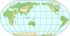 |
|---|---|---|
| GAW ID | TER | |
| WIGOS ID | 0-20008-0-TER | |
| Station name | Teriberka | |
| GAW category | GAW Regional | |
| WMO region | REGION VI (Europe) | |
| Country/territory | Russian Federation | |
| Address 1 | ||
| Address 2 | ||
| Address 3 | ||
| Latitude (north: +; south: −) | 69.1999969482 | |
| Longitude (east: +; west: −) | 35.0999984741 | |
| Elevation (m a.s.l.) | 40 | |
| Timezone | UTC+03:00 | |
| Category | fixed station | |
| Gawsis | https://gawsis.meteoswiss.ch/GAWSIS//index.html#/search/station/stationReportDetails/18 | |
| Climate Zone | Dfc (Snow climate, fully humid, cool summer) | |
| Website | ||
| Status | Operational | |
| Description | Topography: measurement site is located on the shore of Barents Sea at the input to the Teriberka bay. In the angle rang 280-6 deg. from N. Barents Sea, 6-80 deg. - Teriberka bay, 80-280 - ground surface, cliff with slight vegetation. Sampling site is the highest point in the nearest vicinity. The nearest settlement is located south the measurement site at 1 km distance. Vegetation: undergrowth tundra Climate: sub-arctic zone with the influence of Atlantic air masses with net effect of temperate maritime climate, permafrost zone. Mean temperature: annual 0.6oC, max in July 11.2 oC, min in February 11.6 oC. Mean wind speed: annual 7.1m/s, min in July 5.1m/s, max in December and January 8.4m/s. Mean relative humidity: annual 79%, min in April-June 75%, max in August-October 81%. Dominant wind direction: in winter S (30%) and SW (30%), in summer NW (23%). Snow caver 204 days/year from second half of October to second half of May. Annual mean precipitation is 472mm. | |
| Contributor(s) |
|
|
| Gas Species |
|
|
Tiksi Map
| WDCGG ID | TIK2002 | 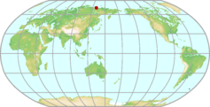 |
|---|---|---|
| GAW ID | TIK | |
| WIGOS ID | 0-20008-0-TIK | |
| Station name | Tiksi | |
| GAW category | GAW Regional | |
| WMO region | REGION II (Asia) | |
| Country/territory | Russian Federation | |
| Address 1 | ||
| Address 2 | ||
| Address 3 | ||
| Latitude (north: +; south: −) | 71.5861663818 | |
| Longitude (east: +; west: −) | 128.9188232422 | |
| Elevation (m a.s.l.) | 8 | |
| Timezone | UTC+09:00 | |
| Category | fixed station | |
| Gawsis | https://gawsis.meteoswiss.ch/GAWSIS//index.html#/search/station/stationReportDetails/319 | |
| Climate Zone | Dfd (Snow climate, fully humid, extremely continental) | |
| Website | ||
| Status | Operational | |
| Description | The station is located in the Arctic region in permafrost. | |
| Contributor(s) |
|
|
| Gas Species |
|
|
Torfhaus Map
| WDCGG ID | TOH6064 | 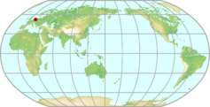 |
|---|---|---|
| GAW ID | TOH | |
| WIGOS ID | 0-20008-0-TOH | |
| Station name | Torfhaus | |
| GAW category | GAW Regional | |
| WMO region | REGION VI (Europe) | |
| Country/territory | Germany | |
| Address 1 | ||
| Address 2 | ||
| Address 3 | ||
| Latitude (north: +; south: −) | 51.808844 | |
| Longitude (east: +; west: −) | 10.53495 | |
| Elevation (m a.s.l.) | 801 | |
| Timezone | UTC+01:00 | |
| Category | fixed station | |
| Gawsis | https://gawsis.meteoswiss.ch/GAWSIS//index.html#/search/station/stationReportDetails/32674 | |
| Climate Zone | Cfb (Warm temperate climate, fully humid, warm summer) | |
| Website | ||
| Status | Operational | |
| Description | ||
| Contributor(s) |
|
|
| Gas Species |
|
|
Trainou (Orléans) Map
| WDCGG ID | TRN6232 | 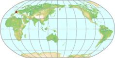 |
|---|---|---|
| GAW ID | TRN | |
| WIGOS ID | 0-20008-0-TRN | |
| Station name | Trainou (Orléans) | |
| GAW category | GAW Contributing networks | |
| WMO region | REGION VI (Europe) | |
| Country/territory | France | |
| Address 1 | ||
| Address 2 | ||
| Address 3 | ||
| Latitude (north: +; south: −) | 47.9646987915 | |
| Longitude (east: +; west: −) | 2.1124999523 | |
| Elevation (m a.s.l.) | 131 | |
| Timezone | UTC+01:00 | |
| Category | fixed station | |
| Gawsis | https://gawsis.meteoswiss.ch/GAWSIS//index.html#/search/station/stationReportDetails/759 | |
| Climate Zone | Cfc (Warm temperate climate, fully humid, cool summer) | |
| Website | ||
| Status | Operational | |
| Description | ||
| Contributor(s) |
|
|
| Gas Species |
|
|
Trinidad Head (CA) Map
| WDCGG ID | THD4022 | 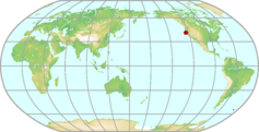 |
|---|---|---|
| GAW ID | THD | |
| WIGOS ID | 0-20008-0-THD | |
| Station name | Trinidad Head (CA) | |
| GAW category | GAW Regional | |
| WMO region | REGION IV (North and Central America) | |
| Country/territory | United States of America | |
| Address 1 | ||
| Address 2 | ||
| Address 3 | ||
| Latitude (north: +; south: −) | 41.0541000366 | |
| Longitude (east: +; west: −) | -124.1510009766 | |
| Elevation (m a.s.l.) | 107 | |
| Timezone | UTC-08:00 | |
| Category | fixed station | |
| Gawsis | https://gawsis.meteoswiss.ch/GAWSIS//index.html#/search/station/stationReportDetails/322 | |
| Climate Zone | Csb (Warm temperate climate with dry and warm summer) | |
| Website | http://www.esrl.noaa.gov/gmd/obop/thd/ | |
| Status | Operational | |
| Description | Located on a point jutting into the ocean along the remote north coast of California, Trinidad Head is ideally suited for measuring marine background air. Much of the time the site experiences baseline conditions, but it also allows for the monitoring of regionally influenced air, affected mainly by forested lands, and to a lesser extent, air having a small urban influence. An instrument trailer was installed in April 2002 as part of the ITCT campaign allowing measurements of aerosols, surface ozone, radiation, and flask sampling for halocarbons and carbon cycle gases. Bi-weekly airborne vertical profile measurements of carbon cycle gases are also collected in flasks above and upwind of Trinidad Head. Following the ITCT campaign GMD maintained a base set of measurements at the site. Additionally, Scripps Institution of Oceanography is operating two in situ instruments, one as part of the Advanced Global Atmospheric Gases Experiment (AGAGE), the other for measuring changes in atmospheric oxygen concentrations. Aerosol and flask measurements at THD ended June 1, 2017 and THD was decommissioned as a GMD baseline observatory. | |
| Contributor(s) |
|
|
| Gas Species |
|
|
Trollhaugen Map
| WDCGG ID | TRL7039 | 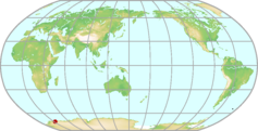 |
|---|---|---|
| GAW ID | TRL | |
| WIGOS ID | 0-578-20008-TRL | |
| Station name | Trollhaugen | |
| GAW category | GAW Global | |
| WMO region | ANTARCTICA | |
| Country/territory | Norway | |
| Address 1 | ||
| Address 2 | ||
| Address 3 | ||
| Latitude (north: +; south: −) | -72.0117 | |
| Longitude (east: +; west: −) | 2.5351 | |
| Elevation (m a.s.l.) | 1553 | |
| Timezone | UTC | |
| Category | fixed station | |
| Gawsis | https://gawsis.meteoswiss.ch/GAWSIS//index.html#/search/station/stationReportDetails/154100 | |
| Climate Zone | EF (Frost climate) | |
| Website | https://nilu.com/facility/nilus-observatories-and-monitoring-stations/trollhaugen-observatory/ | |
| Status | Operational | |
| Description | ||
| Contributor(s) |
|
|
| Gas Species |
|
|
Tudor Hill (Bermuda) Map
| WDCGG ID | BMW4030 |  |
|---|---|---|
| GAW ID | BMW | |
| WIGOS ID | 0-20008-0-BMW | |
| Station name | Tudor Hill (Bermuda) | |
| GAW category | GAW Regional | |
| WMO region | REGION IV (North and Central America) | |
| Country/territory | United Kingdom of Great Britain and Northern Ireland | |
| Address 1 | ||
| Address 2 | ||
| Address 3 | ||
| Latitude (north: +; south: −) | 32.2700004578 | |
| Longitude (east: +; west: −) | -64.8799972534 | |
| Elevation (m a.s.l.) | 30 | |
| Timezone | UTC-04:00 | |
| Category | fixed station | |
| Gawsis | https://gawsis.meteoswiss.ch/GAWSIS//index.html#/search/station/stationReportDetails/324 | |
| Climate Zone | UNK (Unknown) | |
| Website | http://www.bios.edu/research/projects/tudor-hill-marine-atmospheric-observatory/ | |
| Status | Operational | |
| Description | NOAA "Carbon Cycle Surface Flask" Project | |
| Contributor(s) |
|
|
| Gas Species |
|
|
Ulaan Uul Map
| WDCGG ID | UUM2004 | 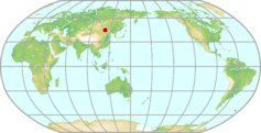 |
|---|---|---|
| GAW ID | UUM | |
| WIGOS ID | 0-20008-0-UUM | |
| Station name | Ulaan Uul | |
| GAW category | GAW Regional | |
| WMO region | REGION II (Asia) | |
| Country/territory | Mongolia | |
| Address 1 | ||
| Address 2 | ||
| Address 3 | ||
| Latitude (north: +; south: −) | 44.444 | |
| Longitude (east: +; west: −) | 111.0861 | |
| Elevation (m a.s.l.) | 992 | |
| Timezone | UTC+08:00 | |
| Category | fixed station | |
| Gawsis | https://gawsis.meteoswiss.ch/GAWSIS//index.html#/search/station/stationReportDetails/327 | |
| Climate Zone | BWk (Desert climate, cold arid) | |
| Website | ||
| Status | Operational | |
| Description | The weekly flask sampling was started in 1992 by NOAA "Carbon Cycle Surface Flask" project. The site is located in the east south side of Mongolia (Mongolian dessert -steppe region) far from any antropogenic sources. Coldest month is January and average minimum temperature of January is -31.6 degrees celsius. Hottest month is July with an average maximum temperature of 36.7 degrees celsium. | |
| Contributor(s) |
|
|
| Gas Species |
|
|
Ulleungdo Map
| WDCGG ID | ULD2159 | 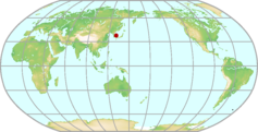 |
|---|---|---|
| GAW ID | ULD | |
| WIGOS ID | 0-410-0-ULD | |
| Station name | Ulleungdo | |
| GAW category | GAW Regional | |
| WMO region | REGION II (Asia) | |
| Country/territory | Republic of Korea | |
| Address 1 | ||
| Address 2 | ||
| Address 3 | ||
| Latitude (north: +; south: −) | 37.48 | |
| Longitude (east: +; west: −) | 130.9 | |
| Elevation (m a.s.l.) | 220.9 | |
| Timezone | UTC+09:00 | |
| Category | fixed station | |
| Gawsis | https://gawsis.meteoswiss.ch/GAWSIS//index.html#/search/station/stationReportDetails/144846 | |
| Climate Zone | Cfa (Warm temperate climate, fully humid, hot summer) | |
| Website | ||
| Status | Operational | |
| Description | ||
| Contributor(s) |
|
|
| Gas Species |
|
|
Urawa Map
| WDCGG ID | URW2020 | 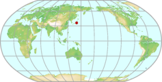 |
|---|---|---|
| GAW ID | ||
| WIGOS ID | 0-20008-0-URW | |
| Station name | Urawa | |
| GAW category | GAW Other elements | |
| WMO region | REGION II (Asia) | |
| Country/territory | Japan | |
| Address 1 | 639-1 Kami-okubo, Sakura-ku, Saitama-shi, Saitama 338-0824, Japan | |
| Address 2 | ||
| Address 3 | ||
| Latitude (north: +; south: −) | 35.868361 | |
| Longitude (east: +; west: −) | 139.612889 | |
| Elevation (m a.s.l.) | 8 | |
| Timezone | UTC+09:00 | |
| Category | fixed station | |
| Gawsis | https://gawsis.meteoswiss.ch/GAWSIS//index.html#/search/station/stationReportDetails/4 | |
| Climate Zone | Cfa (Warm temperate climate, fully humid, hot summer) | |
| Website | ||
| Status | Closed | |
| Description | Urban area,about 25 km north-northwest of Tokyo,center of Kanto plane which is one of mostly populated area in Japan. | |
| Contributor(s) |
|
|
| Gas Species |
|
|
Ushuaia Map
| WDCGG ID | USH3007 | 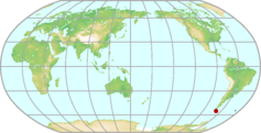 |
|---|---|---|
| GAW ID | USH | |
| WIGOS ID | 0-20008-0-USH | |
| Station name | Ushuaia | |
| GAW category | GAW Global | |
| WMO region | REGION III (South America) | |
| Country/territory | Argentina | |
| Address 1 | Estacion VAG Ushuaia Aeropuerto Malvinas Argentinas CP: 9410 Ushuaia - Tierra del Fuego - Argentina | |
| Address 2 | ||
| Address 3 | ||
| Latitude (north: +; south: −) | -54.8484649658 | |
| Longitude (east: +; west: −) | -68.3106918335 | |
| Elevation (m a.s.l.) | 18 | |
| Timezone | UTC-03:00 | |
| Category | fixed station | |
| Gawsis | https://gawsis.meteoswiss.ch/GAWSIS//index.html#/search/station/stationReportDetails/470 | |
| Climate Zone | Dfc (Snow climate, fully humid, cool summer) | |
| Website | http://www.smn.gov.ar/?mod=ozono&id=70 | |
| Status | Operational | |
| Description | The Ushuaia Station is located on the "Isla Grande de la Tierra del Fuego", Argentina (54° 50' S - 68° 18' W), roughly 10 km south-west of the city of Ushuaia. The station is located in a coastal cliff at an altitude of 18 m a.s.l., on a remote sub-Antarctic marine coast. Steady winds blow prevailing from the clean air sector (SW) down the Beagle Channel. Tierra del Fuego and its adjacent oceanic area are under the westerlies influence. The ground in the vicinity around the station is covered with pasture and bush. The vegetation in the surrounding area (30 Km) is consisting mainly of Nothofagus forest. The facilities at the site consist of the main building of 230 m2, which provides space for offices, meeting rooms and laboratories. Attached to this building is the Dobson spectrophotometer. On the platform at the top of the roof, the air inlet and several radiation and meteorological equipment are mounted. In addition to the main facility, a remote island sampling site with a 12 m tower called "Isla Redonda" is located on Beagle Channel (54° 51' S - 68° 28' W) and can be used for special projects. Since two years, the new Ushuaia airport has opened in the near vicinity of the station. It is located about 500 mts. north-east of the site towards the city of Ushuaia. Air traffic is estimated to 5-10 flight movements per day. As already stated in the first audit report '94 (Martini, Slemr, Mohnen) there is some concern regarding a possible influence of the measurements, in particular when the airport should further develop. | |
| Contributor(s) |
|
|
| Gas Species |
|
|
Utö Map
| WDCGG ID | UTO6105 | 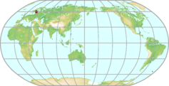 |
|---|---|---|
| GAW ID | UTO | |
| WIGOS ID | 0-20008-0-UTO | |
| Station name | Utö | |
| GAW category | GAW Regional | |
| WMO region | REGION VI (Europe) | |
| Country/territory | Finland | |
| Address 1 | ||
| Address 2 | ||
| Address 3 | ||
| Latitude (north: +; south: −) | 59.7833328247 | |
| Longitude (east: +; west: −) | 21.3833332062 | |
| Elevation (m a.s.l.) | 7 | |
| Timezone | UTC+02:00 | |
| Category | fixed station | |
| Gawsis | https://gawsis.meteoswiss.ch/GAWSIS//index.html#/search/station/stationReportDetails/9 | |
| Climate Zone | Dfb (Snow climate, fully humid, warm summer) | |
| Website | ||
| Status | Operational | |
| Description | EMEP station on a small island of the Baltic Sea, 60 km south of the mainland Finland. Distance from the monitoring site to the shore of the island varies between 150 and 800 m. The nearest significant pollution sources in addition to ship traffic are in Finland about 90 km away and in other countries (Sweden, Estonia) about 200 km away from the station. | |
| Contributor(s) |
|
|
| Gas Species |
|
|
Waldhof-Langenbrügge Map
| WDCGG ID | WAL6018 | 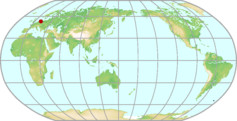 |
|---|---|---|
| GAW ID | WAL | |
| WIGOS ID | 0-20008-0-WAL | |
| Station name | Waldhof-Langenbrügge | |
| GAW category | GAW Other elements | |
| WMO region | REGION VI (Europe) | |
| Country/territory | Germany | |
| Address 1 | Federal Environmental Agency Monitoring site WaldhofD-29394 Lueder | |
| Address 2 | ||
| Address 3 | ||
| Latitude (north: +; south: −) | 52.800867 | |
| Longitude (east: +; west: −) | 10.75623 | |
| Elevation (m a.s.l.) | 74 | |
| Timezone | UTC+01:00 | |
| Category | fixed station | |
| Gawsis | https://gawsis.meteoswiss.ch/GAWSIS//index.html#/search/station/stationReportDetails/14 | |
| Climate Zone | Cfb (Warm temperate climate, fully humid, warm summer) | |
| Website | ||
| Status | Operational | |
| Description | North German lowland, agricultural and forest environment, some influences from pollution sources. Surroundings: Situated in a little forest with agriculture and meadows at a distance of approx. 1 km in the Luneburg Heath, typical German Flatland. Surrounded by small stationary SO2 and NOx sources at distances larger than 1 km. Cities: Langenbrugge: 300 inhabitants, 3 km west; Wittingen: 5,500 inhab., 8 km south; Utzen: 35,600 inhab., 22 km northwest; Salzwedel: 21,000 inhab., 27 km east of the station. Cars: Only a small country lane leading to the station with approx. 3 vehicles/day within 3 km. | |
| Contributor(s) |
|
|
| Gas Species |
|
|
Wank Map
| WDCGG ID | WNK6029 | 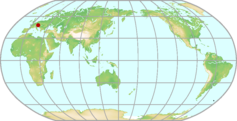 |
|---|---|---|
| GAW ID | WNK | |
| WIGOS ID | 0-20008-0-WNK | |
| Station name | Wank | |
| GAW category | GAW Other elements | |
| WMO region | REGION VI (Europe) | |
| Country/territory | Germany | |
| Address 1 | ||
| Address 2 | ||
| Address 3 | ||
| Latitude (north: +; south: −) | 47.509322 | |
| Longitude (east: +; west: −) | 11.1426503 | |
| Elevation (m a.s.l.) | 1780 | |
| Timezone | UTC+01:00 | |
| Category | fixed station | |
| Gawsis | https://gawsis.meteoswiss.ch/GAWSIS//index.html#/search/station/stationReportDetails/15 | |
| Climate Zone | Cfb (Warm temperate climate, fully humid, warm summer) | |
| Website | ||
| Status | Closed | |
| Description | Mountain top at the northern rim of the Alps, close to Zugspitze | |
| Contributor(s) |
|
|
| Gas Species |
|
|
Wendover (UT) Map
| WDCGG ID | UTA4024 | 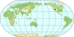 |
|---|---|---|
| GAW ID | UTA | |
| WIGOS ID | 0-20008-0-UTA | |
| Station name | Wendover (UT) | |
| GAW category | GAW Regional | |
| WMO region | REGION IV (North and Central America) | |
| Country/territory | United States of America | |
| Address 1 | ||
| Address 2 | ||
| Address 3 | ||
| Latitude (north: +; south: −) | 39.9000015259 | |
| Longitude (east: +; west: −) | -113.7200012207 | |
| Elevation (m a.s.l.) | 1320 | |
| Timezone | UTC-07:00 | |
| Category | fixed station | |
| Gawsis | https://gawsis.meteoswiss.ch/GAWSIS//index.html#/search/station/stationReportDetails/337 | |
| Climate Zone | BSk (Steppe climate, cold arid) | |
| Website | ||
| Status | Operational | |
| Description | NOAA "Carbon Cycle Surface Flask" Project | |
| Contributor(s) |
|
|
| Gas Species |
|
|
West Branch (Iowa) Map
| WDCGG ID | WBI4021 | 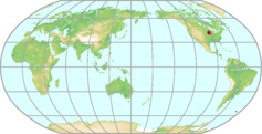 |
|---|---|---|
| GAW ID | WBI | |
| WIGOS ID | 0-20008-0-WBI | |
| Station name | West Branch (Iowa) | |
| GAW category | GAW Other elements | |
| WMO region | REGION IV (North and Central America) | |
| Country/territory | United States of America | |
| Address 1 | ||
| Address 2 | ||
| Address 3 | ||
| Latitude (north: +; south: −) | 41.7249984741 | |
| Longitude (east: +; west: −) | -91.3529968262 | |
| Elevation (m a.s.l.) | 242 | |
| Timezone | UTC-06:00 | |
| Category | fixed station | |
| Gawsis | https://gawsis.meteoswiss.ch/GAWSIS//index.html#/search/station/stationReportDetails/880 | |
| Climate Zone | UNK (Unknown) | |
| Website | ||
| Status | Non-reporting | |
| Description | ||
| Contributor(s) |
|
|
| Gas Species |
|
|
Westerland Map
| WDCGG ID | WES6010 | 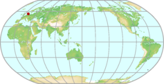 |
|---|---|---|
| GAW ID | WES | |
| WIGOS ID | 0-20008-0-WES | |
| Station name | Westerland | |
| GAW category | GAW Contributing networks | |
| WMO region | REGION VI (Europe) | |
| Country/territory | Germany | |
| Address 1 | Federal Environmental AgencyMonitoring site WesterlandLornsenweg 9D-25980 Westerland/Sylt | |
| Address 2 | ||
| Address 3 | ||
| Latitude (north: +; south: −) | 54.923142 | |
| Longitude (east: +; west: −) | 8.308017 | |
| Elevation (m a.s.l.) | 12 | |
| Timezone | UTC+01:00 | |
| Category | fixed station | |
| Gawsis | https://gawsis.meteoswiss.ch/GAWSIS//index.html#/search/station/stationReportDetails/16 | |
| Climate Zone | Cfb (Warm temperate climate, fully humid, warm summer) | |
| Website | ||
| Status | Operational | |
| Description | Coastal station on Island Sylt (North Sea). Situated directly at the coast, beach to the west, otherwise built-up areas, forest. | |
| Contributor(s) |
|
|
| Gas Species |
|
|
Weybourne Atmospheric Observatory Map
| WDCGG ID | WAO6391 | 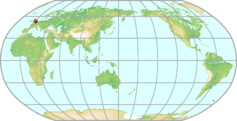 |
|---|---|---|
| GAW ID | WAO | |
| WIGOS ID | 0-20008-0-WAO | |
| Station name | Weybourne Atmospheric Observatory | |
| GAW category | GAW Regional | |
| WMO region | REGION VI (Europe) | |
| Country/territory | United Kingdom of Great Britain and Northern Ireland | |
| Address 1 | ||
| Address 2 | ||
| Address 3 | ||
| Latitude (north: +; south: −) | 52.957 | |
| Longitude (east: +; west: −) | 1.128 | |
| Elevation (m a.s.l.) | 21 | |
| Timezone | UTC | |
| Category | fixed station | |
| Gawsis | https://gawsis.meteoswiss.ch/GAWSIS//index.html#/search/station/stationReportDetails/975 | |
| Climate Zone | UNK (Unknown) | |
| Website | https://www.ncas.ac.uk/index.php/en/the-facility-amf/256-amf-main-category/amf | |
| Status | Operational | |
| Description | The Weybourne Atmospheric Observatory (WAO) is on the North Norfolk coast (52?57?02??N, 1?07?19??E, 15 m asl). It is operated by the University of East Anglia having been established in 1992 with funding from BP (Norway) plc and NERC. Subsequently, long term monitoring and campaigns have been supported through numerous projects funded by NERC, Department of the Environment (DoE, DEFRA) and the EU. NCAS has also supported the site since 2002. Much of the instrumentation at WAO has come from HEFCE JIF and SRIF funds. Weybourne?s location means that it experiences air with a wide range of pollution levels. Predominant south-westerlies bring polluted air from the UK (including from London and the Midlands). At times, especially in anticyclonic conditions, Weybourne experiences polluted air from Europe. Weybourne can also receive clean background air in northerly air flow. This can be impacted by narrow pollution plumes from shipping in the N. Sea, and potentially gas platforms. Over the years the parameters measured at WAO have varied according to the funding and/or scientific interests and requirements. There have been continuous measurements of ozone, as part of the DEFRA network, and basic meteorological parameters. There are many years of CO, NOx, NOy, SO2, CN, VOC and H2 data. In 2007 a long term monitoring programme for CO2 and O2 began. In 2012 a new greenhouse gas GC was set up and measurements of CH4 started. This is being developed to also include measurements of N2O and SF6. Together, the measurements of CO2, O2, CH4, N2O, SF6, CO and H2 are being integrated into a single analytical system with common calibration standards and data processing procedures. As well as being part of the DEFRA ozone network, Weybourne is part of the DEFRA TOMPS network (atmospheric toxic organic samplers), a DEFRA CH4 network, and the EU InGOS network (Integrated non-CO2 Greenhouse gas Observing System). Many successful campaigns have been hosted at WAO to examine oxid | |
| Contributor(s) |
|
|
| Gas Species |
|
|
Yonagunijima Map
| WDCGG ID | YON2028 | 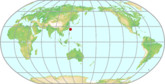 |
|---|---|---|
| GAW ID | YON | |
| WIGOS ID | 0-20008-0-YON | |
| Station name | Yonagunijima | |
| GAW category | GAW Regional | |
| WMO region | REGION II (Asia) | |
| Country/territory | Japan | |
| Address 1 | Yonaguni 999-1 | |
| Address 2 | Yonaguni-cho, Yaeyama-gun | |
| Address 3 | Okinawa, 907-1801, Japan | |
| Latitude (north: +; south: −) | 24.4667 | |
| Longitude (east: +; west: −) | 123.0106 | |
| Elevation (m a.s.l.) | 30 | |
| Timezone | UTC+09:00 | |
| Category | fixed station | |
| Gawsis | https://gawsis.meteoswiss.ch/GAWSIS//index.html#/search/station/stationReportDetails/646 | |
| Climate Zone | Cfa (Warm temperate climate, fully humid, hot summer) | |
| Website | ||
| Status | Operational | |
| Description | Yonagunijima is the westernmost island of Japan, located about 1,900 km southwest of Tokyo and less than 120 km from Taiwan. The island has an area of about 28.9 km² and a population of about 1,800. The station is located near the northern coast of the island. The climate is subtropical, influenced by the continental high pressure in winter and the high pressure on the Pacific. The station is surrounded by grass. Annual normal rainfall amount is about 2400 mm. Annual mean temperature is about 24 °C. Prevailing wind direction is north-easterly in winter and southerly in summer. The station was unmanned and is remotely monitored since October 2008. | |
| Contributor(s) |
|
|
| Gas Species |
|
|
Zeppelin Mountain (Ny Ålesund) Map
| WDCGG ID | ZEP6001 | 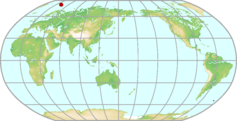 |
|---|---|---|
| GAW ID | ZEP | |
| WIGOS ID | 0-20008-0-ZEP | |
| Station name | Zeppelin Mountain (Ny Ålesund) | |
| GAW category | GAW Global | |
| WMO region | REGION VI (Europe) | |
| Country/territory | Norway | |
| Address 1 | ||
| Address 2 | ||
| Address 3 | ||
| Latitude (north: +; south: −) | 78.906688 | |
| Longitude (east: +; west: −) | 11.889342 | |
| Elevation (m a.s.l.) | 475 | |
| Timezone | UTC+01:00 | |
| Category | fixed station | |
| Gawsis | https://gawsis.meteoswiss.ch/GAWSIS//index.html#/search/station/stationReportDetails/459 | |
| Climate Zone | ET (Tundra climate) | |
| Website | https://www.npolar.no/en/zeppelin | |
| Status | Operational | |
| Description | The research village Ny-Aalesund in the European Arctic is one of the world's northernmost human settlements. It is situated in Kongsfjorden on north-western Spitsbergen, which is the largest of the Svalbard islands. The village is surrounded by mountains and glaciers, which at several places stretch well out into the sea. Large areas of Svalbard (about 60 %) are covered with glaciers. Svalbard, with an area of 62049 km2 is very sparsely populated, and the about 2500 inhabitants are living in one of the five small settlements on Spitsbergen. The Norwegian research village Ny-Aalesund is permanently inhabited by about 30 people year-round and additional approx. 150 scientists during summer peak season. The global GAW station Zeppelin Observatory (coordinates: 78°54'29" N, 11°52'53" E) near Ny-Aalesund lies south of the town. The Observatories unique location at 475 m altitude makes it an ideal place for monitoring of global atmospheric gasses and long-transported contaminants. Since the Observatory is above the inversion layer most of the time, the influence from local contamination sources on the measurements is minimal. The Zeppelin Observatory was officially opened in 1990, but after some time of operation the building did not satisfy the requirements for operation of advanced instruments. The old observatory was demolished in 1999, and a new one was built on the same location, and officially re-opened in May 2000. The observatory is owned by the Norwegian Polar Institute, which is responsible for development, maintenance, daily management and safety. The Norwegian Institute for Air Research (NILU) is responsible for scientific coordination. The primary users of the observatory are NILU, Stockholm University and the Norwegian Polar Institute. Other institutions also have instruments and measurement program here, run permanently or on a campaign basis. | |
| Contributor(s) |
|
|
| Gas Species |
|
|
Zingst Map
| WDCGG ID | ZGT6011 | 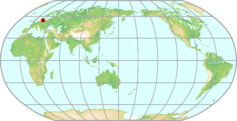 |
|---|---|---|
| GAW ID | ZGT | |
| WIGOS ID | 0-20008-0-ZGT | |
| Station name | Zingst | |
| GAW category | GAW Other elements | |
| WMO region | REGION VI (Europe) | |
| Country/territory | Germany | |
| Address 1 | Federal Environmental Agency (Umweltbundesamt)Monitoring site ZingstLandstrasse 3D-18874 Zingst | |
| Address 2 | ||
| Address 3 | ||
| Latitude (north: +; south: −) | 54.436637 | |
| Longitude (east: +; west: −) | 12.724917 | |
| Elevation (m a.s.l.) | 1 | |
| Timezone | UTC+01:00 | |
| Category | fixed station | |
| Gawsis | https://gawsis.meteoswiss.ch/GAWSIS//index.html#/search/station/stationReportDetails/349 | |
| Climate Zone | Cfb (Warm temperate climate, fully humid, warm summer) | |
| Website | ||
| Status | Operational | |
| Description | Coastal station at the Baltic Sea. Beach to the north, rural environment. The station is situated at the shore of the Baltic Sea (600 m north), meadows and some farming. One heating plant at 9 km distance, 10 kg S/month. Cities: Zingst: 3,224 inhabitants; Bath: 8,000 inhab., 6 km southwest of the station. Cars: One minor road 50 m from the station and 2 roads 10 km from the site with approx 5,000 cars/day. | |
| Contributor(s) |
|
|
| Gas Species |
|
|
Zugspitze-Gipfel Map
| WDCGG ID | ZUG6030 | 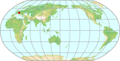 |
|---|---|---|
| GAW ID | ZUG | |
| WIGOS ID | 0-20008-0-ZUG | |
| Station name | Zugspitze-Gipfel | |
| GAW category | GAW Global | |
| WMO region | REGION VI (Europe) | |
| Country/territory | Germany | |
| Address 1 | Federal Environmental AgencyGAW station ZugspitzeSchneefernerhausZugspitze 5D-82475 Garmisch Partenkirchen | |
| Address 2 | ||
| Address 3 | ||
| Latitude (north: +; south: −) | 47.421075 | |
| Longitude (east: +; west: −) | 10.985896 | |
| Elevation (m a.s.l.) | 2962 | |
| Timezone | UTC+01:00 | |
| Category | fixed station | |
| Gawsis | https://gawsis.meteoswiss.ch/GAWSIS//index.html#/search/station/stationReportDetails/481 | |
| Climate Zone | ET (Tundra climate) | |
| Website | ||
| Status | Operational | |
| Description | Zugspitze is the highest mountain of the German Alps (2962 m a.s.l.). It is located in southern Germany, about 90 km southwest of Munich, at the Austrian border near the town of Garmisch-Partenkirchen (720 m a.s.l.). A cable car leads directly from Garmisch to Zugspitze. Monitoring of air pollution up to 2001 was carried out from an aluminium sheltered cabin on the view point terrace (47°25' N 10°59' E; 2962 m a.s.l.) with the air inlet system and meteorological sensors mounted on the flat roof of the shelter. Activities were re-located in 2000 to the new Environmental Research Station "Schneefernerhaus" at 2650 m a.s.l. on the southern slope of Zugspitze. Together with the Meteorological Observatory Hohenpeissenberg (40 km north), this platform establishes the Global Station Zugspitze/Hohenpeissenberg. The monitoring program is operated jointly by the Federal Environmental Agency (Umweltbundesamt, UBA) and the German Meteorological Service (Deutscher Wetterdienst, DWD). | |
| Contributor(s) |
|
|
| Gas Species |
|
|
Zugspitze-Schneefernerhaus Map
| WDCGG ID | ZSF6031 |  |
|---|---|---|
| GAW ID | ZSF | |
| WIGOS ID | 0-20008-0-ZSF | |
| Station name | Zugspitze-Schneefernerhaus | |
| GAW category | GAW Global | |
| WMO region | REGION VI (Europe) | |
| Country/territory | Germany | |
| Address 1 | GAW-Station / SchneefernerhausD-82475 Schneefernerhaus, Germany | |
| Address 2 | ||
| Address 3 | ||
| Latitude (north: +; south: −) | 47.4165 | |
| Longitude (east: +; west: −) | 10.97964 | |
| Elevation (m a.s.l.) | 2666 | |
| Timezone | UTC+01:00 | |
| Category | fixed station | |
| Gawsis | https://gawsis.meteoswiss.ch/GAWSIS//index.html#/search/station/stationReportDetails/440 | |
| Climate Zone | ET (Tundra climate) | |
| Website | www.schneefernerhaus.de | |
| Status | Operational | |
| Description | Zugspitze is the highest mountain of the German Alps (2962 m a.s.l.). It is located in southern Germany, about 90 km southwest of Munich, at the Austrian border near the town of Garmisch-Partenkirchen (720 m a.s.l.). A cable car and a cog wheel train lead directly to Zugspitze. Activities were re-located in 2001 from the Zugspitze summit to the new Environmental Research Station "Schneefernerhaus" at 2650 m a.s.l. on the southern slope of Zugspitze. Together with the Meteorological Observatory Hohenpeissenberg (40 km north), this platform establishes the Global Station Zugspitze/Hohenpeissenberg. The monitoring program is operated jointly by the Federal Environmental Agency (Umweltbundesamt, UBA) and the German Meteorological Service (Deutscher Wetterdienst, DWD). | |
| Contributor(s) |
|
|
| Gas Species |
|
|
Aircraft (off the Pacific coast of Sendai)
Aircraft (over Bass Strait and Cape Grim)
Aircraft (over Japan and mainland)
Aircraft (over Japan and surroundings)
Aircraft (Western North Pacific)
Aircraft: Orleans
Alligator liberty, M/V
Atlantic Ocean
CONTRAIL
Drake Passage
INSTAC
Keifu Maru, R/V
Kofu Maru, R/V
Mirai, R/V
MRI Research, Hakuho Maru, R/V
MRI Research, Kaiyo Maru, R/V
MRI Research, Natushima, R/V
MRI Research, Ryofu Maru, R/V
MRI Research, Ship observations
MRI Research, Wellington Maru, R/V
NOPACCS - Hakurei Maru -
Northern and western Pacific
Pacific Ocean
Pacific Ocean
| WDCGG ID | POC8034 |  |
|---|---|---|
| GAW ID | POC | |
| WIGOS ID | 0-20008-0-POC | |
| Mobile name | Pacific Ocean | |
| GAW category | Mobile | |
| WMO region | MOBILE | |
| Country/territory | ||
| Timezone | ||
| Category | mobile platform | |
| Gawsis | https://gawsis.meteoswiss.ch/GAWSIS//index.html#/search/station/stationReportDetails/744 | |
| Website | ||
| Status | ||
| Description | Flask samples collected by voluntary observing ships in the Pacific Ocean. | |
| Contributor(s) |
|
|
| Gas Species |
|
|
Pacific-Atlantic Ocean
Ryofu Maru, R/V
| WDCGG ID | RYF8010 |  |
|---|---|---|
| GAW ID | RYF | |
| WIGOS ID | 0-20008-0-RYF | |
| Mobile name | Ryofu Maru, R/V | |
| GAW category | Mobile | |
| WMO region | MOBILE | |
| Country/territory | ||
| Timezone | ||
| Category | mobile platform | |
| Gawsis | https://gawsis.meteoswiss.ch/GAWSIS//index.html#/search/station/stationReportDetails/745 | |
| Website | ||
| Status | ||
| Description | Research vessel, Western North Pacific Ocean by the Japan Meteorological Agency | |
| Contributor(s) |
|
|
| Gas Species |
|
|
Santarem
Ship between Ishigaki Island and Hateruma Island
South China Sea
Soyo Maru, R/V
Wakataka-Maru
WEST COSMIC - Hakurei Maru No.2 -
Western Pacific
Mobile(s)
- Aircraft (off the Pacific coast of Sendai)
- Aircraft (over Bass Strait and Cape Grim)
- Aircraft (over Japan and mainland)
- Aircraft (over Japan and surroundings)
- Aircraft (Western North Pacific)
- Aircraft: Orleans
- Alligator liberty, M/V
- Atlantic Ocean
- CONTRAIL
- Drake Passage
- INSTAC
- Keifu Maru, R/V
- Kofu Maru, R/V
- Mirai, R/V
- MRI Research, Hakuho Maru, R/V
- MRI Research, Kaiyo Maru, R/V
- MRI Research, Natushima, R/V
- MRI Research, Ryofu Maru, R/V
- MRI Research, Ship observations
- MRI Research, Wellington Maru, R/V
- NOPACCS - Hakurei Maru -
- Northern and western Pacific
- Pacific Ocean
- Pacific Ocean
- Pacific-Atlantic Ocean
- Ryofu Maru, R/V
- Santarem
- Ship between Ishigaki Island and Hateruma Island
- South China Sea
- Soyo Maru, R/V
- Wakataka-Maru
- WEST COSMIC - Hakurei Maru No.2 -
- Western Pacific
Station(s)
- Adrigole
- Alert
- Amsterdam Island
- Anmyeon-do
- Arembepe
- Argyle (ME)
- Arrival Heights
- Ascension Island
- Assekrem
- Baltic Sea
- Baring Head
- Barrow (AK)
- Begur
- Behchoko
- BEO Moussala
- Bering Island
- BEROMUENSTER
- Bilsdale
- Bird Island (South Georgia)
- Birkenes
- Bratt's Lake
- Brotjacklriegel
- Bukit Kototabang
- CAIRO
- Cambridge Bay
- Candle Lake
- Cape Ferguson
- Cape Kumukahi (HI)
- Cape Meares (OR)
- Cape Ochiishi
- Cape Point
- Cape Rama
- Cape Verde Atmospheric Observatory
- Capo Granitola
- Casey
- Cesar (Cabauw)
- Chapais
- Chibougamau
- CHICHIJIMA
- Cholpon-Ata
- Christmas Island
- Churchill
- Cold Bay (AK)
- Constanta (Black Sea)
- Crozet
- Danum Valley
- Deuselbach
- Diabla Gora / Puszcza Borecka
- Dwejra Point
- East Trout Lake
- Easter Island
- Egbert
- El Tololo
- Estevan Point
- Esther
- Farafra
- Finokalia
- Fraserdale
- Fundata
- Gartow
- Giordan Lighthouse
- Gobabeb
- Grifton - Georgia Station (NC)
- Guam (Mariana Island)
- Gunn Point
- Halley
- Hamamatsu
- Harvard Forest (MA)
- Hateruma Island
- Heathfield
- Hegyhátsál háttérszennyettség-mérő állomás
- Helgoland
- Hohenpeissenberg
- Hok Tsui / Cape d Aguilar
- Huancayo
- Hyltemossa
- Hyytiälä
- Ile Grande
- Inuvik
- Ispra
- Issyk-Kul
- Izaña (Tenerife)
- Jeju Gosan
- Jubany
- Jungfraujoch
- Jülich
- Kaashidhoo (Male Atoll)
- Kaitorete Spit
- Karlsruhe
- Kasprowy Wierch
- Kecskemét K-puszta háttérszennyettség-mérő állomás
- Kennaook / Cape Grim
- Key Biscane (FL)
- King Sejong
- King's Park
- Kisai
- Kitt Peak (AZ)
- Kloosterburen
- Kollumerwaard
- Kosetice Observatory
- Kotelnyj Island
- Kresin u Pacova
- Krvavec
- Kyzylcha
- La Jolla (CA)
- La Réunion
- Lac La Biche (Alberta)
- Lamezia Terme
- Lampedusa
- Lauder
- Lecce Environmental-Climate Observatory
- Lerwick
- Lindenberg
- Lulin
- Lutjewad
- Mace Head
- Macquarie Island
- Madonie - Piano Battaglia
- Mahé
- Mauna Kea (HI)
- Mauna Loa (HI)
- Maunga Kākaramea
- Mawson
- McMurdo
- Memanbetsu
- Mex High Altitude Global Climate Observation Center
- Mikawa-Ichinomiya
- Minamitorishima
- Monte Cimone
- Monte Curcio
- Moody (TX)
- Mould Bay
- Mt. Dodaira
- Mt. Kenya
- Mt. Waliguan
- Nagoya
- Natal
- Nepal Climate Observatory - Pyramid
- Neuglobsow
- Niwot Ridge - T-van (CO)
- Norunda
- Ny Ålesund
- Observatoire Pérenne de l'Environnement
- Ocean Station Charlie
- Ocean Station M
- Ochsenkopf
- Olympic Peninsula (WA)
- Pallas
- Palmer Station
- Park Falls (WI)
- Payerne
- Pha Din
- Pic du Midi
- Plateau Assy
- Plateau Rosa
- Point Arena (CA)
- Puijo
- Puy de Dôme
- Ragged Point
- Ridge Hill
- Rigi
- Ryori
- Sable Island
- Saclay
- Samoa (Cape Matatula)
- Sand Island
- Sary Taukum
- Schauinsland
- Sede Boker
- Serreta (Terceira)
- Shangdianzi
- Shemya Island
- SONNBLICK Observatory
- South Pole
- Southern Great Plains E13 (OK)
- Southern Ocean Ship of Opportunity
- St. Croix
- St. David's Head
- Station Nord
- Steinkimmen
- Storhofdi
- Suita
- Summit
- Svartberget
- Syowa
- Tacolneston Tall Tower
- Tae-ahn Peninsula
- Takayama
- Tateno (Tsukuba)
- Taunus Observatory
- Teriberka
- Tiksi
- Torfhaus
- Trainou (Orléans)
- Trinidad Head (CA)
- Trollhaugen
- Tudor Hill (Bermuda)
- Ulaan Uul
- Ulleungdo
- Urawa
- Ushuaia
- Utö
- Waldhof-Langenbrügge
- Wank
- Wendover (UT)
- West Branch (Iowa)
- Westerland
- Weybourne Atmospheric Observatory
- Yonagunijima
- Zeppelin Mountain (Ny Ålesund)
- Zingst
- Zugspitze-Gipfel
- Zugspitze-Schneefernerhaus


